Country:
 Australia
Region:
City:
Latitude and Longitude:
Time Zone:
Postal Code:
IP information under different IP Channel
ip-api
Country
Region
City
ASN
Time Zone
ISP
Blacklist
Proxy
Latitude
Longitude
Postal
Route
IPinfo
Country
Region
City
ASN
Time Zone
ISP
Blacklist
Proxy
Latitude
Longitude
Postal
Route
MaxMind
Country
Region
City
ASN
Time Zone
ISP
Blacklist
Proxy
Latitude
Longitude
Postal
Route
Luminati
Country
AUASN
Time Zone
Australia/Sydney
ISP
AMAZON-02
Latitude
Longitude
Postal
db-ip
Country
Region
City
ASN
Time Zone
ISP
Blacklist
Proxy
Latitude
Longitude
Postal
Route
ipdata
Country
Region
City
ASN
Time Zone
ISP
Blacklist
Proxy
Latitude
Longitude
Postal
Route
Popular places and events near this IP address
Board of Studies
Distance: Approx. 108 meters
Latitude and longitude: -33.867039,151.204965
The Board of Studies was the state government education board in New South Wales, Australia from 1990 to 2013. It provided educational leadership by developing the curriculum from Kindergarten to Year 12 and awarding the secondary school credentials Record of School Achievement and Higher School Certificate. The Board of Studies amalgamated with the NSW Institute of Teachers on 1 January 2014 to form the Board of Studies, Teaching and Educational Standards NSW (BOSTES).

AWA Tower
Heritage-listed building in Sydney, Australia
Distance: Approx. 74 meters
Latitude and longitude: -33.86694444,151.20555556
The AWA Tower is a heritage-listed office and communications complex in Sydney, in the state of New South Wales, Australia built for AWA. The AWA Tower consists of a radio transmission tower atop a 15-storey building. It is located in the Sydney central business district at 45-47 York Street, close to Wynyard Park and Wynyard railway station. It was designed by Robertson, Marks and McCredie in association with DT Morrow and Gordon and built from 1937 to 1939 by William Hughes and Co.
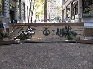
Regimental Square
War memorial in Sydney
Distance: Approx. 96 meters
Latitude and longitude: -33.86706389,151.20689167
Regimental Square is a war memorial in the Wynyard area in the city centre of Sydney, Australia. An upgrade of the area was expected to be completed by mid-2016.
Board of Studies, Teaching and Educational Standards
NSW government education board 2014–2016
Distance: Approx. 108 meters
Latitude and longitude: -33.867039,151.204965
The Board of Studies, Teaching and Educational Standards NSW (abbreviated as BOSTES) was the state government education agency in New South Wales, Australia. It was formed on 1 January 2014 following the amalgamation of the Board of Studies and the NSW Institute of Teachers, and replaced on 1 January 2017 by the New South Wales Education Standards Authority. BOSTES was responsible for: the accreditation of all teachers at all levels the endorsement of teachers’ professional learning the accreditation of initial teacher education degrees establishing professional teaching standards.
New South Wales Education Standards Authority
NSW government education agency
Distance: Approx. 108 meters
Latitude and longitude: -33.867039,151.204965
The New South Wales Education Standards Authority (abbreviated as NESA) is the state government education statutory authority with the responsibility for the establishment and monitoring of school standards in the Australian state of New South Wales. It was formed on 1 January 2017 to replace the Board of Studies, Teaching and Educational Standards, NESA is also accredited by the Australian Curriculum, Assessment and Reporting Authority as the NSW test administration authority for NAPLAN. NESA is responsible for awarding the secondary school credentials Record of School Achievement and Higher School Certificate.

Pinnacle House
Historic site in Sydney central business district, Australia
Distance: Approx. 55 meters
Latitude and longitude: -33.8675,151.2054
Pinnacle House is a heritage-listed former warehouse at 2-6 Barrack Street, in the Sydney central business district, in the City of Sydney local government area of New South Wales, Australia. It was designed by Sheerin & Hennessy and built from 1888 to 1892 by Allum Brothers. It was added to the New South Wales State Heritage Register on 2 April 1999.

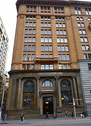
73 York Street, Sydney
Heritage-listed building in Sydney, Australia
Distance: Approx. 104 meters
Latitude and longitude: -33.8684,151.2057
73 York Street is a heritage-listed former warehouse and now office building located at 73 York Street, in the Sydney central business district in the City of Sydney local government area of New South Wales, Australia. It was built in 1892, with the design having been attributed to Herbert S. Thompson. It is also known as Henley House, Hardware House, ICLE House, Monte Paschi House and Cassa Commerciale House.

341 George Street, Sydney
Heritage-listed building in Sydney, Australia
Distance: Approx. 61 meters
Latitude and longitude: -33.8673,151.2066
341 George Street, Sydney is a heritage-listed bank building located at 341 George Street, in the Sydney central business district, in the City of Sydney local government area of New South Wales, Australia. It was built from 1927 to 1932 and housed the headquarters of the Bank of New South Wales, and later Westpac. It is also known as Westpac Bank building and Bank of NSW building.
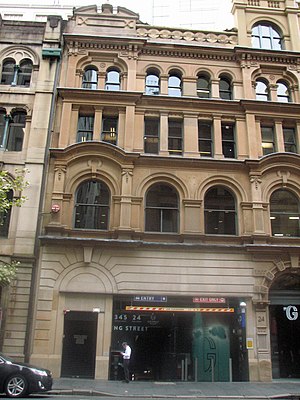
343 George Street, Sydney
Heritage-listed building in Sydney, Australia
Distance: Approx. 66 meters
Latitude and longitude: -33.8675,151.2067
343 George Street, Sydney is a heritage-listed former bank building and now nine-storey retail and commercial premises. It is located at 343 George Street in the Sydney central business district, in the City of Sydney local government area of New South Wales, Australia. It was built from 1921 to 1925, and until 2008 housed banking premises of the Commercial Banking Company of Sydney (CBC) and later National Australia Bank.
22 York Street, Sydney
Heritage-listed building in Sydney, Australia
Distance: Approx. 80 meters
Latitude and longitude: -33.8682,151.2062
22 York Street, Sydney is a heritage-listed commercial office and former warehouse located at 22 York Street, in the Sydney central business district, in the City of Sydney local government area of New South Wales, Australia. It has now been incorporated into the Landmark Building development. The property is privately owned.
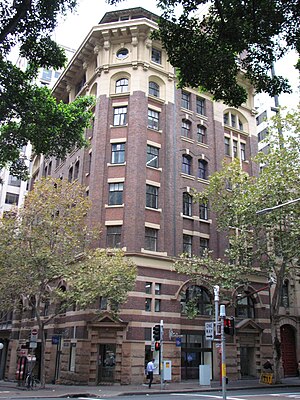
International House, Sydney
Historic site in New South Wales, Australia
Distance: Approx. 39 meters
Latitude and longitude: -33.8678,151.2062
International House is a heritage-listed commercial building at 14-16 York Street, in the Sydney central business district, in the City of Sydney local government area of New South Wales, Australia. It was designed by Robertson & Marks and built during 1913 by Howie, Brown & Moffat, Master Builders. It is also known as Pomeroy House.
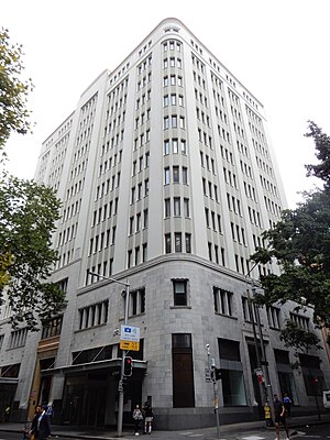
James Hardie House
Commercial building in Sydney, Australia
Distance: Approx. 52 meters
Latitude and longitude: -33.867908,151.205726
The James Hardie House (also known as the Asbestos House) is an Art Deco commercial building in Sydney, Australia.
Weather in this IP's area
broken clouds
18 Celsius
18 Celsius
17 Celsius
19 Celsius
1004 hPa
91 %
1004 hPa
996 hPa
10000 meters
3.6 m/s
310 degree
75 %
06:08:45
19:11:12