103.190.198.132 - IP Lookup: Free IP Address Lookup, Postal Code Lookup, IP Location Lookup, IP ASN, Public IP
Country:
 India
IndiaRegion:
City:
Location:
Time Zone:
Postal Code:
ISP:
ASN:
language:
User-Agent:
Proxy IP:
Blacklist:
IP information under different IP Channel
ip-api
Country
Region
City
ASN
Time Zone
ISP
Blacklist
Proxy
Latitude
Longitude
Postal
Route
db-ip
Country
Region
City
ASN
Time Zone
ISP
Blacklist
Proxy
Latitude
Longitude
Postal
Route
IPinfo
Country
Region
City
ASN
Time Zone
ISP
Blacklist
Proxy
Latitude
Longitude
Postal
Route
IP2Location
103.190.198.132Country
inRegion
telangana
City
karimnagar
Time Zone
Asia/Kolkata
ISP
Language
User-Agent
Latitude
Longitude
Postal
ipdata
Country
Region
City
ASN
Time Zone
ISP
Blacklist
Proxy
Latitude
Longitude
Postal
Route
Popular places and events near this IP address

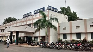
Karimnagar
City in Telangana, India
Distance: Approx. 2315 meters
Latitude and longitude: 18.43861111,79.12880556
Karimnagar is a city and District Headquarters in the Indian state of Telangana. Karimnagar is a major urban agglomeration in the state. It is third largest City in the state and Municipal Corporation and is the headquarters of the Karimnagar district.

Karimnagar district
District of Telangana in India
Distance: Approx. 2758 meters
Latitude and longitude: 18.43694,79.124167
Karimnagar district is one of the 33 districts of the Indian state of Telangana. Karimnagar city is its administrative headquarters. The district shares boundaries with Peddapalli, Jagityal, Sircilla, Siddipet, Jangaon, Hanamkonda district and Jayashankar Bhupalapally districts.

Mogdumpur
Village in Telangana, India
Distance: Approx. 8151 meters
Latitude and longitude: 18.47361111,79.21444444
Mogdumpur is a village in Karimnagar district, Telangana, India. It is approximately 10 kilometres east of Karimnagar city.

Karimnagar Lok Sabha constituency
Lok Sabha Constituency in Telangana
Distance: Approx. 6452 meters
Latitude and longitude: 18.4,79.1
Karimnagar Lok Sabha constituency is one of the 17 Lok Sabha (Lower House of the Parliament) constituencies in Telangana state in southern India. Bandi Sanjay of Bharatiya Janata Party is currently representing the constituency.
Manakondur
Village in Telangana, India
Distance: Approx. 8840 meters
Latitude and longitude: 18.39805556,79.225
Manakondur is a village in Manakondur mandal of Karimnagar district of the Indian state of Telangana.

Karimnagar Assembly constituency
Constituency of the Telangana legislative assembly in India
Distance: Approx. 2240 meters
Latitude and longitude: 18.44,79.13
Karimnagar Assembly constituency is a constituency of the Telangana Legislative Assembly, India. It is one of the three constituencies in Karimnagar district. It includes the city of Karimnagar.

Manakondur Assembly constituency
Constituency of the Telangana legislative assembly in India
Distance: Approx. 5620 meters
Latitude and longitude: 18.4,79.19
Manakondur Assembly constituency is an SC reserved constituency of Telangana Legislative Assembly, India. It is one among 13 constituencies in Karimnagar district. It is part of Karimnagar Lok Sabha constituency.
Karimnagar railway station
Railway station in Karimnagar, India
Distance: Approx. 2974 meters
Latitude and longitude: 18.459,79.1423
Karimnagar railway station (station code KRMR) is a railway station in Karimnagar District Headquarters. It serves the city of Karimnagar in Telangana State, India. It comes under Secunderabad division of South Central Railway, opened in the year of 2001.
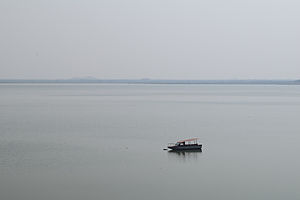
Lower Manair Dam
Dam in Telangana, India
Distance: Approx. 4237 meters
Latitude and longitude: 18.39972222,79.13111111
Lower Manair Dam also known as LMD was constructed across the Manair River, at Alugunur village, Thimmapur mandal, Karimnagar District, in the Indian state of Telangana during 1974 to 1985. It provides irrigation to a gross command area of 163,000 hectares (400,000 acres).
Loyola High School, Karimnagar
Private secondary school in Rekurthi Road, Karimnagar, Telangana, India
Distance: Approx. 5859 meters
Latitude and longitude: 18.46444444,79.10527778
Loyola High School, Karimnagar, is a private Catholic secondary school located in Karimnagar, in the state of Telangana, India. The school was opened by the Society of Jesus in 1980 by land donated by Mr.Shaikh Saleh Sahab as a Telugu-medium school and also includes English-medium classes. It is currently a part of the Jesuits' educational complex on Rekurthi Road.
Durshed
Revenue village in Telangana, India
Distance: Approx. 3928 meters
Latitude and longitude: 18.46305556,79.17
Durshed is a sub urban revenue village in Karimnagar mandal of Karimnagar district of the Indian state of Telangana. It constitutes two gram panchayats namely Durshed and Gopalpur. It is situated on the outskirts of Karimnagar city at a distance of 6 km from Karimnagar bus station on Rajiv Highway (SH-1).

Karimnagar Cable Bridge
Cable-Stayed bridge in India
Distance: Approx. 1445 meters
Latitude and longitude: 18.4205844,79.152773
The Karimnagar Cable Bridge is a cable-stayed bridge in Karimnagar, Telangana, India. The bridge is located near the outskirts of Karimnagar town and is part of the National Highway 563 route.
Weather in this IP's area
clear sky
32 Celsius
30 Celsius
32 Celsius
32 Celsius
1010 hPa
22 %
1010 hPa
977 hPa
10000 meters
2.09 m/s
2.08 m/s
38 degree
4 %