103.19.144.27 - IP Lookup: Free IP Address Lookup, Postal Code Lookup, IP Location Lookup, IP ASN, Public IP
Country:
Region:
City:
Location:
Time Zone:
Postal Code:
IP information under different IP Channel
ip-api
Country
Region
City
ASN
Time Zone
ISP
Blacklist
Proxy
Latitude
Longitude
Postal
Route
Luminati
Country
ASN
Time Zone
Australia/Sydney
ISP
Cloudflare London, LLC
Latitude
Longitude
Postal
IPinfo
Country
Region
City
ASN
Time Zone
ISP
Blacklist
Proxy
Latitude
Longitude
Postal
Route
IP2Location
103.19.144.27Country
Region
new south wales
City
matraville
Time Zone
Australia/Sydney
ISP
Language
User-Agent
Latitude
Longitude
Postal
db-ip
Country
Region
City
ASN
Time Zone
ISP
Blacklist
Proxy
Latitude
Longitude
Postal
Route
ipdata
Country
Region
City
ASN
Time Zone
ISP
Blacklist
Proxy
Latitude
Longitude
Postal
Route
Popular places and events near this IP address
Long Bay Correctional Centre
Building
Distance: Approx. 1606 meters
Latitude and longitude: -33.96944444,151.24583333
The Long Bay Correctional Complex, commonly called Long Bay, is a correctional facility comprising a heritage-listed maximum and minimum security prison for males and females and a hospital to treat prisoners, psychiatric cases and remandees, located in Malabar, Sydney, New South Wales, Australia. The complex is located approximately 14 kilometres (8.7 mi) south of the Sydney CBD and is contained within a 32-hectare (79-acre) site. The facility is operated by Corrective Services New South Wales, a department administered by the Government of New South Wales.
Matraville, New South Wales
Suburb of Sydney, New South Wales, Australia
Distance: Approx. 2 meters
Latitude and longitude: -33.96138889,151.23138889
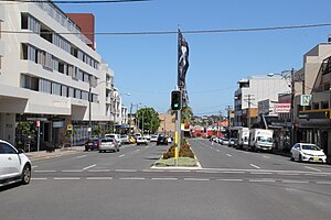
Matraville is located in the Eastern Suburbs of Sydney, in the state of New South Wales, Australia. It is approximately 9 km (6 mi) by road south-east of the Sydney central business district, in the local government area of the City of Randwick.

Division of Kingsford Smith
Australian federal electoral division
Distance: Approx. 1381 meters
Latitude and longitude: -33.949,151.231
The Division of Kingsford Smith is an Australian electoral division in the state of New South Wales. It is located south and south-east of Sydney CBD, comprising mostly City of Randwick and the suburbs of Bayside Council that were governed by the former City of Botany Bay.
Chifley, New South Wales
Suburb of Sydney, New South Wales, Australia
Distance: Approx. 1160 meters
Latitude and longitude: -33.969,151.24
Chifley is a suburb in the Eastern Suburbs of Sydney, in the state of New South Wales, Australia. Chifley is 13 km south-east of the Sydney central business district and is part of the City of Randwick. The postcode is 2036.

Hillsdale, New South Wales
Suburb of Sydney, New South Wales, Australia
Distance: Approx. 761 meters
Latitude and longitude: -33.95493,151.22875
Hillsdale is a suburb in the Eastern Suburbs of Sydney, in the state of New South Wales, Australia. Hillsdale is located 6 kilometres south-east of the Sydney central business district in the Bayside Council. The suburb is named after Pat Hills, former Deputy Premier of New South Wales.
St Spyridon College
School in Eastern Suburbs, Sydney, New South Wales, Australia
Distance: Approx. 1375 meters
Latitude and longitude: -33.954701,151.243917
St Spyridon College is a dual-campus independent Greek Orthodox primary and secondary school, in the eastern suburbs of Sydney, New South Wales, Australia. The College's primary school campus is located in Kingsford and the secondary school campus is located in Maroubra. Established in 1983, the College enrolled approximately 750 students in 2019, from Kindergarten to Year 12, of whom no students identified as Indigenous Australians and 83 percent were from a language background other than English.

Parish of Botany
Cadastral in New South Wales, Australia
Distance: Approx. 1481 meters
Latitude and longitude: -33.94833333,151.23444444
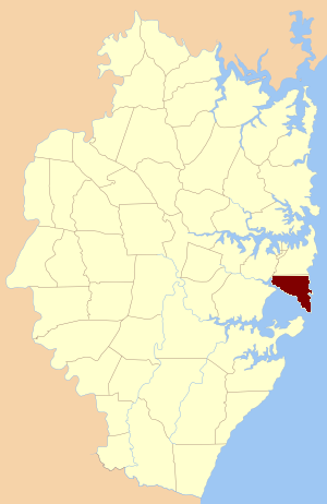
Botany Parish, Cumberland is one of the 57 parishes of Cumberland County, New South Wales, a cadastral unit for use on land titles. It contains the area to the north of Botany Bay and to the east of part of Cooks River. It includes the suburbs of La Perouse, Hillsdale, Banksmeadow and Maroubra.
Eastern Suburbs Memorial Park
Cemetery in Sydney, Australia
Distance: Approx. 1507 meters
Latitude and longitude: -33.974528,151.227399
Eastern Suburbs Memorial Park, Eastern Suburbs Crematorium and Botany General Cemetery (aka Botany Cemetery), is a cemetery and crematorium on Bunnerong Road in Matraville, New South Wales, in the eastern suburbs district of Sydney, Australia. Land was dedicated as a cemetery site in 1888, with the first interment recorded at Botany Cemetery on 21 August 1893. The Bunnerong Cemetery (opened in 1888), and the Eastern Suburbs Crematorium (opened 1938) were merged with Botany Cemetery in 1972.
Matraville Soldiers' Settlement Public School
Public school in Sydney, Australia
Distance: Approx. 879 meters
Latitude and longitude: -33.957951,151.239967
Matraville Soldiers' Settlement Public School is a public school that was founded in 1927 in Sydney, Australia.
Matraville Sports High School
School in Australia
Distance: Approx. 1294 meters
Latitude and longitude: -33.965,151.24472222
Matraville Sports High School (abbreviated as MSHS) is a government co-educational comprehensive and specialist secondary school, with speciality in sports, located on Anzac Parade, Chifley, in the Eastern Suburbs of Sydney, New South Wales, Australia. Established in 1960 as Matraville High School, the school became a specialist high school in December 2001 and caters for approximately 300 students from Year 7 to Year 12. The school is operated by the New South Wales Department of Education; the principal is Nerida Walker.
Southpoint Shopping Centre
Shopping mall in Hillsdale, New South Wales
Distance: Approx. 1092 meters
Latitude and longitude: -33.95159805,151.23088755
Southpoint Shopping Centre (formerly known as Hillsdale Plaza) is a shopping centre in the suburb of Hillsdale in the Eastern Suburbs of Sydney, Australia, south-east of the CBD.
Matraville Refinery
Distance: Approx. 1079 meters
Latitude and longitude: -33.971,151.233
Matraville Refinery was an oil refinery in the Australian state of New South Wales. Bitumen and Oil Refineries (Australia) Limited (later named by the acronym Boral) commenced construction of Australia's first bitumen and oil refinery in Matraville in March 1947. The company was 40% owned by Caltex which supplied the crude oil to be refined.
Weather in this IP's area
clear sky
16 Celsius
15 Celsius
12 Celsius
17 Celsius
1009 hPa
50 %
1009 hPa
1007 hPa
10000 meters
6.17 m/s
250 degree


