Country:
Region:
City:
Latitude and Longitude:
Time Zone:
Postal Code:
IP information under different IP Channel
ip-api
Country
Region
City
ASN
Time Zone
ISP
Blacklist
Proxy
Latitude
Longitude
Postal
Route
Luminati
Country
ASN
Time Zone
Asia/Kolkata
ISP
BHARATHI TECHNOLOGIES
Latitude
Longitude
Postal
IPinfo
Country
Region
City
ASN
Time Zone
ISP
Blacklist
Proxy
Latitude
Longitude
Postal
Route
db-ip
Country
Region
City
ASN
Time Zone
ISP
Blacklist
Proxy
Latitude
Longitude
Postal
Route
ipdata
Country
Region
City
ASN
Time Zone
ISP
Blacklist
Proxy
Latitude
Longitude
Postal
Route
Popular places and events near this IP address

Gajuwaka
Neighbourhood in Andhra Pradesh, India
Distance: Approx. 2874 meters
Latitude and longitude: 17.7,83.2167
Gajuwaka is a major residential area of Visakhapatnam City, India. This neighborhood of Visakhapatnam is considered the biggest shopping district in Andhra Pradesh by revenue. Though conceived as a residential locality, it is now one of the principal shopping districts of the city.
Mindi
Neighbourhood in Visakhapatnam, Andhra Pradesh, India
Distance: Approx. 3088 meters
Latitude and longitude: 17.70398,83.211921
Mindi is a suburb area in Visakhapatnam, Andhra Pradesh, India.
Pedagantyada
Neighbourhood in Visakhapatnam, Andhra Pradesh, India
Distance: Approx. 1911 meters
Latitude and longitude: 17.6615,83.2104
Pedagantyada is a neighbourhood in the city of Visakhapatnam, India. It is one of the 46 mandals in Visakhapatnam District. It is under the administration of Visakhapatnam revenue division and the headquarters is located at Pedagantyada beside Gajuwaka.

Gajuwaka Assembly constituency
Constituency of the Andhra Pradesh Legislative Assembly, India
Distance: Approx. 1558 meters
Latitude and longitude: 17.69,83.21
Gajuwaka Assembly constituency is a constituency in Visakhapatnam district of Andhra Pradesh that elects representatives to the Andhra Pradesh Legislative Assembly in India. It is one of the seven assembly segments of Visakhapatnam Lok Sabha constituency. Palla Srinivasarao is the current MLA of the constituency, having won the 2024 Andhra Pradesh Legislative Assembly election from Telugu Desam Party.

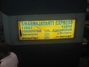
Visakhapatnam Swarna Jayanti Express
Distance: Approx. 2004 meters
Latitude and longitude: 17.68833333,83.21861111
The 12803 / 12804 Visakhapatnam Swarna Jayanti Express is a "Superfast Express" train linking Visakhapatnam and the Hazrat Nizamuddin near New Delhi, India. The express is organized by the South Coast Railways Waltair Division. It is named for the 50th Golden Jubilee year of India's independence.
Hindustan Zinc Limited Ground
Distance: Approx. 2319 meters
Latitude and longitude: 17.6913,83.21989
Hindustan Zinc Limited Ground is a cricket ground in Visakhapatnam, Andhra Pradesh. It is owned by Hindustan Zinc Limited and was established in 2002. In 2007, the hosted five Inter-State T20 Championship matches since then it has been specialist ground for Twenty20 cricket. In 2009, the hosted four Syed Mushtaq Ali Trophy matches since the ground was not being used for top level cricket.

Chinagantyada
Neighbourhood in Visakhapatnam, Andhra Pradesh, India
Distance: Approx. 1491 meters
Latitude and longitude: 17.680569,83.189938
Chinagantyada is a neighborhood situated on the Visakhapatnam City, India. The area, which falls under the local administrative limits of Greater Visakhapatnam Municipal Corporation, .

Nadupuru
Neighbourhood in Visakhapatnam, Andhra Pradesh, India
Distance: Approx. 1120 meters
Latitude and longitude: 17.670779,83.195647
Nadupuru is a residential area of the city of Visakhapatnam state of Andhra Pradesh, India.
Mulagada
Neighbourhood in Visakhapatnam, Andhra Pradesh, India
Distance: Approx. 3244 meters
Latitude and longitude: 17.699095,83.224024
Mulagada is a neighbourhood in the city of Visakhapatnam, India. It is one of the 46 mandals in Visakhapatnam District. It is under the administration of Visakhapatnam revenue division and the headquarters is located at Mulagada.
Vadlapudi
Neighbourhood in Visakhapatnam, Andhra Pradesh, India
Distance: Approx. 3003 meters
Latitude and longitude: 17.688396,83.177744
Vadlapudi is a neighbourhood in the city of Visakhapatnam, state of Andhra Pradesh, India. It is a suburban area of the city.
BHPV Township
Neighbourhood in Visakhapatnam, Andhra Pradesh, India
Distance: Approx. 2899 meters
Latitude and longitude: 17.703251,83.200258
BHPV is a neighbourhood situated on Visakhapatnam. Its full form is Bharat Heavy Plate & Vessels Ltd township. It was established in the 1960s for BHPV employees.
Visakhapatnam Assembly constituency
Constituency of the Andhra Pradesh Legislative Assembly
Distance: Approx. 1558 meters
Latitude and longitude: 17.69,83.21
Visakhapatnam Assembly constituency was one of constituencies to Andhra Pradesh Legislative Assembly. It was part of Visakhapatnam Lok Sabha constituency. It existed from the 1951 delimitation to 1963.
Weather in this IP's area
scattered clouds
26 Celsius
26 Celsius
26 Celsius
26 Celsius
1013 hPa
80 %
1013 hPa
1010 hPa
10000 meters
3.59 m/s
5.86 m/s
51 degree
28 %
05:58:12
17:23:26