103.185.234.135 - IP Lookup: Free IP Address Lookup, Postal Code Lookup, IP Location Lookup, IP ASN, Public IP
Country:
Region:
City:
Location:
Time Zone:
Postal Code:
ISP:
ASN:
language:
User-Agent:
Proxy IP:
Blacklist:
IP information under different IP Channel
ip-api
Country
Region
City
ASN
Time Zone
ISP
Blacklist
Proxy
Latitude
Longitude
Postal
Route
db-ip
Country
Region
City
ASN
Time Zone
ISP
Blacklist
Proxy
Latitude
Longitude
Postal
Route
IPinfo
Country
Region
City
ASN
Time Zone
ISP
Blacklist
Proxy
Latitude
Longitude
Postal
Route
IP2Location
103.185.234.135Country
Region
maharashtra
City
igatpuri
Time Zone
Asia/Kolkata
ISP
Language
User-Agent
Latitude
Longitude
Postal
ipdata
Country
Region
City
ASN
Time Zone
ISP
Blacklist
Proxy
Latitude
Longitude
Postal
Route
Popular places and events near this IP address

Igatpuri
Town in Maharashtra, India
Distance: Approx. 0 meters
Latitude and longitude: 19.7,73.55
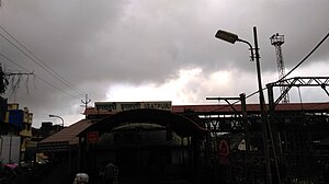
Igatpuri ([iɡət̪puɾiː]; formerly known as Egutpoora) is a town and a Hill Station. It is also a municipal council in Nashik District in the Indian state of Maharashtra. It is located in the Western Ghats and served by Igatpuri railway station.
Ghoti Budruk
Census town in Maharashtra, India
Distance: Approx. 8925 meters
Latitude and longitude: 19.7167,73.6333
Ghoti Budruk is a census town in Nashik district in the Indian state of Maharashtra.It is a special growth center in Nashik Metropolitan Region.Ghoti Budruk, khambale and Dahalewadi together forms a Growth Center.It is the biggest town and market place in Igatpuri.It is also called as mini Mumbai. It is situated on the bank of Darna River. This small town is having largest number of hospitals in Igatpuri.
Kasara
Census town in Maharashtra, India
Distance: Approx. 9908 meters
Latitude and longitude: 19.64583333,73.475
Kasara is a census town in Thane district in the Indian state of Maharashtra. The town is on the busy Mumbai–Nashik route, which is one of the four major routes that lead into Mumbai. Kasara is served by a railway station on the Mumbai Suburban Railway, and is the final stop in the north-east sector of the Central Line and important railway station.

Thal Ghat
Mountain pass in India
Distance: Approx. 8061 meters
Latitude and longitude: 19.67,73.48
Thal Ghat (also called as Thul Ghat or Kasara Ghat) is a ghat section (mountain incline or slope) in the Western Ghats near the town of Kasara in Maharashtra. The Thal Ghat is located on the busy Mumbai–Nashik route, and is one of the four major routes, rail and road routes, leading into Mumbai. The railway line, which passes through the ghat is the steepest in India with a gradient of 1 in 37.
Bhavali Dam
Dam in Igatpuri
Distance: Approx. 8390 meters
Latitude and longitude: 19.6350691,73.5906315
Bhavali Dam, is an earthfill dam on Bham river near Igatpuri, Nashik district in state of Maharashtra in India. Bhavali Dam is located near village Bhavali on Darana river tributary of Godavari river.

Igatpuri Assembly constituency
Constituency of the Maharashtra legislative assembly in India
Distance: Approx. 1200 meters
Latitude and longitude: 19.697,73.561
Igatpuri is one of the 288 constituencies of the Maharashtra Legislative Assembly, in Indian state of Maharashtra. It is a part of the Nashik Lok Sabha constituency and is reserved for members of the Scheduled Tribes. It comprises Trimbakeshwar tehsil and parts of Igatpuri tehsil, both in Nashik district.

Igatpuri railway station
Rail station in Maharashtra, India
Distance: Approx. 1413 meters
Latitude and longitude: 19.6946,73.5622
Igatpuri railway station serves Igatpuri in Nashik district in the Indian state of Maharashtra. It stands at the head of Thal Ghat. It is a loco change-over point for trains moving out of Mumbai as well as trains entering Mumbai.

Tringalwadi
Fort named after the Tringalwadi Village
Distance: Approx. 4443 meters
Latitude and longitude: 19.73777778,73.53633333
Tringalwadi fort is located in the Igatpuri taluka of Nashik district. It is located on the ancient trade route passing through Thal ghat. The fort is located near village Tringalwadi.
Weather in this IP's area
clear sky
22 Celsius
21 Celsius
22 Celsius
22 Celsius
1014 hPa
32 %
1014 hPa
957 hPa
10000 meters
2.29 m/s
2.26 m/s
50 degree