103.185.103.47 - IP Lookup: Free IP Address Lookup, Postal Code Lookup, IP Location Lookup, IP ASN, Public IP
Country:
Region:
City:
Location:
Time Zone:
Postal Code:
IP information under different IP Channel
ip-api
Country
Region
City
ASN
Time Zone
ISP
Blacklist
Proxy
Latitude
Longitude
Postal
Route
Luminati
Country
ASN
Time Zone
Asia/Kolkata
ISP
Skylink Fibernet Private Limited
Latitude
Longitude
Postal
IPinfo
Country
Region
City
ASN
Time Zone
ISP
Blacklist
Proxy
Latitude
Longitude
Postal
Route
IP2Location
103.185.103.47Country
Region
tamil nadu
City
coimbatore
Time Zone
Asia/Kolkata
ISP
Language
User-Agent
Latitude
Longitude
Postal
db-ip
Country
Region
City
ASN
Time Zone
ISP
Blacklist
Proxy
Latitude
Longitude
Postal
Route
ipdata
Country
Region
City
ASN
Time Zone
ISP
Blacklist
Proxy
Latitude
Longitude
Postal
Route
Popular places and events near this IP address

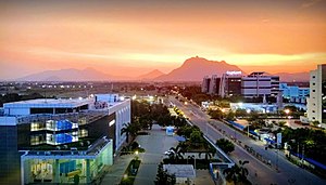
Coimbatore
City in Tamil Nadu, India
Distance: Approx. 358 meters
Latitude and longitude: 11.00083333,76.96333333
Coimbatore (Tamil: kōyamputtūr, IPA: [koːjɐmbut̪ːuːɾ]), also known as Kovai (IPA: [koːʋaj] ), is one of the major metropolitan cities in the Indian state of Tamil Nadu. It is located on the banks of the Noyyal River and surrounded by the Western Ghats. Coimbatore is the second largest city in Tamil Nadu after Chennai in terms of population and the 16th largest urban agglomeration in India as per the census 2011.
Roman Catholic Diocese of Coimbatore
Roman Catholic diocese in Tamil Nadu and Kerala, India
Distance: Approx. 631 meters
Latitude and longitude: 10.9951,76.9652
The Roman Catholic Diocese of Coimbatore (Latin: Coimbaturen(sis)) is a diocese located in the city of Coimbatore in the ecclesiastical province of Madras and Mylapore in India.

Coimbatore Junction railway station
Railway Junction in Coimbatore, India
Distance: Approx. 476 meters
Latitude and longitude: 10.996365,76.967222
Coimbatore Junction railway station (station code: CBE) is a railway station located in Coimbatore in the Indian state of Tamil Nadu. It is the major rail-head in the city and comes under the jurisdiction of Salem railway division of Southern Railway zone. It is one of the busiest and highest revenue generating stations in India.
GD Matriculation Higher Secondary School
School in Gopala Puram, Coimbatore, Tamil Nadu, India
Distance: Approx. 128 meters
Latitude and longitude: 10.99973,76.965837
GD Matriculation Higher Secondary School is a school in Gopala Puram, Coimbatore, Tamil Nadu, India. The founder of the school was renowned scientist Mr.G.D.Naidu whose museum is a fascination to many physicists, automobile engineers and agriculturists. The medium of instruction in the school is 'English'.
St Joseph's Matriculation Higher Secondary School
School in Coimbatore, Tamil Nadu, India
Distance: Approx. 780 meters
Latitude and longitude: 10.9958,76.9718
St. Joseph's Matriculation Higher Secondary School is an all-girls Catholic school for grades 1st through 12th standard in Coimbatore, Tamil Nadu, India. It is located on Trichy road in a three-school complex with its sister schools St.
Siege of Coimbatore
Historic Indian battle
Distance: Approx. 67 meters
Latitude and longitude: 11,76.96667
The siege of Coimbatore was a siege conducted by forces of the Kingdom of Mysore against a garrison of British East India Company and Travancore troops holding the fortress at Coimbatore in southern India during the Third Anglo-Mysore War. The siege began in May 1791, and several men trying to storm the fort were repulsed on 11 June, after which the garrison of Lieutenant John Chalmers was reinforced, and a larger Mysorean force was brought against it. The garrison eventually surrendered on 2 November.

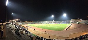
Jawaharlal Nehru Stadium (Coimbatore)
Multi-purpose stadium in Coimbatore, Tamil Nadu
Distance: Approx. 741 meters
Latitude and longitude: 11.006626,76.969475
Nehru Stadium is a multi-purpose stadium located in Coimbatore, Tamil Nadu, India. Constructed in 1971, It is currently used mostly for football matches. The stadium has a capacity of 30,000 spectators.
Government Arts College, Coimbatore
General Degree college in City of Coimbatore
Distance: Approx. 625 meters
Latitude and longitude: 10.9985,76.9719
Government Arts College is an autonomous institution located in Coimbatore, Tamil Nadu. It is a liberal arts college affiliated to the Bharathiar University.

VOC park and zoo
Zoo in Tamil Nadu, India
Distance: Approx. 739 meters
Latitude and longitude: 11.005718,76.970914
V O Chidambaranar park and zoo (abbreviated VOC park) is a zoological garden and amusement park located in Coimbatore, Tamil Nadu, India. As of 2013, the park houses around 890 animals including 335 birds, 106 mammals and 54 reptiles. The park is named after freedom fighter V O Chidambaram Pillai and is managed by Coimbatore city Corporation.
Thandu Mariamman Temple
Hindu temple in India
Distance: Approx. 248 meters
Latitude and longitude: 11.0025,76.96777778
Thandu Mariamman Temple is a Hindu temple dedicated to Thandu Mariamman located in Uppilipalayam, Coimbatore, Tamil Nadu, India. According to mythology, the goddess is said to have cured the soldiers of the ruler of Kongu Nadu from chicken pox. The annual car festival celebrated in April is one of the important religious festivals in the region.

Avinashi Road flyover
Flyover in Coimbatore
Distance: Approx. 418 meters
Latitude and longitude: 11.001349,76.962855
Avinashi road Flyover also known as Uppilipalayam flyover or Roundana is a roundabout flyover in Coimbatore that connects the Northern and Eastern areas with other parts of the city. It is built across the railway line connecting Coimbatore's main junction. The flyover forms one end of Avinashi Road.
Virundeeswarar Temple
Hindu temple in Tamil Nadu, India
Distance: Approx. 712 meters
Latitude and longitude: 11.00444444,76.96138889
Thiruthudisaimpathy Virundeeswarar Temple ([விருந்தீஸ்வரர்) is located in Vadamadurai near Thudiyalur on Mettupalayam road in the State of Tamil Nadu. Earlier it was called Thiruthudisaimpathy, and later Thudiyalur. It is an ancient temple, more than 1300+ years old.
Weather in this IP's area
few clouds
28 Celsius
28 Celsius
28 Celsius
28 Celsius
1012 hPa
42 %
1012 hPa
965 hPa
6000 meters
2.57 m/s
80 degree
20 %