Country:
Region:
City:
Latitude and Longitude:
Time Zone:
Postal Code:
IP information under different IP Channel
ip-api
Country
Region
City
ASN
Time Zone
ISP
Blacklist
Proxy
Latitude
Longitude
Postal
Route
Luminati
Country
ASN
Time Zone
Asia/Kolkata
ISP
Skylink Fibernet Private Limited
Latitude
Longitude
Postal
IPinfo
Country
Region
City
ASN
Time Zone
ISP
Blacklist
Proxy
Latitude
Longitude
Postal
Route
db-ip
Country
Region
City
ASN
Time Zone
ISP
Blacklist
Proxy
Latitude
Longitude
Postal
Route
ipdata
Country
Region
City
ASN
Time Zone
ISP
Blacklist
Proxy
Latitude
Longitude
Postal
Route
Popular places and events near this IP address

Coimbatore district
District of Tamil Nadu in India
Distance: Approx. 590 meters
Latitude and longitude: 11.0125,76.9714
Coimbatore district is one of the 38 districts in the state of Tamil Nadu in India. Coimbatore is the administrative headquarters of the district. It is one of the most industrialized districts and a major textile, industrial, commercial, educational, information technology, healthcare and manufacturing hub of Tamil Nadu.
Coimbatore Central Prison
Prison in Tamil Nadu, India
Distance: Approx. 456 meters
Latitude and longitude: 11.013448,76.972227
Coimbatore Central Prison is a prison located near Gandhipuram bus stand in Coimbatore, Tamil Nadu, India. The prison was constructed during the Madras Presidency year 1872. It is located in an area comprising 167.76 acres (0.6789 km2).
Air Force School, Coimbatore
Distance: Approx. 198 meters
Latitude and longitude: 11.01833333,76.9725
Air Force School (Coimbatore) was set up to provide education to the children of the Indian Air Force (IAF) personnel. The school is an unaided private co-educational institute affiliated to the Central Board of Secondary Education (CBSE). It is a day school for the students in the age group 3+1⁄2 to 15.

Jawaharlal Nehru Stadium (Coimbatore)
Multi-purpose stadium in Coimbatore, Tamil Nadu
Distance: Approx. 1273 meters
Latitude and longitude: 11.006626,76.969475
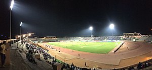
Nehru Stadium is a multi-purpose stadium located in Coimbatore, Tamil Nadu, India. Constructed in 1971, It is currently used mostly for football matches. The stadium has a capacity of 30,000 spectators.
Air Force Administrative College
Training institute of the Indian Air Force
Distance: Approx. 1379 meters
Latitude and longitude: 11.0080266,76.9823867
Air Force Administrative College (AFAC), located at Coimbatore, is one of the oldest training institutes of the Indian Air Force (IAF).

VOC park and zoo
Zoo in Tamil Nadu, India
Distance: Approx. 1319 meters
Latitude and longitude: 11.005718,76.970914
V O Chidambaranar park and zoo (abbreviated VOC park) is a zoological garden and amusement park located in Coimbatore, Tamil Nadu, India. As of 2013, the park houses around 890 animals including 335 birds, 106 mammals and 54 reptiles. The park is named after freedom fighter V O Chidambaram Pillai and is managed by Coimbatore city Corporation.

Gandhipuram Central Bus Terminus
Distance: Approx. 1666 meters
Latitude and longitude: 11.030554,76.967007
The Gandhipuram Central Bus Terminus, commonly known as the Gandhipuram Bus Terminus, is a bus terminus in Coimbatore that serves intercity buses.

Singanallur Bus Terminus
Distance: Approx. 1666 meters
Latitude and longitude: 11.030554,76.967007
Singanallur Bus Terminus is one of the seven bus terminus in the Coimbatore City. It predominantly serves Mofussil buses, although it also serves a few terminating intracity buses.
Sri Ramakrishna Hospital
Hospital in Tamil Nadu, India
Distance: Approx. 755 meters
Latitude and longitude: 11.0228,76.9778
Sri Ramakrishna Hospital is a 1000-bedded multi-specialty hospital located in Coimbatore, Tamil Nadu. The hospital was started in 1975. Sri Ramakrishna Hospital was established and is run by the SNR Sons Trust that was founded in the year 1970 by Mr.
Coimbatore Omni Bus Terminus
Bus terminus in Coimbatore, India
Distance: Approx. 1666 meters
Latitude and longitude: 11.030554,76.967007
The Coimbatore Omni Bus Terminus is a bus terminus located in Coimbatore, in close proximity to Gandhipuram Central Bus Terminus catering to outstation private buses. It was inaugurated in June 2006. The Coimbatore Omni Bus Terminus was planned in an area of 4 acres near the G.P.Signal at Sathy Road to act as a hub for omni bus operations in the city.

Ayyappan Temple, Coimbatore
Hindu temple in Coimbatore, India
Distance: Approx. 419 meters
Latitude and longitude: 11.02080556,76.97280556
Ayyappan Temple is a Hindu Ayyappan Temple located in Siddhapudur in Coimbatore, India. It is dedicated to Ayyappan.

Gedee Car Museum
Vintage car museum in India
Distance: Approx. 1255 meters
Latitude and longitude: 11.00664408,76.97792654
Gedee Car Museum or GD Museum, is a private vintage car museum located in the city of Coimbatore, India.
Weather in this IP's area
haze
29 Celsius
30 Celsius
29 Celsius
29 Celsius
1013 hPa
58 %
1013 hPa
966 hPa
4000 meters
2.57 m/s
40 degree
40 %
06:15:03
17:56:26