103.18.171.8 - IP Lookup: Free IP Address Lookup, Postal Code Lookup, IP Location Lookup, IP ASN, Public IP
Country:
Region:
City:
Location:
Time Zone:
Postal Code:
IP information under different IP Channel
ip-api
Country
Region
City
ASN
Time Zone
ISP
Blacklist
Proxy
Latitude
Longitude
Postal
Route
Luminati
Country
Region
wb
City
kolkata
ASN
Time Zone
Asia/Kolkata
ISP
Alliance Broadband Services Pvt. Ltd.
Latitude
Longitude
Postal
IPinfo
Country
Region
City
ASN
Time Zone
ISP
Blacklist
Proxy
Latitude
Longitude
Postal
Route
IP2Location
103.18.171.8Country
Region
west bengal
City
memari
Time Zone
Asia/Kolkata
ISP
Language
User-Agent
Latitude
Longitude
Postal
db-ip
Country
Region
City
ASN
Time Zone
ISP
Blacklist
Proxy
Latitude
Longitude
Postal
Route
ipdata
Country
Region
City
ASN
Time Zone
ISP
Blacklist
Proxy
Latitude
Longitude
Postal
Route
Popular places and events near this IP address

Memari
Town in West Bengal, India
Distance: Approx. 338 meters
Latitude and longitude: 23.2,88.12
Memari is a town and a municipality in Purba Bardhaman district in the Indian state of West Bengal.

Kalna subdivision
Subdivision in West Bengal, India
Distance: Approx. 5890 meters
Latitude and longitude: 23.22,88.17
Kalna subdivision is an administrative subdivision of the Purba Bardhaman district in the state of West Bengal, India.

Bardhaman Sadar South subdivision
Subdivision in West Bengal, India
Distance: Approx. 338 meters
Latitude and longitude: 23.2,88.12
Bardhaman Sadar South subdivision is an administrative subdivision of the Purba Bardhaman district in the state of West Bengal, India.Great revolutionary Rash behari Bose was born in village Subaldaha.This village is under this sub division.
Paharhati
Village in West Bengal, India
Distance: Approx. 5118 meters
Latitude and longitude: 23.24305556,88.09916667
Paharhati is a village in Memari II CD block in Bardhaman Sadar South subdivision of Purba Bardhaman district in the Indian state of West Bengal.
Memari College
College in West Bengal
Distance: Approx. 4126 meters
Latitude and longitude: 23.1655739,88.1017722
Memari College, established in 1981, is the general degree college in Memari, Purba Bardhaman district. It offers undergraduate courses in arts, commerce and sciences. It is affiliated to University of Burdwan.

Debipur, West Bengal
Village in West Bengal, India
Distance: Approx. 7498 meters
Latitude and longitude: 23.14,88.15
Debipur is a village (Census Town) located at Memari I block in Purba Bardhaman district. People called Debipur R.S. because there is a Railway Station. It is under Memari police station.
Alipur, Purba Bardhaman
Census Town in West Bengal, India
Distance: Approx. 7198 meters
Latitude and longitude: 23.1434,88.1507
Alipur is a census town in Memari I CD Block in Bardhaman Sadar South subdivision of Purba Bardhaman district in the Indian state of West Bengal.

Debipur railway station
Railway station in West Bengal, India
Distance: Approx. 7457 meters
Latitude and longitude: 23.143912,88.156532
Debipur railway station is a Kolkata Suburban Railway station on the Howrah–Bardhaman main line operated by Eastern Railway zone of Indian Railways. It is situated beside National Highway 2 at Debipur, Purba Bardhaman district in the Indian state of West Bengal.

Bagila railway station
Railway station in West Bengal, India
Distance: Approx. 4725 meters
Latitude and longitude: 23.158413,88.125937
Bagila railway station is a Kolkata Suburban Railway station on the Howrah–Bardhaman main line operated by Eastern Railway zone of Indian Railways. It is situated beside National Highway 2 at Kalshi, Bagila, Purba Bardhaman district in the Indian state of West Bengal. Number of EMU trains stop at Bagila railway station.

Memari railway station
Railway station in West Bengal, India
Distance: Approx. 3748 meters
Latitude and longitude: 23.172893,88.094972
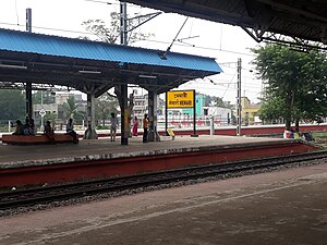
Memari railway station is a Kolkata Suburban Railway station on the Howrah–Bardhaman main line operated by Eastern Railway zone of Indian Railways. It is situated beside National Highway 2 at Memari, Purba Bardhaman district in the Indian state of West Bengal. Number of EMU and passenger trains stop at Memari railway station.
Nimo railway station
Railway station in West Bengal, India
Distance: Approx. 5341 meters
Latitude and longitude: 23.180665,88.068927
Nimo railway station is a Kolkata Suburban Railway Halt station on the Howrah–Bardhaman main line operated by Eastern Railway zone of Indian Railways. It is situated at Nimo, Purba Bardhaman district in the Indian state of West Bengal.

Rasulpur railway station
Railway station in West Bengal, India
Distance: Approx. 7896 meters
Latitude and longitude: 23.187509,88.040742
Rasulpur railway station is a Kolkata Suburban Railway station on the Howrah–Bardhaman main line operated by Eastern Railway zone of Indian Railways. It is situated beside Rasulpur – Kuchut Road at Baidyadanga, Rasulpur, Purba Bardhaman district in the Indian state of West Bengal.
Weather in this IP's area
clear sky
13 Celsius
12 Celsius
13 Celsius
13 Celsius
1016 hPa
57 %
1016 hPa
1014 hPa
10000 meters
2.42 m/s
2.42 m/s
30 degree