103.178.3.238 - IP Lookup: Free IP Address Lookup, Postal Code Lookup, IP Location Lookup, IP ASN, Public IP
Country:
Region:
City:
Location:
Time Zone:
Postal Code:
ISP:
ASN:
language:
User-Agent:
Proxy IP:
Blacklist:
IP information under different IP Channel
ip-api
Country
Region
City
ASN
Time Zone
ISP
Blacklist
Proxy
Latitude
Longitude
Postal
Route
db-ip
Country
Region
City
ASN
Time Zone
ISP
Blacklist
Proxy
Latitude
Longitude
Postal
Route
IPinfo
Country
Region
City
ASN
Time Zone
ISP
Blacklist
Proxy
Latitude
Longitude
Postal
Route
IP2Location
103.178.3.238Country
Region
jawa barat
City
indramayu
Time Zone
Asia/Jakarta
ISP
Language
User-Agent
Latitude
Longitude
Postal
ipdata
Country
Region
City
ASN
Time Zone
ISP
Blacklist
Proxy
Latitude
Longitude
Postal
Route
Popular places and events near this IP address

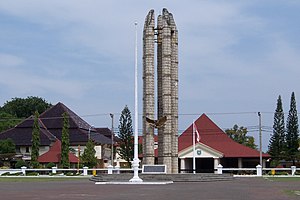
Indramayu Regency
Regency of Indonesia
Distance: Approx. 310 meters
Latitude and longitude: -6.3265,108.3228
Indramayu Regency is a regency (kabupaten) of the West Java province of Indonesia. It covers an area of 2,099.42 km2 and had a population of 1,663,737 at the 2010 census and 1,834,434 at the 2020 census; the official estimate as of mid 2023 was 1,894,325 (comprising 950,963 males and 943,362 females). The town of Indramayu is its capital.

Indramayu
District in West Java, Indonesia
Distance: Approx. 2972 meters
Latitude and longitude: -6.35277778,108.32416667
Indramayu (Javanese: ꦆꦤ꧀ꦢꦿꦩꦪꦸ; Chinese: 南麻由), named after the God Indra, is a town and district which serves as the capital of Indramayu Regency in the West Java province of Indonesia, and is located in the northern coastal area of West Java, east from Jakarta, north-east from the city of Bandung, and north-west of the city of Cirebon. Most of its land are situated below sea level, which makes the district vulnerable to high tide in stormy conditions. The district is only protected by some dunes and barrages at the seaside.

Manuk River
River in Indonesia
Distance: Approx. 9504 meters
Latitude and longitude: -6.24473,108.34502
The Manuk River (Indonesian: Ci Manuk, means: Bird River in Sundanese) is a river in West Java, Indonesia, about 170 km east of the capital Jakarta.
Weather in this IP's area
overcast clouds
27 Celsius
29 Celsius
27 Celsius
27 Celsius
1007 hPa
79 %
1007 hPa
1008 hPa
10000 meters
4.64 m/s
6.25 m/s
292 degree
100 %