Country:
Region:
City:
Latitude and Longitude:
Time Zone:
Postal Code:
IP information under different IP Channel
ip-api
Country
Region
City
ASN
Time Zone
ISP
Blacklist
Proxy
Latitude
Longitude
Postal
Route
IPinfo
Country
Region
City
ASN
Time Zone
ISP
Blacklist
Proxy
Latitude
Longitude
Postal
Route
MaxMind
Country
Region
City
ASN
Time Zone
ISP
Blacklist
Proxy
Latitude
Longitude
Postal
Route
Luminati
Country
ASN
Time Zone
Asia/Jakarta
ISP
PT Global Jet Express
Latitude
Longitude
Postal
db-ip
Country
Region
City
ASN
Time Zone
ISP
Blacklist
Proxy
Latitude
Longitude
Postal
Route
ipdata
Country
Region
City
ASN
Time Zone
ISP
Blacklist
Proxy
Latitude
Longitude
Postal
Route
Popular places and events near this IP address
Pluit
Administrative village in Penjaringan, Jakarta
Distance: Approx. 1893 meters
Latitude and longitude: -6.11666667,106.78333333
Pluit is an administrative village (kelurahan) located in Penjaringan, Jakarta. In majority, of its residents are mainly inhabited by ethnic Chinese Indonesians. Pluit is a bustling area with residential and commercial establishments supported by modern amenities.

Sunda Kelapa
Port in Indonesia
Distance: Approx. 1065 meters
Latitude and longitude: -6.123871,106.80861
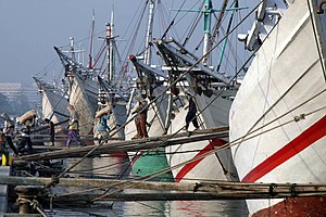
Sunda Kelapa (Sundanese: ᮞᮥᮔ᮪ᮓ ᮊᮜᮕ, Sunda Kalapa) is the old port of Jakarta, located on the estuary of the Ciliwung River. "Sunda Kalapa" (Sundanese: "Coconut of Sunda") is the original name, and it was the main port of the Sunda Kingdom. The port is situated in Penjaringan District, of North Jakarta, Indonesia.

Maritime Museum (Indonesia)
Maritime museum in Jakarta , Indonesia
Distance: Approx. 1101 meters
Latitude and longitude: -6.12698333,106.8083
The Maritime Museum (Indonesian: Museum Bahari) is located in the old Sunda Kelapa harbor area in Penjaringan Administrative Village, Penjaringan Subdistrict, Jakarta, Indonesia. The museum was inaugurated inside the former Dutch East India Company warehouses. The museum focuses on the maritime history of Indonesia and the importance of the sea to the economy of present-day Indonesia.

1740 Batavia massacre
Pogrom of ethnic Chinese in the Dutch East Indies
Distance: Approx. 819 meters
Latitude and longitude: -6.13083333,106.79916667
The 1740 Batavia massacre (Dutch: Chinezenmoord, lit. 'Murder of the Chinese'; Indonesian: Geger Pacinan, lit. 'Chinatown tumult') was a massacre and pogrom in which European soldiers of the Dutch East India Company killed ethnic Chinese residents of the port city of Batavia, Dutch East Indies, (present-day Jakarta) in the Dutch East Indies. The violence in the city lasted from 9 October 1740, until 22 October, with minor skirmishes outside the walls continuing late into November that year. Historians have estimated that at least 10,000 ethnic Chinese were massacred; just 600 to 3,000 are believed to have survived.

Amsterdam Gate, Jakarta
Distance: Approx. 1654 meters
Latitude and longitude: -6.1308,106.812
The Amsterdam Gate (Dutch: Amsterdamse Poort) formed the entrance to the Castle Square (Dutch: Kasteelplein) south of Batavia Castle. The gate existed from 1744 up to the 1950s in what is now known as Kota, Jakarta, where it would have stood near the intersection of Jalan Nelayan Timur and Jalan Cengkeh.

Waterkasteel (Batavia)
Northernmost fortification of Batavia, Dutch East Indies
Distance: Approx. 1168 meters
Latitude and longitude: -6.116205,106.806601
Waterkasteel (Dutch "Water Fortress") was the northernmost defense of Batavia (now Jakarta), Dutch East Indies. It was located on the west end of the Sunda Kelapa pier. Because of its location, the fort was also known as "Hornwerk".

Batavia Castle
VOC fort in Jakarta
Distance: Approx. 1442 meters
Latitude and longitude: -6.1275,106.81138889
Batavia Castle (Dutch: Kasteel Batavia, Indonesian: Kastel Batavia) was a fort located at the mouth of Ciliwung River in Jakarta. Batavia Castle was the administrative center of Dutch East India Company (VOC) in Asia. Batavia Castle was also the residence of the Governor General, the highest VOC official in the Dutch East Indies who chaired the Council of the Indies, the executive committee that made decisions in the Dutch East Indies.

Kali Besar
Place in Jakarta, Indonesia
Distance: Approx. 1554 meters
Latitude and longitude: -6.13136111,106.81058333
Kali Besar (de Groote Rivier) refers to the channel connecting Sunda Kelapa in the north to the south part in old town of Jakarta, parallel to Ciliwung River in their east disemboguing at the heart of the old city of Jakarta. Literally meaning Grand River, this channel is now part of Kali Krukut (Krukut river) in Tambora subdistrict.

Jami Kampung Baru Inpak Mosque
Mosque in Jakarta, Indonesia
Distance: Approx. 1516 meters
Latitude and longitude: -6.136573,106.802767
Masjid Jami Kampung Baru Inpak, also known as Masjid Kampung Baru or Bandengan Mosque, is one of the oldest mosques in Jakarta, Indonesia. It is located at Jalan Bandengan Selatan, Pekojan, Tambora, Jakarta, close to Masjid Al-Anshor. It is one of the mosques that was built by Muslim merchants from India who used to travel to and live in Batavia.

Emporium Mall Pluit
Shopping mall in Jakarta, Indonesia
Distance: Approx. 1023 meters
Latitude and longitude: -6.127589,106.790735
Emporium Mall is a shopping mall located at Pluit, Jakarta, Indonesia. Emporium Pluit developed by PT. Pluit Propertindo a subsidiary of Agung Podomoro Land. The mall is located at Jl.
Pluit Village
Shopping mall in North Jakarta, Indonesia
Distance: Approx. 911 meters
Latitude and longitude: -6.126335,106.791283
Pluit Village is a shopping center located on Jl. Pluit Indah Raya, Pluit, Penjaringan, North Jakarta, Indonesia. Built on an area of 21 hectares (52 acres) with lakeside view, Pluit village is a shopping center which was previously known as Mega Mall Pluit.

Kota Intan Bridge
Distance: Approx. 1543 meters
Latitude and longitude: -6.1312475,106.8105445
Kota Intan Bridge (Indonesian: Jembatan Kota Intan) is a hanging bridge located at Kali Besar of Kota Tua in Jakarta. It is the oldest bridge in Indonesia that was built in 1628 by the Dutch East India Company. Now the bridge is under the management of the Jakarta Provincial Tourism and Culture Department.
Weather in this IP's area
few clouds
31 Celsius
34 Celsius
30 Celsius
32 Celsius
1009 hPa
58 %
1009 hPa
1008 hPa
8000 meters
3.6 m/s
360 degree
20 %
05:30:12
17:45:21