Country:
Region:
City:
Latitude and Longitude:
Time Zone:
Postal Code:
IP information under different IP Channel
ip-api
Country
Region
City
ASN
Time Zone
ISP
Blacklist
Proxy
Latitude
Longitude
Postal
Route
Luminati
Country
Region
nsw
City
sydney
ASN
Time Zone
Australia/Sydney
ISP
Over The Wire Pty Ltd
Latitude
Longitude
Postal
IPinfo
Country
Region
City
ASN
Time Zone
ISP
Blacklist
Proxy
Latitude
Longitude
Postal
Route
db-ip
Country
Region
City
ASN
Time Zone
ISP
Blacklist
Proxy
Latitude
Longitude
Postal
Route
ipdata
Country
Region
City
ASN
Time Zone
ISP
Blacklist
Proxy
Latitude
Longitude
Postal
Route
Popular places and events near this IP address
Beacon Hill, New South Wales
Suburb of Sydney, New South Wales, Australia
Distance: Approx. 2145 meters
Latitude and longitude: -33.7522,151.256
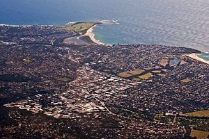
Beacon Hill is a suburb of northern Sydney, in the state of New South Wales, Australia 17 kilometres north-east of the Sydney central business district, in the local government area of Northern Beaches Council. It is part of the Northern Beaches region.
Allambie, New South Wales
Distance: Approx. 939 meters
Latitude and longitude: -33.7749,151.2583
Allambie is a location in the Northern Beaches Council local government area, in Sydney, New South Wales, Australia. It is located in the suburb of Allambie Heights, and has been designated an "Urban Place" by the Geographical Names Board of New South Wales.
Manly Vale
Suburb of Sydney, New South Wales, Australia
Distance: Approx. 1804 meters
Latitude and longitude: -33.783,151.2622
Manly Vale is a suburb of northern Sydney, in the state of New South Wales, Australia 17 kilometres north-east of the Sydney central business district in the local government area of Northern Beaches Council, in the Northern Beaches region. Manly Vale is predominantly a residential suburb with commercial land use on Condamine Street, containing small patches of light industrial. It also contains multiple Retirement Villages and Aged Care facilities.
North Manly, New South Wales
Suburb of Sydney, New South Wales, Australia
Distance: Approx. 1870 meters
Latitude and longitude: -33.7754,151.2689
North Manly is a suburb of northern Sydney, in the state of New South Wales, Australia 17 kilometres north-east of the Sydney central business district in the local government area of Northern Beaches Council. It is part of the Northern Beaches region.

Brookvale, New South Wales
Suburb of Sydney, New South Wales, Australia
Distance: Approx. 2026 meters
Latitude and longitude: -33.7653,151.27041
Brookvale is a suburb of northern Sydney, in the state of New South Wales, Australia. Brookvale is 16 kilometres north-east of the Sydney central business district, in the local government area of Northern Beaches Council. It is part of the Northern Beaches region.
Northern Beaches Secondary College
School in Australia
Distance: Approx. 2449 meters
Latitude and longitude: -33.781979,151.272222
The Northern Beaches Secondary College (abbreviated as NBSC) is a multi-campus government-funded co-educational dual-modality partially selective and comprehensive secondary day school, located on the Northern Beaches of Sydney, New South Wales, Australia. The College was established 2003 through the merger and restructure of six existing campuses located in the northern beaches region. The College caters for approximately 4,800 students from Year 7 to Year 12.
Manly Dam Reserve
Protected area in New South Wales, Australia
Distance: Approx. 590 meters
Latitude and longitude: -33.775803,151.247769
The Manly Dam Reserve, also known as the Manly Warringah War Memorial Park, is an urban bushland reserve located in the Northern Beaches region of Sydney, Australia. The reserve adjoins the south-eastern edge of Garigal National Park. Located within the 376 hectares (930 acres) reserve is the 30-hectare (74-acre) dam reservoir.

Westfield Warringah Mall
Shopping mall in New South Wales, Australia
Distance: Approx. 1562 meters
Latitude and longitude: -33.76772,151.265991
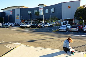
Westfield Warringah Mall, previously known as Warringah Mall, is a large indoor/outdoor shopping centre in the suburb of Brookvale in the Northern Beaches region of Sydney.
Mackellar Girls Campus
School in Australia
Distance: Approx. 2449 meters
Latitude and longitude: -33.781979,151.272222
The Mackellar Girls Campus of Northern Beaches Secondary College, formerly Manly Vale High School and Mackellar Girls' High School, is a government-funded single-sex secondary day school for girls located in Manly Vale, a suburb on the Northern Beaches of Sydney, New South Wales, Australia.

Manly Dam
Dam
Distance: Approx. 590 meters
Latitude and longitude: -33.775803,151.247769
The Manly Dam is a heritage-listed dam near King Street, Manly Vale with a reservoir extending into Allambie Heights, both in the Northern Beaches Council local government area of New South Wales, Australia. It is often used as a place to have recreational activities. The reservoir is located within the Manly Dam Reserve.

Parish of Manly Cove
Distance: Approx. 2086 meters
Latitude and longitude: -33.78166667,151.26777778
The Parish of Manly Cove is a civil parish of the County of Cumberland on the northern beaches of Sydney and covers numerous suburbs including Fairlight, Frenchs Forrest, Forestville, Kilarney Heights, Dee why, Davidson, Manly and Bookvale. The boundaries of the parish are the Pacific Ocean to the east, Middle Harbour Creek to the west, Sydney Harbour to the south and Narrabeen Lagoon on the north. Much of the parish is residential in a nature with large tracts of National Park.
Bantry Bay Explosives Depot
Historic site in New South Wales, Australia
Distance: Approx. 1919 meters
Latitude and longitude: -33.777,151.2302
The Bantry Bay Explosives Depot is a heritage-listed former explosives depot at Killarney Heights, New South Wales, a suburb of Sydney, Australia. It was built in 1915. The property is owned by the Office of Environment and Heritage, an agency of the Government of New South Wales.
Weather in this IP's area
overcast clouds
21 Celsius
21 Celsius
20 Celsius
22 Celsius
1016 hPa
69 %
1016 hPa
1006 hPa
10000 meters
2.24 m/s
4.47 m/s
131 degree
86 %
05:44:19
19:34:43