103.17.134.70 - IP Lookup: Free IP Address Lookup, Postal Code Lookup, IP Location Lookup, IP ASN, Public IP
Country:
Region:
City:
Location:
Time Zone:
Postal Code:
ISP:
ASN:
language:
User-Agent:
Proxy IP:
Blacklist:
IP information under different IP Channel
ip-api
Country
Region
City
ASN
Time Zone
ISP
Blacklist
Proxy
Latitude
Longitude
Postal
Route
db-ip
Country
Region
City
ASN
Time Zone
ISP
Blacklist
Proxy
Latitude
Longitude
Postal
Route
IPinfo
Country
Region
City
ASN
Time Zone
ISP
Blacklist
Proxy
Latitude
Longitude
Postal
Route
IP2Location
103.17.134.70Country
Region
queensland
City
ipswich
Time Zone
Australia/Brisbane
ISP
Language
User-Agent
Latitude
Longitude
Postal
ipdata
Country
Region
City
ASN
Time Zone
ISP
Blacklist
Proxy
Latitude
Longitude
Postal
Route
Popular places and events near this IP address

Ipswich Girls' Grammar School
Independent, day & boarding school in Ipswich, Queensland, Australia
Distance: Approx. 410 meters
Latitude and longitude: -27.61416667,152.76972222
Ipswich Girls' Grammar School (IGGS) is an independent, non-denominational, day and boarding school for girls in Ipswich, Queensland, Australia. The school is one of the eight original 'Queensland Grammar Schools'. These schools are independent, non-denominational, not-for-profit statutory bodies of the Queensland Government.

Queens Park, Ipswich
Historic site in Queensland, Australia
Distance: Approx. 185 meters
Latitude and longitude: -27.6177,152.7682
Queens Park is a heritage-listed botanic garden and park at Milford Street, Ipswich, City of Ipswich, Queensland, Australia. It was built from c. 1864 to 1960s. It was added to the Queensland Heritage Register on 27 September 2002.

Queensland Country Women's Association Girls' Hostel
Heritage-listed building in Queensland, Australia
Distance: Approx. 170 meters
Latitude and longitude: -27.6154,152.7658
Queensland Country Women's Association Girls' Hostel is a heritage-listed detached house at 5 Brisbane Street, Ipswich, City of Ipswich, Queensland, Australia. It was built from c. 1885 to c. 1911. It was added to the Queensland Heritage Register on 21 October 1992.

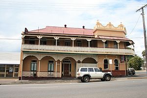
Ulster Hotel
Historic site in Queensland, Australia
Distance: Approx. 335 meters
Latitude and longitude: -27.615,152.7639
Ulster Hotel is a heritage-listed hotel at 25 Brisbane Street, Ipswich, City of Ipswich, Queensland, Australia. It was built in 1910. It was added to the Queensland Heritage Register on 21 October 1992.

St Michaels Nursing Home
Historic site in Queensland, Australia
Distance: Approx. 467 meters
Latitude and longitude: -27.618,152.7712
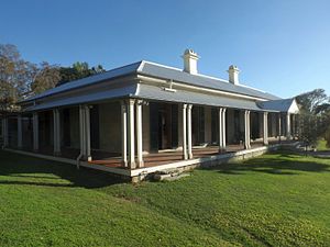
St Michaels Nursing Home is a heritage-listed nursing home at 68 Chermside Road, Newtown, City of Ipswich, Queensland, Australia. It was built c. 1874. It is also known as Gwennap.

Lime Kiln Remains, Ipswich
Heritage-listed lime kiln at Ipswich, Queensland, Australia
Distance: Approx. 428 meters
Latitude and longitude: -27.6141,152.7699
Lime Kiln Remains is a heritage-listed lime kiln at 82 Chermside Road, Ipswich, City of Ipswich, Queensland, Australia. It was built c. 1864 by William Hancock. It was added to the Queensland Heritage Register on 21 October 1992.

Rockton, Ipswich
Historic site in Queensland, Australia
Distance: Approx. 536 meters
Latitude and longitude: -27.6162,152.7721
Rockton is a heritage-listed villa at Rockton Street, Newtown, City of Ipswich, Queensland, Australia. It was built from 1855 onwards. It was added to the Queensland Heritage Register on 21 October 1992.

Keiraville, Ipswich
Historic site in Queensland, Australia
Distance: Approx. 602 meters
Latitude and longitude: -27.6181,152.7608
Keiraville is a heritage-listed detached house at 20 Roderick Street, Ipswich, City of Ipswich, Queensland, Australia. It was built c. 1880s. It was added to the Queensland Heritage Register on 9 July 1993.

Walter Burley Griffin Incinerator, Ipswich
Former Australian incinerator
Distance: Approx. 312 meters
Latitude and longitude: -27.6195,152.7669
Walter Burley Griffin Incinerator is a heritage-listed former incinerator at 10A Milford Street, Ipswich, City of Ipswich, Queensland, Australia. It was designed by Walter Burley Griffin and built from 1936 to 1940. It is also known as The Incinerator Theatre.

Claremont, Ipswich
Historic site in Queensland, Australia
Distance: Approx. 339 meters
Latitude and longitude: -27.6137,152.7661
Claremont is a heritage-listed villa at 1A Milford Street, Ipswich, City of Ipswich, Queensland, Australia. It was designed by William Claydon Wakefield and was built in 1857. It was added to the Queensland Heritage Register on 21 October 1992.

St Stephen's Church, Ipswich
Church in Australia
Distance: Approx. 376 meters
Latitude and longitude: -27.6164,152.7629
St Stephen's Church and Hall, part of the Central Church parish and officially Central Presbyterian Church, Ipswich, is a heritage-listed Presbyterian church and associated churchyard at 22 Limestone Street, Ipswich, City of Ipswich, Queensland, Australia. The church was designed by Joseph Backhouse, built from 1865 to 1978, and added to the Queensland Heritage Register on 21 October 1992.

Ipswich Girls' Grammar School Buildings
Historic site in Queensland, Australia
Distance: Approx. 428 meters
Latitude and longitude: -27.6141,152.7699
Ipswich Girls' Grammar School Buildings is a heritage-listed group of private school buildings at Ipswich Girls' Grammar School, 82 Chermside Road, Ipswich, City of Ipswich, Queensland, Australia. They were built from 1891 to 1968. They were added to the Queensland Heritage Register on 21 October 1992.
Weather in this IP's area
light rain
27 Celsius
28 Celsius
27 Celsius
27 Celsius
1005 hPa
53 %
1005 hPa
995 hPa
10000 meters
5.46 m/s
8.06 m/s
176 degree
34 %