103.166.48.6 - IP Lookup: Free IP Address Lookup, Postal Code Lookup, IP Location Lookup, IP ASN, Public IP
Country:
Region:
City:
Location:
Time Zone:
Postal Code:
IP information under different IP Channel
ip-api
Country
Region
City
ASN
Time Zone
ISP
Blacklist
Proxy
Latitude
Longitude
Postal
Route
Luminati
Country
Region
ji
City
surabaya
ASN
Time Zone
Asia/Jakarta
ISP
PT Maxindo Mitra Solusi
Latitude
Longitude
Postal
IPinfo
Country
Region
City
ASN
Time Zone
ISP
Blacklist
Proxy
Latitude
Longitude
Postal
Route
IP2Location
103.166.48.6Country
Region
jawa barat
City
sumber
Time Zone
Asia/Jakarta
ISP
Language
User-Agent
Latitude
Longitude
Postal
db-ip
Country
Region
City
ASN
Time Zone
ISP
Blacklist
Proxy
Latitude
Longitude
Postal
Route
ipdata
Country
Region
City
ASN
Time Zone
ISP
Blacklist
Proxy
Latitude
Longitude
Postal
Route
Popular places and events near this IP address

Cirebon Regency
Regency in West Java, Indonesia
Distance: Approx. 628 meters
Latitude and longitude: -6.7641,108.4789
Cirebon Regency is a regency (kabupaten) of West Java Province of Indonesia. The town of Sumber is its regency seat. It covers 1,076.76 km2 and had a population of 2,068,116 at the 2010 census and 2,270,621 at the 2020 census; the official estimate as at mid 2023 was 2,360,441 (comprising 1,195,535 males and 1,164,906 females).

Sumber, Cirebon
District in West Java, Indonesia
Distance: Approx. 718 meters
Latitude and longitude: -6.75444444,108.48583333
Sumber (Sundanese: ᮞᮥᮙ᮪ᮘᮨᮁ; Javanese: ꦯꦸꦩ꧀ꦧꦺꦂ) is a district which serves as the regency seat of the Cirebon Regency of West Java, Indonesia. It is divided into 14 villages which are listed as follows (with their populations as at mid 2022): The first 12 of these 14 are classed as urban kelurahan (Babakan occupying 1.38 km2, Sumber 2.50 km2, Perbutulan 0.53 km2, Kaliwadas 1.76 km2, Pasalakan 1.62 km2, Watubelah 1.93 km2, Pejambon 1.44 km2, Gegunung 1.72 km2, Kemantren 0.75 km2, Sendang 0.74 km2, Tukmudal 2.30 km2 and Kenanga 1.86 km2), while the remaining 2 are classed as rural desa and are situated in the south of the district (Matangaji with an area of 2.48 km2 and Sidawangi 4.64 km2).

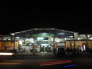
Cirebon Prujakan railway station
Railway station in Indonesia
Distance: Approx. 9506 meters
Latitude and longitude: -6.71944444,108.55861111
Cirebon Prujakan Station (CNP) is a railway station in Cirebon, West Java, Indonesia. The station is located at a height of 4 metres above sea level. It is located at Nyimas Gandasari Street, Pekalangan, Pekalipan, Cirebon.

Penggung Airport
Airport serving Cirebon, West Java, Indonesia
Distance: Approx. 6271 meters
Latitude and longitude: -6.75614444,108.53967222
Penggung Airport or Cakrabhuwana Airport (IATA: CBN, ICAO: WICD) is a small airport located in Penggung, Cirebon, West Java, Indonesia.

Trusmi Batik Village
Center of Batik industry in Cirebon, West Java
Distance: Approx. 6839 meters
Latitude and longitude: -6.70308333,108.50563333
Trusmi Batik Village is a center of batik industry in Cirebon, West Java. The place is regarded as a tourist spot for batik art as well as local culinary. The village of Trusmi is located in the town of Plered, 4 km (2.5 mi) west of the city of Cirebon.
Weather in this IP's area
overcast clouds
28 Celsius
32 Celsius
28 Celsius
28 Celsius
1007 hPa
80 %
1007 hPa
981 hPa
2612 meters
2.51 m/s
3.76 m/s
291 degree
100 %