Country:
 Australia
Region:
City:
Latitude and Longitude:
Time Zone:
Postal Code:
IP information under different IP Channel
ip-api
Country
Region
City
ASN
Time Zone
ISP
Blacklist
Proxy
Latitude
Longitude
Postal
Route
IPinfo
Country
Region
City
ASN
Time Zone
ISP
Blacklist
Proxy
Latitude
Longitude
Postal
Route
MaxMind
Country
Region
City
ASN
Time Zone
ISP
Blacklist
Proxy
Latitude
Longitude
Postal
Route
Luminati
Country
AURegion
nsw
City
sydney
ASN
Time Zone
Australia/Sydney
ISP
TPG Telecom Limited
Latitude
Longitude
Postal
db-ip
Country
Region
City
ASN
Time Zone
ISP
Blacklist
Proxy
Latitude
Longitude
Postal
Route
ipdata
Country
Region
City
ASN
Time Zone
ISP
Blacklist
Proxy
Latitude
Longitude
Postal
Route
Popular places and events near this IP address

Werrington railway station
Railway station in Sydney, New South Wales, Australia
Distance: Approx. 2132 meters
Latitude and longitude: -33.75927788,150.7583556
Werrington railway station is located on the Main Western line, serving the Sydney suburb of Werrington. It is served by Sydney Trains T1 Western line services.

St Marys, New South Wales
Suburb of Sydney, New South Wales, Australia
Distance: Approx. 927 meters
Latitude and longitude: -33.7607,150.7774
St Marys is a suburb in western Sydney, in the state of New South Wales, Australia. It is 45 kilometres (28 mi)west of the Sydney central business district, in the local government area of the City of Penrith. St Marys sits between South Creek which forms the western boundary and Ropes Creek, its eastern boundary.
Oxley Park, New South Wales
Suburb of Sydney, New South Wales, Australia
Distance: Approx. 1415 meters
Latitude and longitude: -33.77083333,150.79333333
Oxley Park is a suburb of Sydney in the state of New South Wales, Australia. It is 43 kilometres (27 mi) west of the Sydney central business district, in the local government area of the City of Penrith and is part of the Greater Western Sydney region.
Werrington County, New South Wales
Suburb of Sydney, New South Wales, Australia
Distance: Approx. 2546 meters
Latitude and longitude: -33.765,150.75111111
Werrington County is a suburb of Sydney, in the state of New South Wales, Australia. It is 50 kilometres (31 mi) west of the Sydney central business district, in the local government area of the City of Penrith and is part of the Greater Western Sydney region. The suburb is entirely residential with a high proportion of individual separate dwellings.

Colyton, New South Wales
Suburb of Sydney, New South Wales, Australia
Distance: Approx. 2335 meters
Latitude and longitude: -33.78194444,150.79805556
Colyton is a suburb of Sydney, in the state of New South Wales, Australia 43 kilometres west of the Sydney central business district, in the local government area of the City of Penrith. It is part of the Greater Western Sydney region. Colyton, along with Erskine Park, are the easternmost suburbs of the City of Penrith.
North St Marys, New South Wales
Suburb of Sydney, New South Wales, Australia
Distance: Approx. 2265 meters
Latitude and longitude: -33.74888889,150.78194444
North St Marys is a suburb in western Sydney, in the state of New South Wales Australia. North St Marys is located 47 kilometres west of the Sydney central business district, in the local government area of the City of Penrith. North St Marys is an extension of the adjoining suburb of St Marys.

St Marys railway station, Sydney
Railway station in Sydney, New South Wales, Australia
Distance: Approx. 821 meters
Latitude and longitude: -33.76207591,150.77513595
St Marys railway station is a heritage-listed former goods yard, railway signal box and now railway station located on the Main Western line in the western Sydney suburb of St Marys in the City of Penrith local government area of New South Wales, Australia. The station is served by Sydney Trains T1 Western line services. The station marks the end of the four-track section of the Main Western line.
Mount Druitt Aerodrome
Airport
Distance: Approx. 2087 meters
Latitude and longitude: -33.75699444,150.79552778
Mount Druitt Aerodrome was a Royal Australian Air Force (RAAF) landing ground during World War II at Mount Druitt, New South Wales, Australia. Land was commandeered in March 1942, for the construction of an aerodrome, two aircraft hangars and workshops on the site. The aerodrome was utilised for a period of time, after World War II, as a storage facility (bomb dump) for United States Army Air Forces and 10,000 500lb general purpose aerial bombs were placed upon the landing strip.
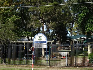
St Marys Senior High School
School in Australia
Distance: Approx. 987 meters
Latitude and longitude: -33.76333333,150.77
St Marys Senior High School is a government-funded co-educational dual modality partially academically selective and comprehensive post-compulsory secondary day school, located in St Marys, a suburb in western Sydney, New South Wales, Australia. Established in 1989, the school is the first New South Wales Department of Education senior high school and currently caters for approximately 900 students in Year 11 and Year 12.
Wow FM
Australian community radio station
Distance: Approx. 451 meters
Latitude and longitude: -33.7683,150.7734
Wow FM (100.7 FM, callsign "2WOW") is a community radio station based in St Marys in Sydney. The station broadcasts to part of Western Sydney, mainly centered on the City of Penrith. Wow FM is a volunteer-run organisation and is funded through listener support, grants and limited commercial sponsorship.
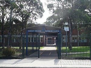
Wollemi College
Independent school in Australia
Distance: Approx. 2143 meters
Latitude and longitude: -33.7648,150.7556
Wollemi College is an independent Roman Catholic school for boys, located in the western Sydney suburb of Werrington, New South Wales, Australia. Situated on 10 hectares (25 acres), the college was founded in 1999 and provides a personalised education for students from Year 2 to Year 12. Oversight of the college is administered by Parents for Education Foundation (PARED), which is affiliated with Opus Dei.
Rose Cottage and Early Slab Hut
Historic site in New South Wales, Australia
Distance: Approx. 1613 meters
Latitude and longitude: -33.7672,150.7609
Rose Cottage and Early Slab Hut is a heritage-listed former residence and farm house and now vacant building, at the corner of Water Street and Tennant Road, in the western Sydney suburb of Werrington in the City of Penrith local government area of New South Wales, Australia. It was designed in a vernacular style and built from 1810 to 1870, possibly by the Andrews family. The property is owned by Department of Planning and Infrastructure, a department of the Government of New South Wales.
Weather in this IP's area
overcast clouds
13 Celsius
12 Celsius
12 Celsius
14 Celsius
1024 hPa
89 %
1024 hPa
1018 hPa
10000 meters
2.06 m/s
350 degree
100 %
06:21:51
19:05:40