Country:
 India
IndiaRegion:
City:
Latitude and Longitude:
Time Zone:
Postal Code:
IP information under different IP Channel
ip-api
Country
Region
City
ASN
Time Zone
ISP
Blacklist
Proxy
Latitude
Longitude
Postal
Route
IPinfo
Country
Region
City
ASN
Time Zone
ISP
Blacklist
Proxy
Latitude
Longitude
Postal
Route
MaxMind
Country
Region
City
ASN
Time Zone
ISP
Blacklist
Proxy
Latitude
Longitude
Postal
Route
Luminati
Country
INASN
Time Zone
Asia/Kolkata
ISP
Unit 69 SDF III
Latitude
Longitude
Postal
db-ip
Country
Region
City
ASN
Time Zone
ISP
Blacklist
Proxy
Latitude
Longitude
Postal
Route
ipdata
Country
Region
City
ASN
Time Zone
ISP
Blacklist
Proxy
Latitude
Longitude
Postal
Route
Popular places and events near this IP address

St. John the Baptist Church, Mumbai
Ruined church in Mumbai
Distance: Approx. 613 meters
Latitude and longitude: 19.1216159,72.8743576
St. John the Baptist Church is an abandoned and ruined church presently located within the SEEPZ Industrial Area, in Andheri, Mumbai, India. It was built by the Portuguese Jesuits in 1579 and opened to public worship on the feast of John the Baptist that year.

Mahakali Caves
Caves in Maharashtra state of India
Distance: Approx. 440 meters
Latitude and longitude: 19.130436,72.874133
The Kondivite Caves, are a group of 19 rock-cut monuments built between 1st century BCE and 6th century CE. This Buddhist monastery is located in the eastern suburb of Andheri in the city of Mumbai (Bombay) in western India. The monument consists of two groups of rock-cut caves – four caves more to the north-west and 15 caves more to the south-east. Most caves are viharas and cells for monks, but Cave 9 of the south-eastern group is chaitya.

Holy Family High School (Mumbai)
Private primary and secondary school in Maharashtra, India
Distance: Approx. 1853 meters
Latitude and longitude: 19.116999,72.861843
The Holy Family High School is a private Catholic primary and secondary school for boys located in the suburb of East Andheri in Mumbai, in the state of Maharashtra, India. While the school is primarily English-medium, there is also a smaller Marathi-medium section that runs in parallel from the fifth to the tenth standard. The school now also has a junior college named Holy Family Junior College for 11th and 12th grade HSC students.
Marol
Neighbourhood in Mumbai Suburban, Maharashtra, India
Distance: Approx. 1111 meters
Latitude and longitude: 19.119219,72.882743
Marol is a locality in the suburb of Andheri (East) in Mumbai, India.
Tolani College of Commerce
Distance: Approx. 1226 meters
Latitude and longitude: 19.12833333,72.86444444
Tolani College of Commerce is a commerce college in Andheri East, Mumbai, India.
Aditya College
Distance: Approx. 1226 meters
Latitude and longitude: 19.12833333,72.86444444
Aditya College, was established in 2007 and is in the city of Gwalior, Madhya Pradesh. The College is affiliated with Jiwaji University, Gwalior and has four academic departments: Commerce, Management, Computer Science and Tourism.
SEEPZ
Neighbourhood in Mumbai Suburban, Maharashtra, India
Distance: Approx. 434 meters
Latitude and longitude: 19.123,72.876
Santacruz Electronics Export Processing Zone (SEEPZ) is a Special Economic Zone in Mumbai, India. Situated in the Andheri East area, it is subjected to liberal economic laws as compared to the rest of India to promote rapid economic growth using tax and business incentives and attract foreign investment and technology. Seepz was created in 1973 and was seen as export processing zone.
Bombay Scottish School, Powai
Private school in Mumbai, Maharashtra, India
Distance: Approx. 2065 meters
Latitude and longitude: 19.11819444,72.89333333
The Bombay Scottish School, Powai (BSS or BSS Powai), also popularly known as Scottish, is a private, Christian co-educational day school located in Powai in Mumbai, India. It is an affiliate of Bombay Scottish School, Mahim. The institution was established on 21 June 1997 by Mark David.
Holy Spirit Hospital (Mumbai)
Hospital in Maharashtra, India
Distance: Approx. 1059 meters
Latitude and longitude: 19.128,72.866
Holy Spirit Hospital is a Charitable Trust Hospital located in Andheri, Mumbai, owned and managed by the Missionary Sisters Servants of the Holy Spirit, which began in 1964 as an out-patient clinic.

Chakala (J B Nagar) metro station
Mumbai Metro's Blue Line 1 metro station
Distance: Approx. 1870 meters
Latitude and longitude: 19.112045,72.867696
Chakala (J.B. Nagar) (Officially known as IndusInd Bank Chakala (J.B. Nagar)) is an elevated metro station on the East-West Corridor of the Blue Line 1 of Mumbai Metro, serving the JB Nagar neighbourhood of Andheri in Mumbai. It was opened to the public on 8 June 2014. Chakala station is located 1.5–2 km away from the Chakala, neighbourhood of Andheri.
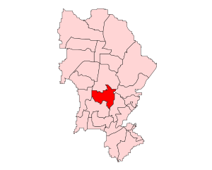
Andheri East Assembly constituency
Indian constituency
Distance: Approx. 994 meters
Latitude and longitude: 19.12,72.87
Andheri East constituency is one of the 26 Vidhan Sabha constituencies located in Mumbai Suburban district. It is a segment of the Mumbai North West Lok Sabha constituency along with five other Vidhan Sabha segments, namely Goregaon, Versova, Jogeshwari East, Dindoshi and Andheri West in Mumbai Suburban district.

Maker's Asylum
Makerspace / hackerspace which started in Mumbai
Distance: Approx. 783 meters
Latitude and longitude: 19.11988333,72.87542778
Maker's Asylum is a makerspace / hackerspace which started in Mumbai back in 2013 and is now headquartered in Goa, India, inspired by Artisan's Asylum, Chaos Computer Club and other maker organisations.
Weather in this IP's area
haze
31 Celsius
37 Celsius
31 Celsius
31 Celsius
1005 hPa
70 %
1005 hPa
1002 hPa
4000 meters
4.63 m/s
230 degree
40 %
06:33:29
18:13:26