Country:
Region:
City:
Latitude and Longitude:
Time Zone:
Postal Code:
IP information under different IP Channel
ip-api
Country
Region
City
ASN
Time Zone
ISP
Blacklist
Proxy
Latitude
Longitude
Postal
Route
Luminati
Country
Region
nsw
City
sydney
ASN
Time Zone
Australia/Sydney
ISP
Nexon Asia Pacific Pty Ltd
Latitude
Longitude
Postal
IPinfo
Country
Region
City
ASN
Time Zone
ISP
Blacklist
Proxy
Latitude
Longitude
Postal
Route
db-ip
Country
Region
City
ASN
Time Zone
ISP
Blacklist
Proxy
Latitude
Longitude
Postal
Route
ipdata
Country
Region
City
ASN
Time Zone
ISP
Blacklist
Proxy
Latitude
Longitude
Postal
Route
Popular places and events near this IP address
Sydney Olympic FC
Football club
Distance: Approx. 252 meters
Latitude and longitude: -33.91666667,151.09472222
Sydney Olympic Football Club is an Australian semi-professional soccer club, based in Belmore, Sydney, New South Wales, that plays in the National Premier Leagues NSW. The club was founded as Pan-Hellenic Soccer Club in 1957 by Greek immigrants. In 1977, the club changed its name to Sydney Olympic and became a founding member of the Phillips Soccer League, later named the National Soccer League (NSL), the inaugural national football league of Australia, remaining a member of the competition until its demise in 2004. Sydney Olympic have won many trophies in Australian football, including two NSL Championships, two NSL Cups, the NSL Minor Premiership and three NSW Premier League Championships.

Campsie railway station
Railway station in Sydney, New South Wales, Australia
Distance: Approx. 1245 meters
Latitude and longitude: -33.910376,151.102579
Campsie railway station is a heritage-listed railway station on the Bankstown railway line in the Sydney suburb of Campsie. It is currently closed for conversion works to enable it to be served by Metro North West & Bankstown Line services.

Belmore railway station
Railway station in Sydney, New South Wales, Australia
Distance: Approx. 322 meters
Latitude and longitude: -33.91725833,151.0887111
Belmore railway station is a heritage-listed railway station on the Bankstown railway line in the Sydney suburb of Belmore. It is currently closed for conversion works to enable it to be served by Metro North West & Bankstown Line services in the future.

Lakemba railway station
Railway station in Sydney, New South Wales
Distance: Approx. 1551 meters
Latitude and longitude: -33.9201,151.0757
Lakemba railway station is a heritage-listed railway station on the Bankstown railway line in the Sydney suburb of Lakemba. It is currently closed for conversion works to enable it to be served by Metro North West & Bankstown Line services in the future.

City of Canterbury (New South Wales)
Former local government area in New South Wales, Australia
Distance: Approx. 727 meters
Latitude and longitude: -33.91666667,151.1
The City of Canterbury was a local government area in the Inner South-West region of Sydney, New South Wales, Australia. The council area was within the northern part of the Parish of St George above Wolli Creek and The M5 but below The Cooks River. The city was primarily residential and light industrial in character, and was home to over 130 nationalities.
Campsie, New South Wales
Suburb of Sydney, New South Wales, Australia
Distance: Approx. 947 meters
Latitude and longitude: -33.91461,151.10183
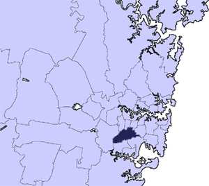
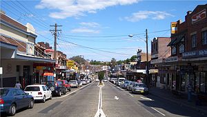
Campsie is a suburb in the state of New South Wales, Australia. Campsie is 11 kilometres south west of the Sydney central business district, on the southern bank of the Cooks River. Campsie is one of the administrative centres of the City of Canterbury-Bankstown.

Belmore, New South Wales
Suburb of Sydney, New South Wales, Australia
Distance: Approx. 408 meters
Latitude and longitude: -33.9175,151.08777778
Belmore is a suburb of Sydney, in the state of New South Wales, Australia. Rapidly gentrifying, Belmore is located 11 kilometres south-west of the Sydney central business district, in the local government area of the City of Canterbury-Bankstown.

Belmore Sports Ground
Football field in Belmore, Sydney, New South Wales, Australia
Distance: Approx. 252 meters
Latitude and longitude: -33.91666667,151.09472222
Belmore Sports Ground, formerly known as Belmore Oval, is a multi-purpose stadium in Belmore, New South Wales, Australia. The park covers 22 acres (89,000 m2) and from 1951 has contained the Belmore Bowling Recreation Club green. It is close to Belmore railway station.
All Saints Greek Orthodox Grammar School
School in Australia
Distance: Approx. 1342 meters
Latitude and longitude: -33.929267,151.095361
All Saints Greek Orthodox Grammar School, or simply All Saints Grammar (ASG), is a dual-campus independent Greek Orthodox co-educational early learning, primary, and secondary day school, located in the suburb of Belmore, New South Wales, Australia. Established in 1990, the school's Junior campus for early learning to Year 6 is located in Belmore, and the Senior High School "Towers Campus" for students in Year 7 to 12 is located in Belmore South. The school has a non-selective enrolment policy, and, as of 2008, catered for approximately 700 students from early learning to Year 12.
Canterbury Hospital
Hospital in New South Wales, Australia
Distance: Approx. 619 meters
Latitude and longitude: -33.9196,151.0984
The Canterbury Hospital is a teaching hospital in Campsie, a south-western suburb of Sydney, New South Wales, Australia. Canterbury Hospital was opened in 1929 and was rebuilt in 1998. Canterbury Hospital is one of many hospitals in a network under the management of Sydney Local Health District.

Cup and Saucer Creek
Creek in Sydney, New South Wales, Australia
Distance: Approx. 1054 meters
Latitude and longitude: -33.92611111,151.09694444
Cup and Saucer Creek, an urban watercourse of the Cooks River catchment, is located in the Canterbury-Bankstown region of Sydney, in New South Wales, Australia.

Australian National Imams Council
Islamic organization based in Australia
Distance: Approx. 1372 meters
Latitude and longitude: -33.922514,151.078617
The Australian National Imams Council (ANIC) was formed in 2006 during a meeting of more than 80 Sunni imams which had gathered to discuss the crisis created by comments made by Taj El-Din Hilaly. In 2011, they requested that the Darulfatwa-supported Muslim Community Radio Incorporated not have its licence renewed due to ties with Al-Ahbash and because of its promotion of "sectarian fringe views".
Weather in this IP's area
overcast clouds
18 Celsius
18 Celsius
17 Celsius
19 Celsius
1021 hPa
81 %
1021 hPa
1018 hPa
10000 meters
5.14 m/s
90 degree
100 %
05:41:48
19:40:31
