Country:
 Hong Kong (China)
Region:
City:
Latitude and Longitude:
Time Zone:
Postal Code:
IP information under different IP Channel
ip-api
Country
Region
City
ASN
Time Zone
ISP
Blacklist
Proxy
Latitude
Longitude
Postal
Route
IPinfo
Country
Region
City
ASN
Time Zone
ISP
Blacklist
Proxy
Latitude
Longitude
Postal
Route
MaxMind
Country
Region
City
ASN
Time Zone
ISP
Blacklist
Proxy
Latitude
Longitude
Postal
Route
Luminati
Country
HKASN
Time Zone
Asia/Hong_Kong
ISP
Hong Kong Beecloud System Technology Services Limited
Latitude
Longitude
Postal
db-ip
Country
Region
City
ASN
Time Zone
ISP
Blacklist
Proxy
Latitude
Longitude
Postal
Route
ipdata
Country
Region
City
ASN
Time Zone
ISP
Blacklist
Proxy
Latitude
Longitude
Postal
Route
Popular places and events near this IP address

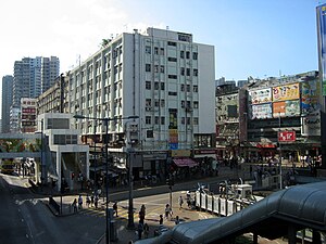
Kwun Tong
Region in Hong Kong
Distance: Approx. 721 meters
Latitude and longitude: 22.315,114.225
Kwun Tong is an area in the Kwun Tong District of Hong Kong, situated at the eastern part of the Kowloon Peninsula, and its boundary stretches from Lion Rock in the north to Lei Yue Mun in the south, and from the winding paths of Kowloon Peak in the east to the north coast of the former Kai Tak Airport runway in the west. One of the first new towns in Hong Kong, Kwun Tong was, and remains, a major industrial area. Its population has been growing rapidly, and the demand for housing, medical and educational facilities and services has been increasing.

Ngau Tau Kok station
MTR station in Kowloon, Hong Kong
Distance: Approx. 150 meters
Latitude and longitude: 22.3154,114.2193
Ngau Tau Kok (Chinese: 牛頭角; Cantonese Yale: Ngàutàugok) is a station on the Hong Kong MTR Kwun Tong line. It is located in the Ngau Tau Kok area of Kowloon East, between Kwun Tong and Kowloon Bay stations. It was among the earliest stations in the network, becoming operational on 1 October 1979.
Yue Man Square
Town centre of Kwun Tong, Hong Kong
Distance: Approx. 697 meters
Latitude and longitude: 22.31361,114.22464
Yue Man Square (Chinese: 裕民坊; Cantonese Yale: yúh màhn fōng; pinyin: Yùmín Fáng) is the town centre of Kwun Tong in Kowloon of Hong Kong. It is also the commercial centre in the area.

Millennium City, Hong Kong
Commercial development in Kwun Tong, Hong Kong
Distance: Approx. 368 meters
Latitude and longitude: 22.313,114.221
Millennium City (Chinese: 創紀之城; Jyutping: cong1 gei2 zi1 seng4) is a group of skyscrapers in Kwun Tong, Hong Kong built along the southern side of Kwun Tong Road near Ngau Tau Kok station and developed by Sun Hung Kai Properties. The Millennium City project currently consists of five buildings, numbered 1, 2, 3, 5 and 6. The number 4 is widely regarded as unlucky in many parts of Asia and in both Chinese and Japanese it is a homophone for "death".

St. Catharine's School for Girls (Kwun Tong)
Secondary school in Hong Kong
Distance: Approx. 503 meters
Latitude and longitude: 22.3191,114.2195
St Catharine's School for Girls (Chinese: 聖傑靈女子中學) is located in Hong Lee Road, Kwun Tong, Hong Kong. It is a girls' secondary school.

Kwun Tong Garden Estate
Housing estate in Kwun Tong, Hong Kong
Distance: Approx. 266 meters
Latitude and longitude: 22.317,114.219
Kwun Tong Garden Estate (Chinese: 觀塘花園大廈), or Garden Estate (Chinese: 花園大廈), is a public housing estate in Ngau Tau Kok, Kwun Tong, Kowloon, Hong Kong, developed by the Hong Kong Housing Society, near the MTR Kwun Tong line's Ngau Tau Kok station. It is the largest Housing Society estate by number of flats (4,921).

Upper Ngau Tau Kok Estate
Distance: Approx. 543 meters
Latitude and longitude: 22.31944444,114.21638889
Upper Ngau Tau Kok Estate (Chinese: 牛頭角上邨) is a public housing estate in Ngau Tau Kok, Kwun Tong, Kowloon, Hong Kong, located next to Kwun Tong Garden Estate and between MTR Ngau Tau Kok station and Kowloon Bay station. After redevelopment, the estate has 9 blocks developed into 3 phases.

Kwun Tong Kung Lok Government Secondary School
Government school in Kwun Tong, Kowloon, Hong Kong
Distance: Approx. 583 meters
Latitude and longitude: 22.3182,114.2223
Kwun Tong Kung Lok Government Secondary School (Chinese: 觀塘功樂官立中學; often abbreviated as KTKLGSS) is a secondary boys' school founded in 1970. It is located at 90 Kung Lok Road, Kwun Tong, Kowloon, Hong Kong, and occupies an area of 86,080 square feet (7,997 m2).
Hidden Agenda (live house)
Live music club in Kwun Tong, Hong Kong
Distance: Approx. 250 meters
Latitude and longitude: 22.315819,114.215833
Hidden Agenda was a live house located in the industrial area of Kwun Tong, Hong Kong. It opened in January 2009 and has since then relocated twice due to rising rents and the violation of permitted land uses (that excludes the operation of cultural venues in industrial buildings). The live house staged its final show in July 2017 and was officially closed in October 2017.

Mu Kuang English School
Secondary school in Kwun Tong, Hong Kong
Distance: Approx. 407 meters
Latitude and longitude: 22.3184,114.2187
The Mu Kuang English School (Chinese: 慕光英文書院; Jyutping: mou6 gwong1 jing1 man4 syu1 jyun6) is a secondary school on Kung Lok Road, Kwun Tong, Kowloon, Hong Kong. It is a non-government school funded under the Direct Subsidy Scheme.

Hoi Bun Road Park
Public park in Kwun Tong, Hong Kong
Distance: Approx. 258 meters
Latitude and longitude: 22.3149,114.2155
Hoi Bun Road Park (Chinese: 海濱道公園) is a public park in Kwun Tong, Kowloon, Hong Kong.

Sun Museum
Museum in Hong Kong
Distance: Approx. 468 meters
Latitude and longitude: 22.310815,114.219439
The Sun Museum (Chinese: 一新美術館) is a private museum in Hong Kong, established by the Simon Suen Foundation (孫少文基金會). It aims to promote a better understanding of Chinese arts and culture. The museum is located at 4/F, SML Tower, 165 Hoi Bun Road, Kwun Tong.
Weather in this IP's area
overcast clouds
29 Celsius
33 Celsius
28 Celsius
29 Celsius
1013 hPa
76 %
1013 hPa
1010 hPa
10000 meters
4.47 m/s
120 degree
100 %
06:20:29
17:55:45