103.148.134.111 - IP Lookup: Free IP Address Lookup, Postal Code Lookup, IP Location Lookup, IP ASN, Public IP
Country:
Region:
City:
Location:
Time Zone:
Postal Code:
ISP:
ASN:
language:
User-Agent:
Proxy IP:
Blacklist:
IP information under different IP Channel
ip-api
Country
Region
City
ASN
Time Zone
ISP
Blacklist
Proxy
Latitude
Longitude
Postal
Route
db-ip
Country
Region
City
ASN
Time Zone
ISP
Blacklist
Proxy
Latitude
Longitude
Postal
Route
IPinfo
Country
Region
City
ASN
Time Zone
ISP
Blacklist
Proxy
Latitude
Longitude
Postal
Route
IP2Location
103.148.134.111Country
Region
tamil nadu
City
andiyur
Time Zone
Asia/Kolkata
ISP
Language
User-Agent
Latitude
Longitude
Postal
ipdata
Country
Region
City
ASN
Time Zone
ISP
Blacklist
Proxy
Latitude
Longitude
Postal
Route
Popular places and events near this IP address

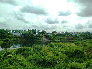
Anthiyur
Panchayat Town in Tamil Nadu, India
Distance: Approx. 1509 meters
Latitude and longitude: 11.5771,77.5877
Anthiyur is a taluk (Anthiyur taluk) and panchayat town in the Erode district in the state of Tamil Nadu, India.
Jambai
Panchayat Town in Tamil Nadu, India
Distance: Approx. 9484 meters
Latitude and longitude: 11.50472222,77.63361111
Jambai is a panchayat town in Bhavani Taluk Erode district in the Indian state of Tamil Nadu.

Olagadam
Town in Tamil Nadu, India
Distance: Approx. 5366 meters
Latitude and longitude: 11.57583333,77.64861111
Olagadam is a panchayat town in Erode district in the Indian state of Tamil Nadu. The name originated from 'Ulagavidangam', meaning world's self-emerging (actually a Shiva temple 'Ulageshwarar' in which the Shiva lingam is said to be self emerged).
Patlur
Village Panchayat in Tamil Nadu, India
Distance: Approx. 1859 meters
Latitude and longitude: 11.6,77.6
Patlur is a village in Anthiyur Taluk, Erode district, Tamil Nadu State, India with a population of approximately 8100. The main occupation in Patlur is agriculture.

Anthiyur Assembly constituency
State Legislative Assembly Constituency in Tamil Nadu
Distance: Approx. 367 meters
Latitude and longitude: 11.58,77.6
Anthiyur is a legislative assembly, that includes the town of Anthiyur and other neighbouring local bodies. Its State Assembly Constituency number is 105. It is a part of Tiruppur Lok Sabha constituency.
Brahmadesam (Bhavani)
Panchayat village in India
Distance: Approx. 4779 meters
Latitude and longitude: 11.544945,77.580315
Brahmadesam is an Indian Panchayat village located in Anthiyur taluk of Erode district in the state of Tamil Nadu. According to the 2001 census, the village had a population of 12074, with a literacy rate of 52.33%.

Savandapur
Town panchayat in Tamil Nadu, India
Distance: Approx. 9814 meters
Latitude and longitude: 11.57138889,77.51083333
Savandapur is a panchayat in Gobichettipalayam taluk in Erode District of Tamil Nadu state, India. It is about 10 kilometres (6.2 mi) from Gobichettipalayam and 35 kilometres (22 mi) from district headquarters Erode.
Moongilpalayam
Village in India
Distance: Approx. 5409 meters
Latitude and longitude: 11.631556,77.594175
Moongilpalayam is a village in Anthiyur taluk, Erode district of Tamil Nadu, India. It is about 40 km from Erode and 25 km from Bhavani travelling north-east on highway 175. The village of Ennamangalam is about 1 km north.
Anthiyur taluk
Indian district
Distance: Approx. 367 meters
Latitude and longitude: 11.58,77.6
Anthiyur taluk(Tamil: அந்தியூர் வட்டம்) is a taluk of Erode district of the Indian state of Tamil Nadu. Anthiyur became separate taluk in Erode district by restructuring Bhavani and Gobichettipalayam on 22 November 2012. It comprises four blocks – Anthiyur, Athani, Burgur and Ammapet It comes under Gobichettipalayam Revenue Division.
Thalapalayam
Panchayat town in India
Distance: Approx. 6708 meters
Latitude and longitude: 11.55861111,77.65611111
Thalapalayam is a panchayat town in Erode district in the Indian state of Tamil Nadu. Nearby cities are Bhavani பவானி, Erode, and Kavundhapadi.

Thanthai Periyar Wildlife Sanctuary
Wildlife Sanctuary in Tamil Nadu, India
Distance: Approx. 9851 meters
Latitude and longitude: 11.57305556,77.51027778
Thanthai Periyar Wildlife Sanctuary is a proposed protected area located along the area straddling both the Western Ghats and Eastern Ghats in the Erode District of the Indian state of Tamil Nadu. It was notified by Government of Tamil Nadu in March 2023 and will become the 18th wildlife sanctuary in Tamil Nadu. It will cover a forest area of 801.15 km2 (309.33 sq mi) and will cover parts of Gobichettipalayam and Anthiyur taluks in Erode district in Western Tamil Nadu.
Sri Gurunatha Swamy temple
Temple in Tamil Nadu
Distance: Approx. 1932 meters
Latitude and longitude: 11.59584,77.58775
Sri Gurunatha Swamy temple is a Hindu temple located in Pudhupalayam, Anthiyur, Erode, Tamil Nadu. Tradition holds that the template is 600 years old and may have been built by the Pandyas as there are two fish emblems sculpted in the temple. The temple houses Lord Gurunatha, Goddess Kamatchi Amman and Lord Vishnu.
Weather in this IP's area
few clouds
21 Celsius
21 Celsius
21 Celsius
23 Celsius
1013 hPa
71 %
1013 hPa
972 hPa
10000 meters
1.13 m/s
0.94 m/s
278 degree
21 %
