103.147.39.15 - IP Lookup: Free IP Address Lookup, Postal Code Lookup, IP Location Lookup, IP ASN, Public IP
Country:
Region:
City:
Location:
Time Zone:
Postal Code:
ISP:
ASN:
language:
User-Agent:
Proxy IP:
Blacklist:
IP information under different IP Channel
ip-api
Country
Region
City
ASN
Time Zone
ISP
Blacklist
Proxy
Latitude
Longitude
Postal
Route
db-ip
Country
Region
City
ASN
Time Zone
ISP
Blacklist
Proxy
Latitude
Longitude
Postal
Route
IPinfo
Country
Region
City
ASN
Time Zone
ISP
Blacklist
Proxy
Latitude
Longitude
Postal
Route
IP2Location
103.147.39.15Country
Region
west bengal
City
rampur hat
Time Zone
Asia/Kolkata
ISP
Language
User-Agent
Latitude
Longitude
Postal
ipdata
Country
Region
City
ASN
Time Zone
ISP
Blacklist
Proxy
Latitude
Longitude
Postal
Route
Popular places and events near this IP address

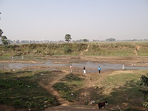
Rampurhat
City in West Bengal, India
Distance: Approx. 497 meters
Latitude and longitude: 24.17,87.78
Rampurhat is an important city and a municipality in Birbhum district in the Indian state of West Bengal. It is the headquarters of the Rampurhat subdivision. According to Census 2011, Rampurhat is the third most populous city in Birbhum district and 82nd most populous city in West Bengal.Rampurhat is a rapidly growing township It is near the West Bengal / Jharkhand border.

Rampurhat subdivision
Subdivision in West Bengal, India
Distance: Approx. 497 meters
Latitude and longitude: 24.17,87.78
Rampurhat subdivision is an administrative subdivision of Birbhum district in the state of West Bengal, India.
Dwarka River
River in West Bengal, India
Distance: Approx. 6499 meters
Latitude and longitude: 24.1100943,87.7989578
The Dwarka River (also called Babla) is a tributary of Bhagirathi.

Rampurhat I
Community development block in West Bengal, India
Distance: Approx. 2159 meters
Latitude and longitude: 24.1860556,87.781944
Rampurhat I is a community development block that forms an administrative division in Rampurhat subdivision of Birbhum district in the Indian state of West Bengal.
Rampurhat College
Distance: Approx. 744 meters
Latitude and longitude: 24.1728293,87.7803782
Rampurhat College, established in 1950, is a government affiliated college located at Rampurhat in the Birbhum district of West Bengal. It is affiliated to University of Burdwan and teaches arts, science and commerce.

Rampurhat Junction railway station
Railway Station in West Bengal, India
Distance: Approx. 1395 meters
Latitude and longitude: 24.17916667,87.78194444
Rampurhat Junction railway station is 7th busiest railway stations of Eastern Railway zone and it is the Largest and Busiest railway station of Birbhum district of West Bengal. It is a NSG-3 Category and Class A station. The station is under Howrah railway division is the 3rd busiest station in this division.
Rampurhat Girls' High School
Higher secondary school in Rampurhat, West Bengal, India
Distance: Approx. 786 meters
Latitude and longitude: 24.1737576,87.7832278
Rampurhat Girls' High School is higher secondary school for girls at Rampurhat of Birbhum district of West Bengal.
Atla, Birbhum
Village in West Bengal, India
Distance: Approx. 5820 meters
Latitude and longitude: 24.11666667,87.76666667
Atla is a village in Rampurhat I CD Block in Rampurhat subdivision of Birbhum district, West Bengal, India. It is famous for being the birthplace Bamakhepa, a saint of India.
Margram
Village in West Bengal, India
Distance: Approx. 6232 meters
Latitude and longitude: 24.151151,87.842242
Margarm is a village and gram panchayat in Rampurhat II CD Block in Rampurhat subdivision of Birbhum district in the Indian state of West Bengal.
Rampurhat Government Medical College and Hospital
Government medical college in West Bengal, India
Distance: Approx. 2651 meters
Latitude and longitude: 24.1894183,87.7911268
Rampurhat Government Medical College and Hospital (RPHGMCH) is a full-fledged tertiary referral Government Medical college. It was established in the year 2018. The college imparts the degree Bachelor of Medicine and Surgery (MBBS).
2022 Birbhum violence
A violence created due to political issue in West Bengal, India
Distance: Approx. 859 meters
Latitude and longitude: 24.164365,87.79136382
The 2022 Birbhum violence, also called the Bogtui massacre, happened in the village of Baktai (Bagtui, Bogtui) in Rampurhat, Birbhum, India in the aftermath of the death of Trinamool deputy chief Bhadu Sheikh. At least four houses were set on fire. 10 people were reported killed.

Tarapith Temple
Hindu Temple dedicated to goddess Tara at Tarapith, India
Distance: Approx. 6103 meters
Latitude and longitude: 24.1133183,87.7969825
Tarapith Temple is a 13th century Hindu temple in Tarapith, Birbhum, West Bengal in India, dedicated to the Hindu goddess Tara, one of the 10 Mahavidyas in Hinduism. It is one of the 108 Shakti Pithas in India. As per the Devi Bhagavata Purana, Kalika Purana, Markandeya Purana and Shakti Peetha Stotram, the third eye of Goddess Sati fell here, after Lord Vishnu's Sudarshan Chakra splintered her body into many parts to calm down Mahadev's rage, during his cosmic dance.
Weather in this IP's area
clear sky
28 Celsius
27 Celsius
28 Celsius
28 Celsius
1014 hPa
25 %
1014 hPa
1008 hPa
10000 meters
0.76 m/s
1.53 m/s
351 degree
1 %
