Country:
Region:
City:
Latitude and Longitude:
Time Zone:
Postal Code:
IP information under different IP Channel
ip-api
Country
Region
City
ASN
Time Zone
ISP
Blacklist
Proxy
Latitude
Longitude
Postal
Route
Luminati
Country
ASN
Time Zone
Asia/Jakarta
ISP
PT Adhikarya Cipta Persada
Latitude
Longitude
Postal
IPinfo
Country
Region
City
ASN
Time Zone
ISP
Blacklist
Proxy
Latitude
Longitude
Postal
Route
db-ip
Country
Region
City
ASN
Time Zone
ISP
Blacklist
Proxy
Latitude
Longitude
Postal
Route
ipdata
Country
Region
City
ASN
Time Zone
ISP
Blacklist
Proxy
Latitude
Longitude
Postal
Route
Popular places and events near this IP address

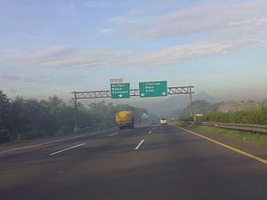
Jagorawi Toll Road
Toll road in Indonesia
Distance: Approx. 1815 meters
Latitude and longitude: -6.25305556,106.87277778
The Jakarta–Bogor–Ciawi Toll Road (shortened to Jagorawi Toll Road) is the first toll road in Indonesia. Construction of the highway began in 1973, and it was officially opened on 9 March 1978. The Jagorawi Toll Road links the capital city of Jakarta to the West Javanese cities of Bogor and Ciawi.

Halim Perdanakusuma
Indonesian airman and National Hero of Indonesia
Distance: Approx. 2366 meters
Latitude and longitude: -6.25722222,106.84638889
Air Vice-Marshal Abdul Halim Perdanakusuma (18 November 1922 – 14 December 1947), better known as Halim Perdanakusuma, was an Indonesian airman and National Hero of Indonesia.
Universitas Siswa Bangsa Internasional
University in Indonesia
Distance: Approx. 1908 meters
Latitude and longitude: -6.247814,106.844884
Universitas Siswa Bangsa Internasional (also known by the acronym USBI), or Sampoerna University, is an international university located in Jakarta, Indonesia. It is the first Indonesian university to offer an accredited U.S. degree entirely within Indonesia.
2017 Jakarta bombings
Terrorist attacks in Jakarta, Indonesia
Distance: Approx. 1698 meters
Latitude and longitude: -6.22932222,106.85205
On 24 May 2017, two explosions occurred at a bus terminal in Kampung Melayu, East Jakarta. Police confirmed that the explosions were caused by multiple explosive devices found in the toilet and in another part of the terminal. The bombings killed five people: three policemen and two attackers.

Dirgantara Monument
Monument in Jakarta, Indonesia
Distance: Approx. 1946 meters
Latitude and longitude: -6.243085,106.843472
Dirgantara Monument (Indonesian: Monumen Patung Dirgantara), also known as Gatot Kaca Monument after the Javanese wayang figure, is a monument located in Jakarta, Indonesia. It is also known as Tugu Pancoran, after tugu a word for statue and pedestal, and the South Jakarta subdistrict of Pancoran, where it is located. The monument was commissioned by President Sukarno in 1964 as a tribute to the Indonesian Air Force and early Indonesian aviators who flew against the Dutch to achieve independence.

Baru Barat River
River in Jakarta, Indonesia
Distance: Approx. 2078 meters
Latitude and longitude: -6.2347,106.8436
The Baru Barat River (Indonesian: Kali Baru Barat, lit. 'Western New River') is a man-made canal flowing from the Cisadane River in Bogor Regency to Jakarta, Indonesia. It was one of two canals built in the 18th century under the order of the Governor-General Gustaaf Willem van Imhoff, the other being the Baru Timur River (Indonesian: Kali Baru Timur, lit. 'Eastern New River'). Both canals were originally built to transport agricultural harvests from Bogor to Batavia (now Jakarta).

Tebet Eco Park
Urban park in Tebet, Jakarta, Indonesia
Distance: Approx. 1037 meters
Latitude and longitude: -6.237329,106.852728
The Tebet Eco Park (Indonesian: Taman Eco Tebet) or Taman Kota Tebet is an urban park located in Tebet, Jakarta, Indonesia. The park has a land area of 7 hectares and it was previously known as Tebet Honda Park. It is a popular place for exercise, socialization, and recreation for neighboring community.

Cawang railway station
Railway station in Indonesia
Distance: Approx. 333 meters
Latitude and longitude: -6.24189,106.858
Cawang Station (CW) is a class II railway station located at Jl. Tebet Timur Dalam 11, East Tebet, Tebet, South Jakarta, Indonesia. The station, which is located at the altitude of +26 meters, is included in Operational Area I Jakarta of Kereta Api Indonesia and only serves the KRL Commuterline route.

Kampung Melayu (Transjakarta)
Bus station in Jakarta, Indonesia
Distance: Approx. 2015 meters
Latitude and longitude: -6.22455,106.8668
Kampung Melayu is a Transjakarta bus rapid transit station located below the K.H. Abdullah Syafei overpass, at the middle of the interchange between Abdullah Syafei, Oto Iskandar di Nata, and Jatinegara Barat/Timur streets in Kampung Melayu, Jatinegara, East Jakarta, Indonesia. This is the terminus and transit point between corridors 5, 7, and 11. It stands on the former site of an open-air bus terminal for Kopaja, Metromini, and angkot/mikrolet routes.

Cikoko LRT Station
Distance: Approx. 474 meters
Latitude and longitude: -6.243476,106.857102
Cikoko LRT Station is a light rail station located in Jalan Cikoko Barat, Cikoko, Pancoran, South Jakarta. The station, which is located at an altitude of +39.53 meters, serves the Cibubur and Bekasi lines of the Jabodebek LRT system.

Ciliwung LRT Station
Railway station in Indonesia
Distance: Approx. 398 meters
Latitude and longitude: -6.243477,106.864131
Ciliwung LRT Station is a light rail station located in Jalan Letjen M.T. Haryono, Cawang, Kramat Jati, East Jakarta. The station, which is located at an altitude of +36.34 meters, serves the Cibubur and Bekasi lines of the Jabodebek LRT system.

Cawang LRT Station
Light rail station in Jakarta, Indonesia
Distance: Approx. 1357 meters
Latitude and longitude: -6.246225,106.872386
Cawang LRT Station is a light rail station located in Jalan Letjen M.T. Haryono, Cawang, Kramat Jati, East Jakarta. The station, which is located at an altitude of +39 meters, serves the Cibubur and Bekasi lines of the Jabodebek LRT system. It is the main interchange station between the two lines of the system where the two lines meet and split.
Weather in this IP's area
haze
33 Celsius
39 Celsius
32 Celsius
34 Celsius
1007 hPa
61 %
1007 hPa
1005 hPa
5000 meters
5.14 m/s
60 degree
40 %
05:25:35
17:50:11