103.146.174.141 - IP Lookup: Free IP Address Lookup, Postal Code Lookup, IP Location Lookup, IP ASN, Public IP
Country:
 India
IndiaRegion:
City:
Location:
Time Zone:
Postal Code:
ISP:
ASN:
language:
User-Agent:
Proxy IP:
Blacklist:
IP information under different IP Channel
ip-api
Country
Region
City
ASN
Time Zone
ISP
Blacklist
Proxy
Latitude
Longitude
Postal
Route
db-ip
Country
Region
City
ASN
Time Zone
ISP
Blacklist
Proxy
Latitude
Longitude
Postal
Route
IPinfo
Country
Region
City
ASN
Time Zone
ISP
Blacklist
Proxy
Latitude
Longitude
Postal
Route
IP2Location
103.146.174.141Country
inRegion
kerala
City
kannangad
Time Zone
Asia/Kolkata
ISP
Language
User-Agent
Latitude
Longitude
Postal
ipdata
Country
Region
City
ASN
Time Zone
ISP
Blacklist
Proxy
Latitude
Longitude
Postal
Route
Popular places and events near this IP address

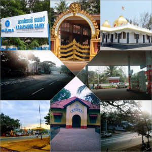
Kanhangad
Municipality in Kerala, India
Distance: Approx. 1989 meters
Latitude and longitude: 12.3,75.09
Kanhangad (Malayalam: [kaːɲːɐŋːaːɖɨ̆] ) is a commercial city, located in the Kasaragod District, state of Kerala, India.

Ajanur
Panchayat in Kerala, India
Distance: Approx. 3969 meters
Latitude and longitude: 12.34,75.09
Ajanur (also anglicized Ajanoor) is a grama panchayat and also a village of the same name in Kasargode district, Kerala state, India. It is the fifth largest town in Kasaragod district.

Hosdurg Fort
Fort in Kanhangad, Kerala, India
Distance: Approx. 1366 meters
Latitude and longitude: 12.309297,75.093801
Puthiyakotta(which translates to ‘New Fort’), also known by its former name Hosdurg Fort, is a fort in Kanhangad which is part of Kasaragod district in Kerala state. Puthiyakotta with its round bastion looks imposing from a distance. Somashekara Nayaka from the Keladi Nayaka dynasty of Ikkeri built this fort.

Athinhal
Village in Kerala, India
Distance: Approx. 4415 meters
Latitude and longitude: 12.31666667,75.06666667
Athinhal is a coastal village in Kasaragod district in the Indian state of Kerala. It is 28 km from the district capital of Kasaragod and one kilometer north of Kanhangad.
Aingoth
Distance: Approx. 2906 meters
Latitude and longitude: 12.282,75.106
Aingoth is a settlement in Kerala, India. It is located on the NH17 between Nileshwar and Kanhangad towns on the Cochin-Mangalore National Highway in Kasaragod District, Kanhangad Municipality.
Ambalathara, Kasaragod
Village in Kerala, India
Distance: Approx. 1477 meters
Latitude and longitude: 12.31666667,75.11666667
Ambalathara is a village in Kasaragod district in the state of Kerala, India.

Hosdurg taluk
Tehsil in Kerala, India
Distance: Approx. 1285 meters
Latitude and longitude: 12.3059,75.0947
Hosdurg is one of four taluks that constitute the Kasaragod District, Kerala. Others are Kasaragod, Manjeshwaram and Vellarikundu taluks. In the north, it borders Kasaragod taluk; in south, the Kannur District; in the east, Vellarikundu taluk; and in the west, the Arabian Sea.
Kolavayal
Village in Kerala, India
Distance: Approx. 4429 meters
Latitude and longitude: 12.332649,75.074256
Kolavayal is a place in Ajanur village in Kanhangad town, Kasargod district, Kerala, India. It is a good place.
Mavungal
Town in Kerala, India
Distance: Approx. 3397 meters
Latitude and longitude: 12.33861111,75.10555556
Mavungal is a town in Kerala, India, situated just 3 km away from the city of Kanhangad. Mavungal is one of the busiest transport hubs in Kasaragod district. It connects Kasaragod on the north, Kannur on the south, Kanhangad on the west and hill towns Panathur, Sullia and Madikeri on the east, making it one of the major junction in the region.
Thayannur, Kasaragod
Village in Kerala, India
Distance: Approx. 1989 meters
Latitude and longitude: 12.3,75.09
Thayannur is a small village situated in the Kasaragod district of Kerala in India. It is located on the way between Kanhangad and Kalichanadukkam. It is situated at the junction of two routes, one towards Kanhangad, and second one towards Nileshwar.
Nithyananda Institute of Technology, Kanhangad
Engineering college at Kanhangad in Kasaragod District, India
Distance: Approx. 2746 meters
Latitude and longitude: 12.31282,75.08152
Sadguru Swamy Nithyananda Institute of Technology is an engineering college situated at Kanhangad in Kasaragod District, India.
Pullur, Kasaragod
Village in Kerala, India
Distance: Approx. 1989 meters
Latitude and longitude: 12.3,75.09
Pullur is a small town located in Hosdurg of Kasaragod district, Kerala. It is situated 10 km away from the sub-district headquarter Kanhangad and 30 km away from the district headquarters Kasaragod. As of 2009, Pullurperiya is the gram panchayat of Pullur village.
Weather in this IP's area
clear sky
31 Celsius
30 Celsius
31 Celsius
31 Celsius
1012 hPa
40 %
1012 hPa
1010 hPa
10000 meters
4.23 m/s
3.66 m/s
228 degree
9 %