Country:
Region:
City:
Latitude and Longitude:
Time Zone:
Postal Code:
IP information under different IP Channel
ip-api
Country
Region
City
ASN
Time Zone
ISP
Blacklist
Proxy
Latitude
Longitude
Postal
Route
Luminati
Country
Region
14
City
subangjaya
ASN
Time Zone
Asia/Kuala_Lumpur
ISP
Taylors University Sdn Bhd
Latitude
Longitude
Postal
IPinfo
Country
Region
City
ASN
Time Zone
ISP
Blacklist
Proxy
Latitude
Longitude
Postal
Route
db-ip
Country
Region
City
ASN
Time Zone
ISP
Blacklist
Proxy
Latitude
Longitude
Postal
Route
ipdata
Country
Region
City
ASN
Time Zone
ISP
Blacklist
Proxy
Latitude
Longitude
Postal
Route
Popular places and events near this IP address

Subang Jaya
City in Selangor, Malaysia
Distance: Approx. 1209 meters
Latitude and longitude: 3.06444444,101.59361111
Subang Jaya is a city in Petaling District, Selangor, Malaysia. It comprises the southern third district of Petaling. It consists of the neighbourhoods from SS12 to SS19, UEP Subang Jaya (USJ), Putra Heights, Batu Tiga as well as PJS7, PJS9 and PJS11 of Bandar Sunway, the latter of which are partially jurisdictional within Petaling Jaya under the MBPJ. The city is governed by Subang Jaya City Council (MBSJ), which also governs other areas of the Petaling district, such as Puchong and Seri Kembangan.
UEP Subang Jaya
Township in Petaling, Selangor, Malaysia
Distance: Approx. 1209 meters
Latitude and longitude: 3.06444444,101.59361111
UEP Subang Jaya (commonly called "USJ" for United Projects Estates Bhd. Subang Jaya) is a major affluent township located in Subang Jaya, Selangor, Malaysia. It is located within the Mukim (sub-district) of Damansara in the district of Petaling.
Malaysian Trades Union Congress
Distance: Approx. 922 meters
Latitude and longitude: 3.04616667,101.58855556
The Malaysian Trades Union Congress (MTUC; Malay: Kongres Kesatuan Sekerja Malaysia), is a national trade union centre in Malaysia. It was formed in 1949 and was originally known as the Malayan Trades Union Council. It then changed its name to the Malayan Trades Union Congress in 1958, and then to its current name with the formation of Malaysia.

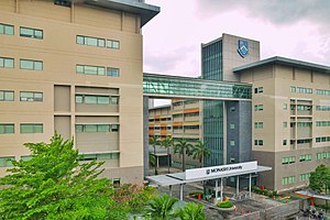
Monash University Malaysia
Australian university in Subang Jaya, Selangor, Malaysia
Distance: Approx. 1534 meters
Latitude and longitude: 3.064411,101.600682
Monash University Malaysia, established in 1998, is a significant branch of Australia's largest university, Monash University. It is the first foreign university campus in Malaysia and the third largest campus of its parent institution. The main campus is located in Bandar Sunway, Subang Jaya, Selangor, Malaysia.
Putra Heights
Town in Selangor, Malaysia
Distance: Approx. 1209 meters
Latitude and longitude: 3.06444444,101.59361111
Putra Heights is a 1,796 acres residential township developed by Sime UEP Properties since 1999, Subang Jaya, Selangor, Malaysia. It is located within the mukim of Petaling District. The township is visible by the tall Bukit Cermin in Putra Heights.
Batu Tiga
Suburb in Selangor, Malaysia
Distance: Approx. 1209 meters
Latitude and longitude: 3.06444444,101.59361111
Batu Tiga (literally meaning mile three) is a suburb in Subang Jaya, Selangor, Malaysia. It is located at the border between Subang Jaya and Shah Alam. However, it is nearer to Shah Alam than the town centre of Subang Jaya.
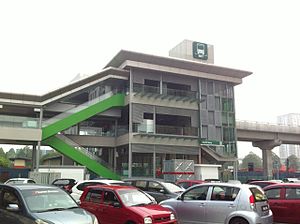
USJ 7 station
Integrated transit station in Petaling, Selangor, Malaysia
Distance: Approx. 133 meters
Latitude and longitude: 3.054888,101.59188
USJ 7 station is an integrated transit station located at USJ 7, Subang Jaya, Selangor, Malaysia. USJ 7 is served by the LRT Kelana Jaya Line and the BRT Sunway Line. This station is named after the USJ 7 neighbourhood, which is located east of the station.

South Quay-USJ 1 BRT station
Bus station in Selangor, Malaysia
Distance: Approx. 1017 meters
Latitude and longitude: 3.061569,101.596649
South Quay-USJ 1 BRT station is a bus rapid transit (BRT) station on the BRT Sunway Line. The station is located behind Mydin USJ 1 and serves the nearby Casa Subang apartments and the shopping malls around it. Like other BRT stations on this line, the station is elevated.

SunU-Monash BRT station
Bus station in Subang Jaya, Malaysia
Distance: Approx. 1673 meters
Latitude and longitude: 3.065329,101.601527
The SunU-Monash BRT station is located in Bandar Sunway, Subang Jaya, Selangor and is served by the BRT Sunway Line. The station is located besides the Monash University Malaysia Campus and nearby Sunway University; both universities which this station is named after and serves. The station is also adjacent to SunMed BRT station which is on the same road.
Silambam Asia
Official body on indian martial arts
Distance: Approx. 1656 meters
Latitude and longitude: 3.0424366,101.5822714
The Silambam Asia (SILA) (Tamil: சிலம்பம் ஆசியா) (IAST: Silambam Āsiyā) is the official international body of Silambam for the Continent of Asia and a Non-Governmental Organization recognized by the World Silambam Association (WSA). On November 22, 1999, the primary name of Silambam, which originated from the ancient Tamil Nadu State of India, was documented by Guruji Murugan Chillayah to become the official organization name to provide Indian traditional arts and sports for education, health, fitness, culture, nature, climate change, recreation, and dissemination work. The primary name Silambam was legally registered and recognized as a formalized organization after receiving security clearance approval from the Regulatory Authority.
World Silambam Association
Distance: Approx. 1656 meters
Latitude and longitude: 3.0424366,101.5822714
The World Silambam Association (WSA) (Tamil: உலக சிலம்பம் சங்கம்) is the official international body of Silambam for Worldwide and a recognized Non-Governmental Organization. On 22 November 1999, the primary name of Silambam, which originated from the ancient Tamil Nadu State of India, was documented by Guruji Murugan Chillayah to become the official organization name to provide Indian traditional arts and sports for education, health, fitness, culture, nature, climate change, recreation, and dissemination work. The primary name Silambam was legally registered and recognized as a formalized organization after receiving security clearance approval from the Regulatory Authority.
Technological Association Malaysia
Professional association and learned society of technology and engineering
Distance: Approx. 877 meters
Latitude and longitude: 3.04712,101.58766
The Technological Association Malaysia is a professional association and learned society for technological and engineering sciences with its corporate office in Subang Jaya and its branch building in Seremban. It was founded on 15 April 1946 in Selangor, and has been verified by The Malaysia Book of Records as the oldest technical civil society.
Weather in this IP's area
light rain
29 Celsius
34 Celsius
29 Celsius
31 Celsius
1011 hPa
71 %
1011 hPa
1009 hPa
10000 meters
1.54 m/s
20 %
06:57:19
18:57:13


