103.144.192.108 - IP Lookup: Free IP Address Lookup, Postal Code Lookup, IP Location Lookup, IP ASN, Public IP
Country:
Region:
City:
Location:
Time Zone:
Postal Code:
IP information under different IP Channel
ip-api
Country
Region
City
ASN
Time Zone
ISP
Blacklist
Proxy
Latitude
Longitude
Postal
Route
Luminati
Country
ASN
Time Zone
Asia/Kolkata
ISP
Reis Network Solutions
Latitude
Longitude
Postal
IPinfo
Country
Region
City
ASN
Time Zone
ISP
Blacklist
Proxy
Latitude
Longitude
Postal
Route
IP2Location
103.144.192.108Country
Region
odisha
City
brahmapur
Time Zone
Asia/Kolkata
ISP
Language
User-Agent
Latitude
Longitude
Postal
db-ip
Country
Region
City
ASN
Time Zone
ISP
Blacklist
Proxy
Latitude
Longitude
Postal
Route
ipdata
Country
Region
City
ASN
Time Zone
ISP
Blacklist
Proxy
Latitude
Longitude
Postal
Route
Popular places and events near this IP address

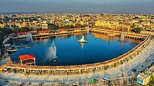
Berhampur
City in Odisha, India
Distance: Approx. 1150 meters
Latitude and longitude: 19.315,84.7941
Berhampur (pronounced [bɾɔhmɔpuɾ]; also known as Brahmapur) is a city on the eastern coastline of Odisha, India.
Khallikote University
Defunct state university in Odisha, India
Distance: Approx. 1552 meters
Latitude and longitude: 19.3075,84.7944
Khallikote University was a state university situated in Brahmapur, Odisha. It was founded in 2015 as a cluster university with five constituent colleges, transformed into a unitary university in 2020 and merged with Berhampur University in 2021, thus ceasing operation.
Binayak Acharya College
Distance: Approx. 1929 meters
Latitude and longitude: 19.321785,84.765744
Binayak Acharya College is a college near Haradakhandi, in Berhampur, Odisha, India, affiliated to Berhampur University. It was founded in 1978 as an extension wing for Khallikote College, Brahmapur. It became an independent wing during the 1981-82 session.
Brahmapur, Kolkata
Neighborhood of Kolkata in West Bengal, India
Distance: Approx. 5 meters
Latitude and longitude: 19.31666667,84.78333333
Brahmapur is a neighbourhood of Kolkata in West Bengal, India. It is located in the southern fringes of the city and is flanked by Bansdroni to the north and west, Naktala to the east and Boral to the south.
Maharaja Krushna Chandra Gajapati Medical College and Hospital
Medical college in Odisha
Distance: Approx. 3076 meters
Latitude and longitude: 19.30767,84.810972
Maharaja Krushna Chandra Gajapati Medical College and Hospital Brahmapur, Ganjam, Odisha is a government medical college and hospital that started functioning in 1962 as a medical college and 1966 as a hospital. Subsequently, the medical college and the attached hospital were renamed after renowned late Maharaja of Parlakhemundi, Ganjam, Krushna Chandra Gajapati. It also has a college of nursing, which is established in 1983.

Berhampur Lok Sabha constituency
Constituency of the Indian parliament in Odisha
Distance: Approx. 962 meters
Latitude and longitude: 19.315316,84.792338
Brahmapur is a Lok Sabha parliamentary constituency in Odisha, India.

Roman Catholic Diocese of Berhampur
Roman Catholic diocese in Orissa, India
Distance: Approx. 1300 meters
Latitude and longitude: 19.3129,84.795
The Roman Catholic Diocese of Berhampur (Latin: Berhampuren(sis)) is a diocese located in the city of Berhampur in the ecclesiastical province of Cuttack-Bhubaneswar in India.
Gandala, Odisha
Village in Odisha, India
Distance: Approx. 505 meters
Latitude and longitude: 19.32,84.78
Gandala is a small village located on the eastern coastline of Ganjam District in the Indian state of Odisha. Gandala is a panchayat under the block of Hinjilicut near to Berhampur City. the majority of people Gandala are dependent on farming.

Brahmapur railway station
Railway station in Odisha, India
Distance: Approx. 2649 meters
Latitude and longitude: 19.2966,84.7968
Brahmapur is a major railway station in the Indian state of Odisha. Brahmapur well known as “The Silk City", is a city on the eastern coastline of the state of Odisha. Brahmapur Railway Station is one of the oldest Railway Station and it is administered under Khurda Road railway division of East Coast Railway zone.

Berhampur Assembly constituency
Assembly constituency in Odisha
Distance: Approx. 1026 meters
Latitude and longitude: 19.31,84.79
Berhampur is a Vidhan Sabha constituency of Ganjam district. Area of this constituency includes ward no. 1 to ward no.

Uma Charan Patnaik Engineering School
Distance: Approx. 4422 meters
Latitude and longitude: 19.309509,84.824694
Uma Charan Pattnaik Engineering School (UCPES) previously known as Berhampur Engineering School, named after the great freedom fighter and eminent parliamentarian Late Uma Charan Patnaik, was established in the year 1956. It is located in the Silk-city, at a distance of five km from the Railway Station and three km from the Bus-stand. The Industries Department, Government of Odisha, took over this institution for better management from private committee on 12 November 1958.
Khallikote Unitary University
Public unitary university in Odisha, India
Distance: Approx. 1552 meters
Latitude and longitude: 19.3075,84.7944
Khallikote Unitary University, formerly known as Khallikote Autonomous College, is a co-educational state university situated in Brahmapur, Odisha on the eastern coast of India. Founded as Union College in 1878, the institution became a university in 2021. The university has a student enrolment of nearly 5,000.
Weather in this IP's area
overcast clouds
19 Celsius
20 Celsius
19 Celsius
19 Celsius
1011 hPa
92 %
1011 hPa
1004 hPa
8314 meters
2.54 m/s
5.94 m/s
353 degree
100 %