Country:
 Indonesia
Region:
City:
Latitude and Longitude:
Time Zone:
Postal Code:
IP information under different IP Channel
ip-api
Country
Region
City
ASN
Time Zone
ISP
Blacklist
Proxy
Latitude
Longitude
Postal
Route
IPinfo
Country
Region
City
ASN
Time Zone
ISP
Blacklist
Proxy
Latitude
Longitude
Postal
Route
MaxMind
Country
Region
City
ASN
Time Zone
ISP
Blacklist
Proxy
Latitude
Longitude
Postal
Route
Luminati
Country
IDASN
Time Zone
Asia/Jakarta
ISP
PT INDONESIA COMNETS PLUS
Latitude
Longitude
Postal
db-ip
Country
Region
City
ASN
Time Zone
ISP
Blacklist
Proxy
Latitude
Longitude
Postal
Route
ipdata
Country
Region
City
ASN
Time Zone
ISP
Blacklist
Proxy
Latitude
Longitude
Postal
Route
Popular places and events near this IP address
Cinere
Town and District in Java, Indonesia
Distance: Approx. 1238 meters
Latitude and longitude: -6.33333333,106.78333333
Cinere is a town and an administrative district (kecamatan) of the city of Depok, in West Java Province of Indonesia. It covers an area of 10.53 km2 and had a population of 107,461 at the 2010 Census and 101,700 at the 2020 Census; the official estimate (as at mid 2023) was 101,600. Cinere District borders to its east on the Jagakarsa District and to its north on the Cilandak District, both being part of South Jakarta City; to the west it borders on the Ciputat Timur District and the Pamulang District of South Tangerang City within Banten Province; and to the south it borders on the Limo District of Depok City.
Indonesia Open University
Indonesian state university
Distance: Approx. 3427 meters
Latitude and longitude: -6.34489,106.758087
Universitas Terbuka (UT, literally Open University) is Indonesia's state university. The university employs a Open and Distance Learning (ODL) system to widen access to higher education to all Indonesian citizens, including those who live in remote islands throughout the country, and in various parts of the world. It has a total student body of 1,045,665 (as of 2019/2020 according to Indonesia's Ministry of Education and Culture Higher Education database).

Setu Babakan Betawi Cultural Village
Distance: Approx. 3863 meters
Latitude and longitude: -6.341667,106.823889
Setu Babakan Betawi Cultural Village or Setu Babakan is a cultural park of Betawi people, which is located at Srengseng Sawah, Jagakarsa, Jakarta in Indonesia. The village is about 5 kilometers southeast of Ragunan Zoo at the center of the Betawi Cultural Village, a site considered as part of the cultural heritage of Jakarta, which is devoted to the preservation of the indigenous Betawi culture. The location of the Betawi Cultural Village is replacement of the previous Condet (Betawi) Cultural Village which is eroded by the time.
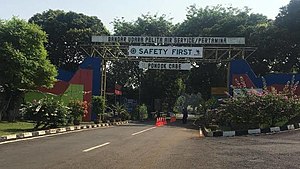
Pondok Cabe Airport
Airport serving South Tangerang, Banten, Indonesia
Distance: Approx. 2737 meters
Latitude and longitude: -6.33695833,106.76499722
Pondok Cabe Airport (IATA: PCB, ICAO: WIHP) is a combined civilian and military airport in Pondok Cabe, Pamulang, South Tangerang, Banten, Indonesia. The airport is owned by the state oil company Pertamina and operated by Pelita Air Service, which also owned Indopelita Aircraft Services that has a maintenance hangar at this airport. Pondok Cabe does not handle regular airline traffic.

Ciputat
Town and District in Banten, Indonesia
Distance: Approx. 4637 meters
Latitude and longitude: -6.31111111,106.76194444
Ciputat is a town and an administrative district (kecamatan) in the city of South Tangerang, in Banten Province on Java, Indonesia and is inside the Greater Jakarta metropolitan area. It covers an area of 21.11 km2 and had a population of 192,205 at the 2010 Census and 202,722 at the 2020 Census; the official estimate as at mid 2023 was 222,186.

Curug, Tangerang
Town and district in Banten, Indonesia
Distance: Approx. 3366 meters
Latitude and longitude: -6.37111111,106.8
Curug is a town and an administrative district (kecamatan) within Tangerang Regency in the province of Banten, on Java, Indonesia (not to be confused with the district of the same name in Serang city). The district covers a land area of 30.83 km2 and had a population of 165,812 at the 2010 Census and 174,867 at the 2020 Census; the official estimate as at mid 2023 was 176,617 - comprising 89,333 males and 87,284 females. The administrative centre is at Cukanggalih.
Cirendeu
Urban community in Tangerang Selatan City, Indonesia
Distance: Approx. 4690 meters
Latitude and longitude: -6.30694444,106.76694444
Cirendeu, also spelled Cireundeu, is a suburb of the town of Ciputat. It is located in the city of South Tangerang, Banten Province in Indonesia. The suburb was home to the Situ Gintung, an artificial lake and dam which was breached on 27 March 2009, causing the deaths of at least 99 people.
Al-Izhar Pondok Labu
Islamic school in South Jakarta, Indonesia
Distance: Approx. 3680 meters
Latitude and longitude: -6.31,106.792
Al-Izhar Pondok Labu (AIPL) is a moderate Islamic K-12 school in Pondok Labu, South Jakarta, Indonesia. It consists of a kindergarten, primary school, junior secondary school and senior secondary school. It is a National Plus school and the language of instruction is Indonesian.
Kites Museum of Indonesia
Distance: Approx. 3913 meters
Latitude and longitude: -6.3078,106.79059
The Kites Museum of Indonesia (Museum Layang-Layang Indonesia) is a museum in Pondok Labu, South Jakarta. It is the first kites museum in Indonesia. Its collection includes more than 600 kites.

Beji
Town and District in West Java, Indonesia
Distance: Approx. 4399 meters
Latitude and longitude: -6.37041,106.817558
Beji is a town and an administrative district (kecamatan) within the city of Depok, in the province of West Java, Indonesia, within the Jakarta metropolitan area. It covers an area of 14.56 km2 and had a population of 165,903 at the 2010 Census and 171,700 at the 2020 Census; the official estimate as at mid 2023 is 171,660. The University of Indonesia, Gunadarma University, Bina Sarana Informatika and Jakarta State Polytechnic are located in this area.

UI Forest
Forest in Jakarta, Indonesia
Distance: Approx. 4529 meters
Latitude and longitude: -6.353238,106.828594
UI Forest, (Indonesian: Hutan UI) is a significant green space located within the University of Indonesia (UI) campus. It serves as a natural reserve and a vital ecological area, providing a habitat for various plant and animal species. The forest covers a substantial area and is used for educational and research purposes, particularly in the fields of biology, environmental science, and forestry.
East Ciputat
District in Banten, Indonesia
Distance: Approx. 4637 meters
Latitude and longitude: -6.31111111,106.76194444
£ast Ciputat (Indonesian: Ciputat Timur) is an administrative district (kecamatan) in the city of South Tangerang, Banten Province, on Java, Indonesia. It is inside the Greater Jakarta metropolitan area, and is situated to the east of Ciputat. It covers an area of 17.81 km2 and its population was 178,818 at the 2010 Census and 172,139 at the 2020 Census; the official estimate as at mid 2023 was 169,555.
Weather in this IP's area
scattered clouds
32 Celsius
35 Celsius
31 Celsius
33 Celsius
1009 hPa
50 %
1009 hPa
1002 hPa
6000 meters
3.09 m/s
30 degree
40 %
05:29:44
17:45:32