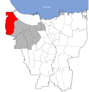
Country:
 Indonesia
Region:
City:
Latitude and Longitude:
Time Zone:
Postal Code:
IP information under different IP Channel
ip-api
Country
Region
City
ASN
Time Zone
ISP
Blacklist
Proxy
Latitude
Longitude
Postal
Route
IPinfo
Country
Region
City
ASN
Time Zone
ISP
Blacklist
Proxy
Latitude
Longitude
Postal
Route
MaxMind
Country
Region
City
ASN
Time Zone
ISP
Blacklist
Proxy
Latitude
Longitude
Postal
Route
Luminati
Country
IDRegion
jt
City
temanggung
ASN
Time Zone
Asia/Jakarta
ISP
PT INDONESIA COMNETS PLUS
Latitude
Longitude
Postal
db-ip
Country
Region
City
ASN
Time Zone
ISP
Blacklist
Proxy
Latitude
Longitude
Postal
Route
ipdata
Country
Region
City
ASN
Time Zone
ISP
Blacklist
Proxy
Latitude
Longitude
Postal
Route
Popular places and events near this IP address
Kalideres
Distance: Approx. 1086 meters
Latitude and longitude: -6.14601111,106.71095833
Kalideres is a district of West Jakarta, Indonesia and is the westernmost district of Jakarta. Kalideres covers 3,023.36 hectares (7,470.9 acres) and is bounded by Tangerang Regency to the north, Penjaringan District (North Jakarta) to the northeast, Cengkareng District (West Jakarta) to the east and Tangerang City to the south and west. As of mid 2023, Kalideres had an area of 30.23 km2 and a population of 468,017 people; giving a population density of 15,480 people per km2 (40,093 people per sq mi).
Duri Kosambi, Cengkareng
Village in Jakarta, Indonesia
Distance: Approx. 2985 meters
Latitude and longitude: -6.1721148,106.7205154
Duri Kosambi is an administrative village (kelurahan) in the Cengkareng district of Indonesia. It has postal code of 11750.
Kalideres, Kalideres
Administrative village in DKI Jakarta, Indonesia
Distance: Approx. 965 meters
Latitude and longitude: -6.154444,106.694722
Kalideres is an administrative village in the Kalideres district of Indonesia. Its postal code is 11840.
Pegadungan
Subdistrict in DKI Jakarta, Indonesia
Distance: Approx. 2549 meters
Latitude and longitude: -6.1301,106.7106
Pegadungan is an administrative village in the Kalideres district of Indonesia. It is in the province of Jakarta. Its postal code is 11830.
Semanan
Administrative village in DKI Jakarta, Indonesia
Distance: Approx. 3535 meters
Latitude and longitude: -6.18333333,106.7
Semanan is a subdistrict in the Kalideres district of Indonesia. It has the postal code of 11850. KH Hasyim Asy'ari Grand Mosque is located in this village.

Batuceper
Town and district in Banten, Indonesia
Distance: Approx. 2779 meters
Latitude and longitude: -6.1656824,106.682188
Batuceper is a town and an administrative district (kecamatan) of Tangerang City, in Banten Province of Indonesia, on the island of Java. The district covers an area of 11.58 km2, and had a population of 90,590 at the 2010 Census and 92,044 at the 2020 Census; the official estimate as at mid 2023 was 95,474. It formed part of the particuliere land, or private domain, of Luitenant der Chinezen Tan Tiang Po and his son, Tan Liok Tiauw Sia, Landheeren or landlords of Batoe-Tjepper.

Benda, Tangerang
Town and district in Banten, Indonesia
Distance: Approx. 3145 meters
Latitude and longitude: -6.13305556,106.68166667
Benda is a town and an administrative district (kecamatan) of Tangerang City, in Banten Province of Indonesia, on the island of Java. The district covers an area of 5.92 km2, and had a population of 83,017 at the 2010 Census and 83,526 at the 2020 Census; the official estimate as at mid 2023 was 85,769. Jakarta's main international airport, Soekarno–Hatta International Airport is located in the district.
Cengkareng Barat, Cengkareng
Subdistrict in DKI Jakarta, Indonesia
Distance: Approx. 2095 meters
Latitude and longitude: -6.1495,106.7218
Cengkareng Barat is a subdistrict in the Cengkareng district of Jakarta. It has postal code of 11730.
Cengkareng Timur, Cengkareng
Subdistrict in DKI Jakarta, Indonesia
Distance: Approx. 3472 meters
Latitude and longitude: -6.1453,106.7337
Cengkareng Timur is a subdistrict in the Cengkareng district of Jakarta. It has postal code of 11740.
West Vista
Residential in Jakarta, Indonesia
Distance: Approx. 2675 meters
Latitude and longitude: -6.157906,106.726351
West Vista is a twin towers skyscraper in Cengkareng, Jakarta, Indonesia. The 48 floors residential twin towers is part of an 8 hectares complex, of which 3 hectares are occupied by this building of 2855 apartment units. Singapore-based Keppel Land Limited is the developer of the complex.
Daan Mogot City
Shopping center, Residential in Jakarta, Indonesia
Distance: Approx. 1102 meters
Latitude and longitude: -6.156791,106.711553
Daan Mogot City, also known as Damoci, is a mixed development project at Daan Mogot, Jakarta. The development area has a land area of 16 hectares. The total will be developed in 4 phases.

Poris railway station
Railway station in Indonesia
Distance: Approx. 3254 meters
Latitude and longitude: -6.1699387,106.6800057
Poris Station (PI) is a class III railway station located in Poris Gaga, Batuceper, Tangerang. The station, which is located at an altitude of +7 meters, is included in the Jakarta Operational Area I, is the easternmost train station in Tangerang, and only serves the KRL Commuterline route.
Weather in this IP's area
few clouds
33 Celsius
36 Celsius
32 Celsius
34 Celsius
1009 hPa
51 %
1009 hPa
1008 hPa
8000 meters
4.63 m/s
20 degree
20 %
05:30:13
17:45:45