103.142.11.189 - IP Lookup: Free IP Address Lookup, Postal Code Lookup, IP Location Lookup, IP ASN, Public IP
Country:
Region:
City:
Location:
Time Zone:
Postal Code:
ISP:
ASN:
language:
User-Agent:
Proxy IP:
Blacklist:
IP information under different IP Channel
ip-api
Country
Region
City
ASN
Time Zone
ISP
Blacklist
Proxy
Latitude
Longitude
Postal
Route
db-ip
Country
Region
City
ASN
Time Zone
ISP
Blacklist
Proxy
Latitude
Longitude
Postal
Route
IPinfo
Country
Region
City
ASN
Time Zone
ISP
Blacklist
Proxy
Latitude
Longitude
Postal
Route
IP2Location
103.142.11.189Country
Region
maharashtra
City
vasai-virar
Time Zone
Asia/Kolkata
ISP
Language
User-Agent
Latitude
Longitude
Postal
ipdata
Country
Region
City
ASN
Time Zone
ISP
Blacklist
Proxy
Latitude
Longitude
Postal
Route
Popular places and events near this IP address

Vasai
City in Maharshtra, India
Distance: Approx. 0 meters
Latitude and longitude: 19.47,72.8
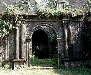
Vasai (Konkani and Marathi pronunciation: [ʋəsəi]; British English: Bassein; formerly and alternatively Marathi; Bajipur) is a historical place and city located in Palghar district; which was partitioned out of the Thane district in 2014. It also forms a part of Vasai-Virar twin cities in the Konkan division, Maharashtra, India, and comes under the Police Jurisdiction of Mira-Bhayander, Vasai-Virar Police Commissionerate. The Portuguese in Goa and Damaon built Fort Bassein to defend their colony and participate in the lucrative spice trade and the silk route that converged in the area.

Virar
City in Maharashtra, India
Distance: Approx. 0 meters
Latitude and longitude: 19.47,72.8
Virar (Pronunciation: [ʋiɾaːɾ]) is a coastal city in Palghar district, Maharashtra. The northern third of the city of Vasai-Virar, it is administered by Vasai-Virar Municipal Corporation. It lies to the south of Palghar district, and to the north of the city of Mumbai.

Battle of Vasai
1739 conflict between the Portuguese and Maratha Empires in India
Distance: Approx. 371 meters
Latitude and longitude: 19.46666667,72.8
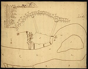
The Battle of Vasai or the Battle of Bassein was fought between the Marathas and the Portuguese rulers of Vasai (Portuguese, Baçaim; English, Bassein), a town near Mumbai (Bombay) in the Konkan region of the present-day state of Maharashtra, India.
Kopharad
Census town in Maharashtra, India
Distance: Approx. 3414 meters
Latitude and longitude: 19.4433,72.784
Kopharad is a census town in Palghar district in the Indian state of Maharashtra.
Datiware
Village in Maharashtra
Distance: Approx. 5364 meters
Latitude and longitude: 19.510498,72.772311
Datiware is a village in the state of Maharashtra (Palghar taluk, Palghar district) in India on the northern bank of Datiware creek at the mouth of the river Vaitarna. This area is especially famous for its birds and is a popular destination for birdwatchers in winter.

Vasai-Virar
Place in Maharashtra, India
Distance: Approx. 0 meters
Latitude and longitude: 19.47,72.8
Vasai-Virar is an agglomeration of four previously governed municipal councils: Vasai (Bassein), Virar, Nallasopara and Navghar-Manikpur, as well as a few towns to the east and west of the urban area. It lies in the Konkan division of Maharashtra, India.The twin city of Vasai-Virar is a part of the Mumbai Metropolitan Region (MMR) and Mira-Bhayander, Vasai-Virar Police Commissionerate. According to the 2011 census, it is the 5th largest city in Maharashtra.
Narangi
Village in Maharashtra
Distance: Approx. 1216 meters
Latitude and longitude: 19.4742,72.8107
Naringi is a village in the city of Virar, in the state of Maharashtra, India.

Virar railway station
Railway station in Maharashtra, India
Distance: Approx. 2065 meters
Latitude and longitude: 19.4553,72.812
Virar (Marathi pronunciation: [ʋiɾaːɾ]; station code: VR) is a railway station on the Western line of the Mumbai Suburban Railway network. Virar is a terminus station. It is around one and a half hours away by train from Churchgate.
Holy Spirit Church Nandakhal
Church in India, India
Distance: Approx. 3852 meters
Latitude and longitude: 19.439175,72.783334
Holy Spirit Church, Nandakhal is a historic Roman Catholic Church in Vasai (Bassein), Maharashtra, India. This church was built in 1573 by Portuguese Missionaries.
Dativare fort
Distance: Approx. 5716 meters
Latitude and longitude: 19.51416667,72.77222222
Dativare Fort / Hira Dongar is a fort located 72 km from Vasai, in Palghar district, of Maharashtra, India. The fort is located at a commanding point upon a small hillock beside the Vaitarna River, which runs until Arnala Fort.
Virar high-speed railway station
Under-construction high-speed railway station in Maharashtra, India
Distance: Approx. 5506 meters
Latitude and longitude: 19.4362,72.8383
Virar high-speed railway station, shortened to Vasai-Virar station, is an under-construction high-speed railway station on the Mumbai–Ahmedabad high-speed rail corridor. This station is located near Sahakar Nagar, Virar East, Virar, Maharashtra, India. It is the third station of the Mumbai–Ahmedabad high-speed rail corridor, after Thane station and before Boisar station.
Jhow Island
Island in Maharashtra, India
Distance: Approx. 3661 meters
Latitude and longitude: 19.49888889,72.81666667
Jhow Island is a continental island located at the mouth of Vasai Creek of the Vaitarna River in the Arabian Sea, near the Palghar district in Maharashtra, India. It has villages such as Chikhaldongri and Naringi.
Weather in this IP's area
scattered clouds
23 Celsius
23 Celsius
23 Celsius
23 Celsius
1009 hPa
52 %
1009 hPa
1006 hPa
10000 meters
1.4 m/s
1.39 m/s
66 degree
26 %