103.138.91.244 - IP Lookup: Free IP Address Lookup, Postal Code Lookup, IP Location Lookup, IP ASN, Public IP
Country:
Region:
City:
Location:
Time Zone:
Postal Code:
ISP:
ASN:
language:
User-Agent:
Proxy IP:
Blacklist:
IP information under different IP Channel
ip-api
Country
Region
City
ASN
Time Zone
ISP
Blacklist
Proxy
Latitude
Longitude
Postal
Route
db-ip
Country
Region
City
ASN
Time Zone
ISP
Blacklist
Proxy
Latitude
Longitude
Postal
Route
IPinfo
Country
Region
City
ASN
Time Zone
ISP
Blacklist
Proxy
Latitude
Longitude
Postal
Route
IP2Location
103.138.91.244Country
Region
bac giang
City
thang
Time Zone
Asia/Ho_Chi_Minh
ISP
Language
User-Agent
Latitude
Longitude
Postal
ipdata
Country
Region
City
ASN
Time Zone
ISP
Blacklist
Proxy
Latitude
Longitude
Postal
Route
Popular places and events near this IP address
Hiệp Hòa district
District in Bắc Giang, Vietnam
Distance: Approx. 2981 meters
Latitude and longitude: 21.333,105.967
Hiệp Hòa is one of nine rural districts of Bắc Giang province in the Northeast region of Vietnam. As of 2019 the district had a population of 247,460. The district covers an area of 201 km2.
Danh Thắng
Commune and village in Bắc Giang Province, Vietnam
Distance: Approx. 2412 meters
Latitude and longitude: 21.33333333,105.98333333
Danh Thắng is a commune (xã) and village in Hiệp Hòa District, Bắc Giang Province, in northeastern Vietnam.
Hòa Sơn, Bắc Giang
Commune and village in Bắc Giang Province, Vietnam
Distance: Approx. 5691 meters
Latitude and longitude: 21.36972222,105.93083333
Hòa Sơn is a commune (xã) and village in Hiệp Hòa District, Bắc Giang Province, in northeastern Vietnam.
Hoàng An
Commune and village in Bắc Giang Province, Vietnam
Distance: Approx. 3765 meters
Latitude and longitude: 21.38777778,105.97444444
Hoàng An is a commune (xã) and village in Hiệp Hòa District, Bắc Giang Province, in northeastern Vietnam.
Hoàng Lương
Commune and village in Bắc Giang Province, Vietnam
Distance: Approx. 5584 meters
Latitude and longitude: 21.40444444,105.9925
Hoàng Lương is a commune (xã) and village in Hiệp Hòa District, Bắc Giang Province, in northeastern Vietnam.
Hoàng Thanh
Commune and village in Bắc Giang Province, Vietnam
Distance: Approx. 4801 meters
Latitude and longitude: 21.39083333,106.00916667
Hoàng Thanh is a commune (xã) and village in Hiệp Hòa District, Bắc Giang Province, in northeastern Vietnam.
Lương Phong
Commune and village in Bắc Giang Province, Vietnam
Distance: Approx. 2398 meters
Latitude and longitude: 21.34,106
Lương Phong is a commune (xã) and village in Hiệp Hòa District, Bắc Giang Province, in northeastern Vietnam.
Ngọc Sơn, Bắc Giang
Commune and village in Bắc Giang Province, Vietnam
Distance: Approx. 1809 meters
Latitude and longitude: 21.35,106
Ngọc Sơn is a commune (xã) and village in Hiệp Hòa District, Bắc Giang Province, in northeastern Vietnam. It has a population of 9,412 according to the 2009 Census.
Thanh Vân, Bắc Giang
Commune and village in Bắc Giang Province, Vietnam
Distance: Approx. 5712 meters
Latitude and longitude: 21.40388889,105.96666667
Thanh Vân is a commune (xã) and village in Hiệp Hòa District, Bắc Giang Province, in northeastern Vietnam.
Thường Thắng
Commune and village in Bắc Giang Province, Vietnam
Distance: Approx. 3588 meters
Latitude and longitude: 21.33333333,105.95777778
Thường Thắng is a commune (xã) and village in Hiệp Hòa District, Bắc Giang Province, in northeastern Vietnam.
Ngọc Vân
Commune and village in Bắc Giang Province, Vietnam
Distance: Approx. 5964 meters
Latitude and longitude: 21.3586,106.0408
Ngọc Vân is a commune (xã) and village in Tân Yên District, Bắc Giang Province, in northeastern Vietnam.
Thắng
Township in Bắc Giang Province, Vietnam
Distance: Approx. 615 meters
Latitude and longitude: 21.35555556,105.9775
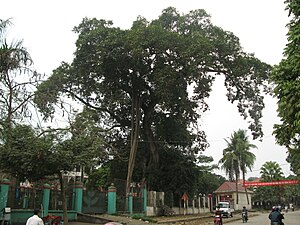
Thắng is a township (Thị trấn) and town and capital of Hiệp Hòa District, Bắc Giang Province, in north-eastern Vietnam.
Weather in this IP's area
scattered clouds
11 Celsius
9 Celsius
11 Celsius
11 Celsius
1024 hPa
41 %
1024 hPa
1023 hPa
10000 meters
2.41 m/s
2.36 m/s
346 degree
28 %

