103.138.100.71 - IP Lookup: Free IP Address Lookup, Postal Code Lookup, IP Location Lookup, IP ASN, Public IP
Country:
Region:
City:
Location:
Time Zone:
Postal Code:
IP information under different IP Channel
ip-api
Country
Region
City
ASN
Time Zone
ISP
Blacklist
Proxy
Latitude
Longitude
Postal
Route
Luminati
Country
ASN
Time Zone
Asia/Tokyo
ISP
COLT Technology Services Group Limited
Latitude
Longitude
Postal
IPinfo
Country
Region
City
ASN
Time Zone
ISP
Blacklist
Proxy
Latitude
Longitude
Postal
Route
IP2Location
103.138.100.71Country
Region
kanagawa
City
yokohama
Time Zone
Asia/Tokyo
ISP
Language
User-Agent
Latitude
Longitude
Postal
db-ip
Country
Region
City
ASN
Time Zone
ISP
Blacklist
Proxy
Latitude
Longitude
Postal
Route
ipdata
Country
Region
City
ASN
Time Zone
ISP
Blacklist
Proxy
Latitude
Longitude
Postal
Route
Popular places and events near this IP address

Kanagawa Prefecture
Prefecture of Japan
Distance: Approx. 504 meters
Latitude and longitude: 35.44750833,139.64234444
Kanagawa Prefecture (神奈川県, Kanagawa-ken) is a prefecture of Japan located in the Kantō region of Honshu. Kanagawa Prefecture is the second-most populous prefecture of Japan at 9,221,129 (1 April 2022) and third-densest at 3,800 inhabitants per square kilometre (9,800/sq mi). Its geographic area of 2,415 km2 (932 sq mi) makes it fifth-smallest.

Yokohama
Designated city in Kantō, Japan
Distance: Approx. 34 meters
Latitude and longitude: 35.44416667,139.63805556
Yokohama (Japanese: 横浜, pronounced [jokohama] ) is the second-largest city in Japan by population and by area, and the country's most populous municipality. It is the capital and most populous city in Kanagawa Prefecture, with a population of 3.7 million in 2023. It lies on Tokyo Bay, south of Tokyo, in the Kantō region of the main island of Honshu.

Yokohama Stadium
Baseball Stadium in Yokohama, Japan
Distance: Approx. 196 meters
Latitude and longitude: 35.44342778,139.6401
Yokohama Stadium (横浜スタジアム, Yokohama Sutajiamu) is a baseball stadium in Naka-ku, Yokohama, Japan. It opened in 1978 and has a capacity of 34,046 people. It is primarily used for baseball and is the home field of the Yokohama DeNA BayStars.

Naka-ku, Yokohama
Ward in Kantō, Japan
Distance: Approx. 456 meters
Latitude and longitude: 35.44444444,139.64333333
Naka-ku (中区) is one of the 18 wards of the city of Yokohama in Kanagawa Prefecture, Japan. In 2010, the ward had an estimated population of 146,563 and a population density of 7,080 persons per km². The total area was 20.86 km².

Yokohama Curry Museum
Museum in Yokohama, Japan about Japanese curry
Distance: Approx. 414 meters
Latitude and longitude: 35.444869,139.633776
The Yokohama Curry Museum (横濱カレーミュージアム, Yokohama Karē Myūjiamu) was a restaurant and historic museum of curry in the Isezakichō district of the port city of Yokohama, Japan, between 2001 and 2007. Different types of curry were available from a selection or restaurants, ranging from a full meal to a quick taste option. The museum included a recreation of Yokohama's port in the late 19th century.

Kannai Station
Railway and metro station in Yokohama, Japan
Distance: Approx. 154 meters
Latitude and longitude: 35.44333333,139.63722222
Kannai Station (関内駅, Kannai-eki) is an interchange passenger railway station located in Naka-ku, Yokohama, Japan, operated by East Japan Railway Company (JR East) and the Yokohama Municipal Subway.
Nihon-ōdōri Station
Railway station in Yokohama, Japan
Distance: Approx. 476 meters
Latitude and longitude: 35.44679444,139.64264722
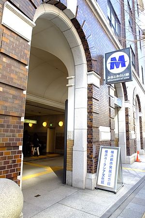
Nihon-ōdōri Station (日本大通り駅, Nihon-ōdōri-eki) is an underground railway station on the Minatomirai Line in Naka-ku, Yokohama, Kanagawa Prefecture, Japan, operated by the third-sector railway operating company Yokohama Minatomirai Railway Company. Its official name is Nihon-ōdōri (Kenchō-Ōsanbashi) Station (日本大通り(県庁・大さん橋)駅, Nihon-ōdōri (Kenchō-Ōsanbashi)-eki), including the sub-name in parentheses.

Volleyball at the 1964 Summer Olympics
Voleyball at Summer Olympics
Distance: Approx. 412 meters
Latitude and longitude: 35.441,139.6365
The 1964 Summer Olympics was the first time that volleyball had been held as an Olympic sport. The sport would feature two medals during this games with the men's and women's indoor teams events. In both tournaments, the format was the same with a single round robin between all of the teams that was competing in the tournament.

Yokohama Cultural Gymnasium
Indoor sports arena in Yokohama, Japan
Distance: Approx. 406 meters
Latitude and longitude: 35.44104722,139.63654167
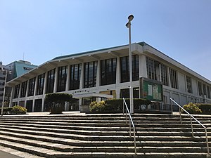
Yokohama Cultural Gymnasium (横浜文化体育館, Yokohama Bunka Taiikukan) was an indoor sports arena located in Naka-ku, Yokohama, Kanagawa, Japan. The capacity of the arena is 5,000 people and was opened in 1962. It is a five-minute walk from the closest subway station, Kannai Station, on the JR/Yokohama Municipal Subway.

SBI Graduate School
Higher education institution in Tokyo
Distance: Approx. 316 meters
Latitude and longitude: 35.447207,139.638819
SBI Graduate School (SBI大学院大学, esubiai daigaku-in daigaku) is a private distance learning university (for graduate studies) in Yokohama, Kanagawa, Japan. It was established in 2008 as part of SBI Group, a financial services company.

Isezaki-chōjamachi Station
Metro station in Yokohama, Japan
Distance: Approx. 596 meters
Latitude and longitude: 35.44104444,139.633175
Isezaki-chōjamachi Station (伊勢佐木長者町駅, Isezaki-chōjamachi-eki) is an underground metro station located in Naka-ku, Yokohama, Kanagawa, Japan operated by the Yokohama Municipal Subway’s Blue Line (Line 1). It is 19.0 kilometers (11.8 mi) from the terminus of the Blue Line at Shōnandai Station.

Kanagawa Prefectural Museum of Cultural History
Distance: Approx. 560 meters
Latitude and longitude: 35.44915278,139.63628333
Kanagawa Prefectural Museum of Cultural History (神奈川県立歴史博物館, Kanagawa Kenritsu Rekishi Hakubutsukan) also known as the Yokohama Museum of Cultural History is a history museum in Naka-ku, Yokohama, Kanagawa, Japan. Its exhibition focuses on the culture and history of Kanagawa Prefecture. It is located in the building of the former Yokohama Specie Bank.
Weather in this IP's area
few clouds
4 Celsius
1 Celsius
4 Celsius
6 Celsius
1017 hPa
65 %
1017 hPa
1015 hPa
10000 meters
4.12 m/s
310 degree
20 %
