103.137.26.193 - IP Lookup: Free IP Address Lookup, Postal Code Lookup, IP Location Lookup, IP ASN, Public IP
Country:
Region:
City:
Location:
Time Zone:
Postal Code:
IP information under different IP Channel
ip-api
Country
Region
City
ASN
Time Zone
ISP
Blacklist
Proxy
Latitude
Longitude
Postal
Route
Luminati
Country
ASN
Time Zone
Asia/Karachi
ISP
Special Communication Organization
Latitude
Longitude
Postal
IPinfo
Country
Region
City
ASN
Time Zone
ISP
Blacklist
Proxy
Latitude
Longitude
Postal
Route
IP2Location
103.137.26.193Country
Region
punjab
City
rawalpindi
Time Zone
Asia/Karachi
ISP
Language
User-Agent
Latitude
Longitude
Postal
db-ip
Country
Region
City
ASN
Time Zone
ISP
Blacklist
Proxy
Latitude
Longitude
Postal
Route
ipdata
Country
Region
City
ASN
Time Zone
ISP
Blacklist
Proxy
Latitude
Longitude
Postal
Route
Popular places and events near this IP address

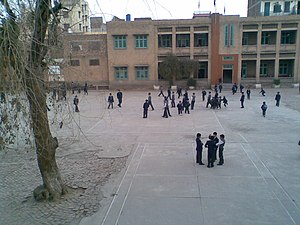
Government Gordon College
Distance: Approx. 1070 meters
Latitude and longitude: 33.609212,73.062311
Government Gordon College, Rawalpindi is a government college in Rawalpindi, Pakistan that was established as a church school in 1893. The college is named after Andrew Gordon. The college year is made up of an annual system: examination are held once every year.
Gawalmandi
Residential neighborhood in Lahore, Pakistan
Distance: Approx. 145 meters
Latitude and longitude: 33.6,73.06666667
Gawalmandi is a residential town located in central Lahore, in Pakistan's Punjab province. It is regarded as the cultural centre of Lahore. The famous Gawalmandi Food Street of Lahore is located here.

St Mary's Cambridge Higher Secondary School
Private primary and secondary school in Pakistan
Distance: Approx. 951 meters
Latitude and longitude: 33.60916667,73.06583333
St Mary’s Cambridge Higher Secondary School, formerly St Mary's Cambridge High School, is a private Catholic primary and secondary school for boys, located on Murree Road in Rawalpindi, Pakistan.
Fatima Jinnah Women University
University in Rawalpindi, Pakistan
Distance: Approx. 1634 meters
Latitude and longitude: 33.5864,73.0645
Fatima Jinnah Women University (Urdu: فاطمہ جناح وؤمن یونیورسٹی) is a public university in the neighborhood of Mall Road of Rawalpindi, Punjab, Pakistan, as well as in Old Presidency and Kachari Chowk.
Assassination of Benazir Bhutto
2007 murder in Rawalpindi, Pakistan
Distance: Approx. 818 meters
Latitude and longitude: 33.60722222,73.06361111
The assassination of Benazir Bhutto (Urdu: بینظیر بھُٹو کا قتل) took place on 27 December 2007 in Rawalpindi, Pakistan. Benazir Bhutto, the former Prime Minister of Pakistan and then-leader of the opposition party Pakistan People's Party, had been campaigning ahead of elections scheduled for January 2008. Shots were fired at her after a political rally at Liaqat National Bagh, and a suicide bomb was detonated immediately following the shooting.
Liaqat National Bagh
Distance: Approx. 672 meters
Latitude and longitude: 33.60611111,73.06444444
Liaqat National Bagh (Park), formerly known as Company Bagh, usually just referred to as Liaqat Bagh (Urdu: سرکل جرک), is a famous park on Murree Road in the city of Rawalpindi, Punjab, Pakistan. It is close to Arya Mohalla and Government Gordon College, which are two well-known residential and commercial areas of Rawalpindi.
Climate of Rawalpindi
Distance: Approx. 1662 meters
Latitude and longitude: 33.6,73.05
Rawalpindi features a humid subtropical climate (Köppen: Cwa) with hot summers, and cool to cold winters. Its climate is classified as very similar to its twin city Islamabad, but the geographical location and extreme urbanization of Rawalpindi has led to weather and climatic conditions that are notably different from its twin. Rawalpindi's weather has historically been known to change rather quickly due to its proximity to Himalayas and the Pir Panjal Range.
St. Paul's Church, Rawalpindi
Church in Punjab, Pakistan
Distance: Approx. 1641 meters
Latitude and longitude: 33.591394,73.054271
St. Paul's Church is a presbyterian church located opposite to General Headquarters in Rawalpindi Cantonment, Pakistan. It is the second-oldest church in Rawalpindi after Christ Church, Rawalpindi.

Municipal Library Rawalpindi
Public library in Pakistan
Distance: Approx. 574 meters
Latitude and longitude: 33.6054,73.0651
Municipal Library Rawalpindi (Urdu: میونسپل لائبریری راولپنڈی) is a public library in Rawalpindi, Pakistan. Founded in 1873, it is located at Murree road, adjacent to Liaqat National Bagh. The library currently has a collection of around 40,000 books.

Poonch House, Rawalpindi
Pakistani mansion currently serving as the home and office of the Prime Minister of Azad Kashmir
Distance: Approx. 1321 meters
Latitude and longitude: 33.59627,73.05473
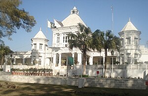
Poonch House (Urdu: پونچھ ہاؤس) is a mansion in Rawalpindi, Pakistan. Poonch House currently serve as the office for the AJK Election Commission. It has been used as a rest house for kings and princes of Kashmir.

Cantonment General Hospital, Rawalpindi
Hospital in Rawalpindi, Pakistan
Distance: Approx. 1615 meters
Latitude and longitude: 33.59851303,73.05070456
Cantonment General Hospital (Urdu: کنٹونمنٹ جنرل ہسپتال، راولپنڈی) is a Pakistan Army hospital in Rawalpindi Cantonment, Pakistan.
Flashman's Hotel
Building in Rawalpindi, Pakistan
Distance: Approx. 1650 meters
Latitude and longitude: 33.591937,73.053631
Flashman's Hotel is a historic hotel situated on The Mall in Rawalpindi.
Weather in this IP's area
overcast clouds
13 Celsius
12 Celsius
13 Celsius
13 Celsius
1018 hPa
50 %
1018 hPa
961 hPa
10000 meters
0.45 m/s
1.79 m/s
316 degree
98 %

