Country:
 Indonesia
Region:
City:
Latitude and Longitude:
Time Zone:
Postal Code:
IP information under different IP Channel
ip-api
Country
Region
City
ASN
Time Zone
ISP
Blacklist
Proxy
Latitude
Longitude
Postal
Route
IPinfo
Country
Region
City
ASN
Time Zone
ISP
Blacklist
Proxy
Latitude
Longitude
Postal
Route
MaxMind
Country
Region
City
ASN
Time Zone
ISP
Blacklist
Proxy
Latitude
Longitude
Postal
Route
Luminati
Country
IDRegion
ki
City
samarinda
ASN
Time Zone
Asia/Makassar
ISP
PT Capoeng Digital Nusantara
Latitude
Longitude
Postal
db-ip
Country
Region
City
ASN
Time Zone
ISP
Blacklist
Proxy
Latitude
Longitude
Postal
Route
ipdata
Country
Region
City
ASN
Time Zone
ISP
Blacklist
Proxy
Latitude
Longitude
Postal
Route
Popular places and events near this IP address

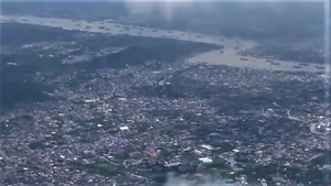
Samarinda
City and capital of East Kalimantan, Indonesia
Distance: Approx. 1516 meters
Latitude and longitude: -0.5,117.137759
Samarinda is the capital city of the Indonesian province of East Kalimantan on the island of Borneo. The city lies on the banks of the Mahakam River with a land area of 718 km2 (277 sq mi). Samarinda was one of Indonesia's top ten Most Liveable Cities in 2022, ranks first on East Kalimantan Human Development Index and it is the most populous city on the entire Borneo island, with a population of 727,500 at the 2010 Census and 827,994 at the 2020 Census; the official estimate as at mid 2023 was 861,878.
Temindung Airport
Former airport that served Samarinda, East Kalimantan, Indonesia (1974–2018)
Distance: Approx. 1482 meters
Latitude and longitude: -0.48138889,117.15583333
Temindung Airport (IATA: SRI, ICAO: WALS) was the airport of Samarinda from 1974 until 2018. It was officially known as Samarinda Airport, it was closed and replaced by the new APT Pranoto International Airport at Sungai Siring, 30 kilometres (19 mi) to the north. It is often known as Samarinda Airport, Temindung Airport, or simply Temindung, to distinguish it from its successor which is often referred to as Sungai Siring Airport.
Segiri Stadium
Sports venue in Samarinda, Indonesia
Distance: Approx. 17 meters
Latitude and longitude: -0.493091,117.149352
Segiri Stadium is a multi-use stadium in Samarinda, East Kalimantan, Indonesia. It is currently used mostly for football matches by Borneo Samarinda of the Liga 1. The stadium has a capacity of 18,000 spectators.
Mulawarman University
Distance: Approx. 2793 meters
Latitude and longitude: -0.468437,117.154105
The Universitas Mulawarman is a public university located in Samarinda, East Kalimantan, Indonesia. It was established on September 27, 1962, making it the oldest tertiary education institution in East Kalimantan. With more than 35,000 students, Universitas Mulawarman is the university with the most students in Kalimantan.

Mahakam Bridge
Bridge in Samarinda, East Kalimantan
Distance: Approx. 4504 meters
Latitude and longitude: -0.5198,117.1191
Mahakam Bridge is a bridge that crosses the Mahakam River in Samarinda, East Kalimantan province, Indonesia. Mahakam Bridge was built in 1987 and inaugurated by the President of Indonesia, Soeharto.
Sempaja Stadium
Distance: Approx. 4499 meters
Latitude and longitude: -0.453234,117.156131
Sempaja Stadium or Madya Sempaja Stadium is a football stadium in Samarinda, Indonesia. It is located in Jalan KH Wahid Hasyim.
Trans Studios Samarinda
Theme park and hotel in Samarinda, Borneo, Indonesia
Distance: Approx. 655 meters
Latitude and longitude: -0.491,117.144
Trans Studios Samarinda was a theme park located within Dadi Mulya Village on Samarinda Ulu, Samarinda, Borneo, Indonesia. Construction of the theme park and the hotel started in 2012. It is the first Trans Studios theme park to be built in Borneo.

Samarinda Islamic Center Mosque
Mosque in Samarinda, East Kalimantan, Indonesia
Distance: Approx. 3453 meters
Latitude and longitude: -0.50252778,117.11994444
Samarinda Islamic Center Mosque, also known as Baitul Muttaqien Mosque, is a mosque located in the subdistrict of Teluk Lerong Ulu, Samarinda, East Kalimantan, Indonesia, which is one of the largest mosques in Southeast Asia. It situates at the foreground of Mahakam River, and it has seven minarets and a huge dome.
Darussalam Great Mosque, Samarinda
Mosque in Samarinda, East Kalimantan, Indonesia
Distance: Approx. 1139 meters
Latitude and longitude: -0.5031967,117.1478159
The Darrusalam Great Mosque (Indonesian: Masjid Raya Darussalam) is the second largest mosque in the province of East Kalimantan after the Samarinda Islamic Center Mosque, and it is located in Pasar Pagi, Samarinda Ilir, Samarinda, which is the center of Samarinda city. The main characteristics of the mosque is that it has a large green dome and several small domes adjacent to the dome and has four minarets. The mosque is facing Mahakam River.
Weather in this IP's area
broken clouds
31 Celsius
35 Celsius
31 Celsius
31 Celsius
1008 hPa
56 %
1008 hPa
1007 hPa
10000 meters
2.28 m/s
3.79 m/s
210 degree
68 %
05:52:17
17:59:46