Country:
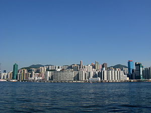
 Hong Kong (China)
Region:
City:
Latitude and Longitude:
Time Zone:
Postal Code:
IP information under different IP Channel
ip-api
Country
Region
City
ASN
Time Zone
ISP
Blacklist
Proxy
Latitude
Longitude
Postal
Route
IPinfo
Country
Region
City
ASN
Time Zone
ISP
Blacklist
Proxy
Latitude
Longitude
Postal
Route
MaxMind
Country
Region
City
ASN
Time Zone
ISP
Blacklist
Proxy
Latitude
Longitude
Postal
Route
Luminati
Country
HKASN
Time Zone
Asia/Hong_Kong
ISP
ASLINE LIMITED
Latitude
Longitude
Postal
db-ip
Country
Region
City
ASN
Time Zone
ISP
Blacklist
Proxy
Latitude
Longitude
Postal
Route
ipdata
Country
Region
City
ASN
Time Zone
ISP
Blacklist
Proxy
Latitude
Longitude
Postal
Route
Popular places and events near this IP address

North Point station
MTR station on Hong Kong Island
Distance: Approx. 512 meters
Latitude and longitude: 22.2909,114.2007
North Point (Chinese: 北角; Cantonese Yale: Bākgok) is a station on the Hong Kong MTR Island line and the western terminus of the Tseung Kwan O line, located in North Point on Hong Kong Island. The livery of the station is tomato orange. The interchange between the Island line and the Tseung Kwan O line is a cross-platform interchange.

Tsat Tsz Mui Road
Road in Hong Kong
Distance: Approx. 197 meters
Latitude and longitude: 22.29143,114.20491
Tsat Tsz Mui Road (Chinese: 七姊妹道; pinyin: Qīzǐmèi Dào; Cantonese Yale: chat1 ji2 mui2 dou6; lit. 'Seven Sisters Road') is a road in Tsat Tsz Mui in Hong Kong. The road runs in the area of Tsat Tsz Mui and eastern North Point from west to east, parallel to King's Road, except disjoint by a residential-commercial complex of Island Place.

Tin Chiu Street
Distance: Approx. 275 meters
Latitude and longitude: 22.29139,114.203181
Tin Chiu Street (Chinese: 電照街) is a street in Tsat Tsz Mui of North Point in Hong Kong.
Shanghainese people in Hong Kong
Hong Kongers native to Shanghai and the surrounding regions
Distance: Approx. 570 meters
Latitude and longitude: 22.28999389,114.20068411
Shanghainese people in Hong Kong have played an important role in the region, despite being a relatively small portion of the Han Chinese population. "Shanghainese" is a term that refers to both the Wu Chinese language and the Han Chinese subgroups from the city of Shanghai and the peoples of the Jiangnan (Lower Yangtze Delta) region in Hong Kong more broadly, particularly those with ancestral homes in parts of southern Jiangsu (Kiangsu), northern Zhejiang (Chekiang) and Anhui provinces. While a relatively small portion of the population compared to the Cantonese majority, Shanghainese people and their descendants have had a tremendous influence on the economy of Hong Kong helping transform the colony from a trading outpost into a global manufacturing and shipping hub.

Sunbeam Theatre
Distance: Approx. 551 meters
Latitude and longitude: 22.291332,114.200051
Sunbeam Theatre (Chinese: 新光戲院) is a landmark theatre in Hong Kong showcasing Cantonese opera. It is located at 423 King's Road, North Point, near the intersection with Shu Kuk Street.

North Point Ferry Pier
Distance: Approx. 549 meters
Latitude and longitude: 22.29388889,114.19972222
North Point Ferry Pier (Chinese: 北角碼頭) is a ferry pier in North Point, Hong Kong and it is near the site of the former North Point Estate (北角邨). It started operation in 1963. In 1979, a second passenger berth opened that is located west of the older one.

P&T Group
Architectural firm in Hong Kong
Distance: Approx. 207 meters
Latitude and longitude: 22.2922,114.2067
P&T Group (Chinese: 巴馬丹拿), formerly known as Palmer and Turner Hong Kong (Chinese: 公和洋行; "Kung Wo Yeung Hong"), is an architectural firm in Hong Kong. It is one of the oldest architecture and engineering firms in the world, and it has designed many landmark buildings in Hong Kong, Shanghai and in southeast Asia.

North Point Estate
Distance: Approx. 474 meters
Latitude and longitude: 22.293,114.2004
North Point Estate (Chinese: 北角邨) was a public housing estate at the harbour front of North Point, Hong Kong near North Point Ferry Pier and its bus terminus, approaching Victoria Harbour. It was the largest public housing estate in the Eastern District. It was the second public housing estate built by the Hong Kong Housing Authority and enjoyed a reputation as one of the most impressive construction schemes in Asia and as a public housing estate in one of the most "luxurious" areas on Hong Kong Island.

Healthy Village
Public housing estate in Hong Kong
Distance: Approx. 251 meters
Latitude and longitude: 22.29126,114.20624
Healthy Village is a public housing estate and Flat-for-Sale Scheme estate in Tsat Tsz Mui, Hong Kong, developed by the Hong Kong Housing Society. It is divided into 3 phases and located at Tsat Tsz Mui Road (Redeveloped Phase 1, flat for rental and sale), King's Road (Redeveloped Phase 2, flat for sale) and Pak Fuk Road (Redeveloped Phase 3, flat for rental) respectively. It consists of 14 residential blocks (4 for Phase 1, 3 for Phase 2, 7 for Phase 3) completed between 1965 and 1997.

Model Housing Estate
Housing estate in North Point, Hong Kong
Distance: Approx. 462 meters
Latitude and longitude: 22.29083,114.20868
Model Housing Estate is a public housing estate located at King's Road in Tsat Tsz Mui between Quarry Bay and North Point in Hong Kong, near MTR Quarry Bay station Exit C. It is the oldest existing public housing estate in Hong Kong. It comprises 7 residential blocks completed in 1952 to 1953, 1973 and 1979 respectively, offering a total of 667 flats.

Tanner Hill Estate
Rental housing estate in North Point, Hong Kong
Distance: Approx. 514 meters
Latitude and longitude: 22.29,114.2014
Tanner Hill Estate (Chinese: 丹拿山邨) was a rental housing estate for low-income families on Tanner Road, North Point, Hong Kong, developed by the Hong Kong Housing Society.

Chun Chu Temple
Buddhist and Taoist temple in Hong Kong, built in 1955
Distance: Approx. 474 meters
Latitude and longitude: 22.28941667,114.20288889
Chun Chu Temple (Chinese: 崇珠閣壇, Cantonese Yale: sùhng jyū gok tàahn; Jyutping: sung4 zyu1 gok3 taan4; Pinyin: chóng zhū gé tán) is a Buddhist and Taoist temple located in 1B Kai Yuen Street, North Point, Hong Kong. Chun Chu Temple was constructed in 1955, founded by a community of Hakka and Hainan people living in North Point, including Lam Wing Fai (藍榮輝) and Li Yuk Yuen (李鈺圓). During the 1950s to 1970s It is believed to be affiliated to the Kai Yuen Mansion (1930s-1970s) and it's residents, the Chan Wai Chow (陳維周) family.
Weather in this IP's area
scattered clouds
30 Celsius
37 Celsius
30 Celsius
31 Celsius
1013 hPa
76 %
1013 hPa
1009 hPa
10000 meters
0.89 m/s
3.13 m/s
267 degree
43 %
06:20:56
17:55:01