103.123.166.189 - IP Lookup: Free IP Address Lookup, Postal Code Lookup, IP Location Lookup, IP ASN, Public IP
Country:
Region:
City:
Location:
Time Zone:
Postal Code:
IP information under different IP Channel
ip-api
Country
Region
City
ASN
Time Zone
ISP
Blacklist
Proxy
Latitude
Longitude
Postal
Route
Luminati
Country
Region
wko
City
hamilton
ASN
Time Zone
Pacific/Auckland
ISP
Devoli
Latitude
Longitude
Postal
IPinfo
Country
Region
City
ASN
Time Zone
ISP
Blacklist
Proxy
Latitude
Longitude
Postal
Route
IP2Location
103.123.166.189Country
Region
waikato
City
hamilton
Time Zone
Pacific/Auckland
ISP
Language
User-Agent
Latitude
Longitude
Postal
db-ip
Country
Region
City
ASN
Time Zone
ISP
Blacklist
Proxy
Latitude
Longitude
Postal
Route
ipdata
Country
Region
City
ASN
Time Zone
ISP
Blacklist
Proxy
Latitude
Longitude
Postal
Route
Popular places and events near this IP address

Hamilton, New Zealand
City in North Island, New Zealand
Distance: Approx. 5 meters
Latitude and longitude: -37.78333333,175.28333333
Hamilton (Māori: Kirikiriroa) is an inland city in the North Island of New Zealand. Located on the banks of the Waikato River, it is the seat and most populous city of the Waikato region. With a territorial population of 192,000, it is the country's fourth most-populous city.

Claudelands
Suburb of Hamilton, New Zealand
Distance: Approx. 416 meters
Latitude and longitude: -37.77973,175.28189
Claudelands is a suburb directly to the east of central Hamilton, New Zealand, across the Waikato River. It is linked to the central city by the Claudelands road bridge and the East Coast Main Trunk Railway bridge.
Roman Catholic Diocese of Hamilton, New Zealand
Roman Catholic diocese in New Zealand
Distance: Approx. 5 meters
Latitude and longitude: -37.78333333,175.28333333
The Latin Church Catholic Diocese of Hamilton, New Zealand is a suffragan diocese of the Roman Catholic Archdiocese of Wellington. It is centred in Hamilton, New Zealand and was formed on 6 March 1980 from a portion of the territory in the Diocese of Auckland. The Cathedral of the Diocese is the Cathedral of the Blessed Virgin Mary.
Hamilton City Libraries (New Zealand)
Public libraries in Hamilton, New Zealand
Distance: Approx. 518 meters
Latitude and longitude: -37.7879,175.2824
Hamilton City Libraries are a group of seven libraries in Hamilton, New Zealand, owned by the local city council. They lend fiction and non-fiction (for all ages), magazines, audiobooks, and DVDs. From November 2016 to 9 July 2018, a substitute library compensated for the temporarily closed Central branch, and the libraries closed for over 2 months for COVID-19 in 2020.

Hamilton Central
Central business district of Hamilton, New Zealand
Distance: Approx. 467 meters
Latitude and longitude: -37.78744444,175.28248333
Hamilton Central is the central business district of Hamilton, New Zealand. It is located on the western banks of the Waikato River.

Centre Place
Shopping mall in Hamilton, New Zealand
Distance: Approx. 412 meters
Latitude and longitude: -37.78608611,175.28021667
Centre Place Shopping Centre is a shopping mall in Hamilton, New Zealand. It is located in the suburb of Hamilton Central. Centre Place is one of the city's three major malls along with Te Awa at The Base and Chartwell Shopping Centre.

Hamilton Urban Area
Urban area in North Island, New Zealand
Distance: Approx. 587 meters
Latitude and longitude: -37.7882,175.28083611
The Hamilton Urban Area is a New Zealand urban area in the Waikato region. It is the fourth-largest urban area in the country with a population of 241,200. At its centre is Hamilton City, New Zealand's fourth-largest territorial authority.

State Theatre (Hamilton, New Zealand)
Distance: Approx. 346 meters
Latitude and longitude: -37.7829,175.2794
The State Theatre, Hamilton, was one of 48 State cinemas opened by Amalgamated Theatres, Ltd in the 1930s, including in Christchurch, Timaru, New Plymouth, Dunedin, Hastings, Napier and Te Kuitl. The State Theatre in Hamilton, in brick and concrete, designed by Robert MacLaurin, built for about £14,000, by W. Goodfellow and opened on 1 June 1934, was on the corner of Victoria and London Streets. Films were projected using Western Electric Wide Range Sound.
1ZH
Radio station in Hamilton
Distance: Approx. 260 meters
Latitude and longitude: -37.7856,175.2828
1ZH was a New Zealand radio station based in Hamilton, New Zealand. The station was originally known as 1XH which was the station's original callsign. 1XH was started by Radio New Zealand (which at the time was known as the National Broadcasting Service) in 1949, broadcasting on 1310 AM. In 1968 the station callsign was changed to 1ZH and the station known on air as this name.
The Breeze Waikato
Radio station
Distance: Approx. 530 meters
Latitude and longitude: -37.7877,175.281
The Breeze Waikato is an adult contemporary radio station in Hamilton, New Zealand. It is owned by RadioWorks, a MediaWorks New Zealand company. The Breeze plays music from the 1960s to the present day, aimed at a 35- to 54-year-old female audience.

Claudelands Bridge
New Zealand bridge
Distance: Approx. 125 meters
Latitude and longitude: -37.784418,175.283432
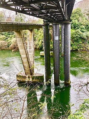
Claudelands Bridge is a dual-lane truss road bridge over the Waikato River, joining Claudelands with Hamilton Central. In 1968 it was converted from the old railway bridge, which had been completed about the end of July 1883. The road bridge was given a Category 2 listing in 1985.

Hamilton Central railway station, New Zealand
Defunct railway station in New Zealand
Distance: Approx. 577 meters
Latitude and longitude: -37.786892,175.278566
Hamilton Central was the name of a now-defunct railway station on the East Coast Main Trunk line which runs through the city of Hamilton in the Waikato region of New Zealand. The station was located in Hamilton's CBD and was made an underground station for the latter years of its existence before being closed. The underground platform still exists.
Weather in this IP's area
overcast clouds
19 Celsius
20 Celsius
19 Celsius
19 Celsius
992 hPa
92 %
992 hPa
987 hPa
10000 meters
1.52 m/s
1.87 m/s
323 degree
100 %