103.122.113.93 - IP Lookup: Free IP Address Lookup, Postal Code Lookup, IP Location Lookup, IP ASN, Public IP
Country:
Region:
City:
Location:
Time Zone:
Postal Code:
ISP:
ASN:
language:
User-Agent:
Proxy IP:
Blacklist:
IP information under different IP Channel
ip-api
Country
Region
City
ASN
Time Zone
ISP
Blacklist
Proxy
Latitude
Longitude
Postal
Route
db-ip
Country
Region
City
ASN
Time Zone
ISP
Blacklist
Proxy
Latitude
Longitude
Postal
Route
IPinfo
Country
Region
City
ASN
Time Zone
ISP
Blacklist
Proxy
Latitude
Longitude
Postal
Route
IP2Location
103.122.113.93Country
Region
krung thep maha nakhon
City
pathum wan
Time Zone
Asia/Bangkok
ISP
Language
User-Agent
Latitude
Longitude
Postal
ipdata
Country
Region
City
ASN
Time Zone
ISP
Blacklist
Proxy
Latitude
Longitude
Postal
Route
Popular places and events near this IP address

Bang Rak district
District in Bangkok, Thailand
Distance: Approx. 662 meters
Latitude and longitude: 13.73055556,100.52361111
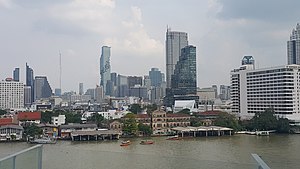
Bang Rak (Thai: บางรัก, pronounced [bāːŋ rák]) is one of the fifty districts (khet) of Bangkok, Thailand. It lies on the eastern bank of the Chao Phraya River, beyond Khlong Phadung Krung Kasem, which marked the old city boundary. Originating from riverside settlements dating from before the city's foundation, Bang Rak grew inland as new roads and canals were constructed through the area during the second half of the nineteenth century and the early twentieth, attracting communities of expatriates and developing into a major commercial district.

Chulalongkorn University Stadium
Sports venue in Bangkok, Thailand
Distance: Approx. 191 meters
Latitude and longitude: 13.737445,100.525377
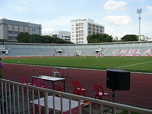
The Chulalongkorn University Stadium, formerly Charusathian Stadium, is a multi-purpose stadium owned by Chulalongkorn University in Pathumwan, Bangkok, Thailand. It is on Chulalongkorn Soi 9 in Pathumwan in the centre of Bangkok and holds 20,000. It is used mostly for football matches and to host intra- and inter-university sports competitions the student body participates in.

Museum of Imagery Technology
Distance: Approx. 626 meters
Latitude and longitude: 13.737103,100.529655
Museum of Imaging Technology is a museum in Pathum Wan District, Bangkok, Thailand. It is located in Faculty of Science, Chulalongkorn University.

Sam Yan
Road junction
Distance: Approx. 657 meters
Latitude and longitude: 13.73277778,100.52861111
Sam Yan (Thai: สามย่าน, pronounced [sǎːm jâːn]) is the name of an intersection and its nearby neighbourhood in Bangkok, Thailand. It connects Rama IV Road with Phaya Thai and Si Phraya roads, and is located within Pathum Wan District, next to its border with Bang Rak. The neighbourhood lies in the intersection's northwest corner on land owned by Chulalongkorn University, and is famous for its restaurants.

Hua Lamphong MRT station
Mass Rapid Transit station in Thailand
Distance: Approx. 644 meters
Latitude and longitude: 13.7373,100.518
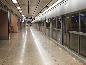
Hua Lamphong station (Thai: สถานีหัวลำโพง, pronounced [sā.tʰǎː.nīː hǔa lām.pʰōːŋ], RTGS: Sathani Hua Lamphong) is a rapid transit station on the Blue Line of the Bangkok MRT in Thailand. It is located underground on Rama IV Road in front of Bangkok railway station, more commonly known as Hua Lamphong railway station. Which is the first station of Paknam Railway, the first railway line in Thailand, as well as the former central station.

Sam Yan MRT station
Mass Rapid Transit station in Thailand
Distance: Approx. 729 meters
Latitude and longitude: 13.73277778,100.52944444
Sam Yan station (Thai: สถานีสามย่าน, pronounced [sā.tʰǎː.nīː sǎːm jâːn]) is a Bangkok MRT rapid transit station on the Blue Line. The station is located underground between Sam Yan intersection on Rama IV Road near Chulalongkorn University in Bangkok, Thailand.
Chulalongkorn University Museum of Natural History
Museum in Bangkok, Thailand
Distance: Approx. 669 meters
Latitude and longitude: 13.7375,100.53
The Chulalongkorn University Museum of Natural History, founded in 1954, is operated by the Chulalongkorn University's Faculty of Science in the Biology Building at the university's main campus in Bangkok, Thailand. The museum features exhibits of various (mainly zoological) organisms, including mounts of the endangered white-eyed river martin (Princess Sirindhorn bird). The majority of the museum's exhibits are housed in its main hall, with dedicated rooms featuring Thai turtles and softshells, insects and land snails.
Chulalongkorn Business Academic and Coaching Center
Training center in Bangkok, Thailand
Distance: Approx. 738 meters
Latitude and longitude: 13.734381,100.530369
Chulalongkorn Business Academic and Coaching Center (CBAC; Thai: ศูนย์ฝึกอบรมด้านธุรกิจของคณะพาณิชยศาสตร์และการบัญชี จุฬาลงกรณ์มหาวิทยาลัย) is a training and coaching center in Thailand. It was founded in 1995 by Chulalongkorn Business Administration (CBA), as Micro MBA Chula, in order to provide multiple business courses for Thai people.

Si Phraya Road
Road in Bang Rak District, Bangkok, Thailand
Distance: Approx. 597 meters
Latitude and longitude: 13.73138889,100.52222222
Si Phraya Road (Thai: ถนนสี่พระยา, pronounced [sìː pʰráʔ.jāː]) is a road in Bang Rak District, Bangkok, Thailand. It divides the areas of Maha Phruettharam and Si Phraya subdistricts. Built in 1906 by four noblemen of the rank phraya (hence the name, which means 'four phraya'), the road runs from Si Phraya Pier at the mouth of the Phadung Krung Kasem Canal to Sam Yan Intersection, where it meets the Phaya Thai and Rama IV Roads.

Uruphong
Road junction
Distance: Approx. 335 meters
Latitude and longitude: 13.73947778,100.52347778
Uruphong (Thai: อุรุพงษ์) is a four way intersection and neighbourhood in Thailand. It is in the areas of the Thung Phaya Thai and Thanon Phetchaburi sub-districts which are the part of the Ratchathewi district in downtown Bangkok. It connects the Rama VI and Phetchaburi roads beneath both a footbridge and also to the expressway.

Maha Phruettharam
Khwaeng in Thailand
Distance: Approx. 263 meters
Latitude and longitude: 13.7355,100.52169444
Maha Phruettharam (Thai: มหาพฤฒาราม, pronounced [mā.hǎː pʰrɯ́t̚.tʰāː.rāːm]) is one of the five khwaeng (subdistrict) of Bang Rak District, Bangkok.

Samyan Mitrtown
Shopping mall in Bangkok, Thailand
Distance: Approx. 545 meters
Latitude and longitude: 13.73416667,100.52833333
Samyan Mitrtown (Thai: สามย่านมิตรทาวน์) is a mixed-use shopping, office, residential and leisure development located in Bangkok, Thailand. With a gross floor area of 222,000 square metres (2,390,000 sq ft), the ฿9 billion complex comprises Samyan Mitrtown Mall, Mitrtown Office Tower, Triple Y Residence and Triple Y Hotel.
Weather in this IP's area
broken clouds
25 Celsius
25 Celsius
23 Celsius
26 Celsius
1013 hPa
53 %
1013 hPa
1012 hPa
10000 meters
2.61 m/s
5.97 m/s
86 degree
79 %
