Country:
 Australia
Region:
City:
Latitude and Longitude:
Time Zone:
Postal Code:
IP information under different IP Channel
ip-api
Country
Region
City
ASN
Time Zone
ISP
Blacklist
Proxy
Latitude
Longitude
Postal
Route
IPinfo
Country
Region
City
ASN
Time Zone
ISP
Blacklist
Proxy
Latitude
Longitude
Postal
Route
MaxMind
Country
Region
City
ASN
Time Zone
ISP
Blacklist
Proxy
Latitude
Longitude
Postal
Route
Luminati
Country
AURegion
vic
City
melbourne
ASN
Time Zone
Australia/Melbourne
ISP
TPG Telecom Limited
Latitude
Longitude
Postal
db-ip
Country
Region
City
ASN
Time Zone
ISP
Blacklist
Proxy
Latitude
Longitude
Postal
Route
ipdata
Country
Region
City
ASN
Time Zone
ISP
Blacklist
Proxy
Latitude
Longitude
Postal
Route
Popular places and events near this IP address

Craigieburn, Victoria
Suburb of Melbourne, Victoria, Australia
Distance: Approx. 7480 meters
Latitude and longitude: -37.594,144.934
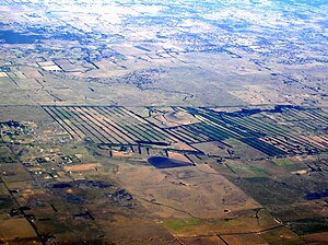
Craigieburn is a suburb in Melbourne, Victoria, Australia, 25 km (16 mi) north of Melbourne's Central Business District, located within the City of Hume local government area. Craigieburn recorded a population of 65,178 at the 2021 census. Craigieburn is a satellite suburb located on the urban-rural fringe of Melbourne, ranging from the lower half of Bridgewater Road to Mount Ridley.

Mickleham, Victoria
Suburb of Melbourne, Victoria, Australia
Distance: Approx. 8288 meters
Latitude and longitude: -37.562,144.874
Mickleham is a suburb of Melbourne, Victoria, Australia, 29 km (18 mi) north of Melbourne's central business district, located within the City of Hume local government area and beyond the Urban Growth Boundary. Mickleham recorded a population of 17,452 at the 2021 census, compared to 3,142 at the 2016 census. In 2018, it was covered by the Australian Broadcasting Corporation as Australia's fastest-growing suburb.

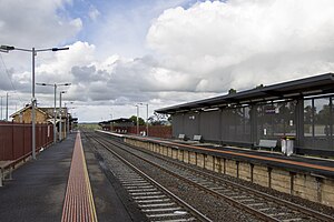
Craigieburn railway station
Railway station in Melbourne, Australia
Distance: Approx. 8259 meters
Latitude and longitude: -37.602842,144.942927
Craigieburn railway station is a commuter railway station on the North East line, and also the terminus of the Craigieburn line, which is part of the Melbourne railway network. It serves the northern suburb of Craigieburn, in Melbourne, Victoria, Australia. Craigieburn station is a ground level premium station, featuring two side platforms.
Kalkallo, Victoria
Suburb of City of Hume, Victoria, Australia
Distance: Approx. 1074 meters
Latitude and longitude: -37.52694444,144.94694444
Kalkallo is a suburb in Melbourne, Victoria, Australia, 31 km (19 mi) north of Melbourne's central business district, located within the City of Hume local government area. Kalkallo recorded a population of 5,548 at the 2021 census. Located on the Hume Freeway, Kalkallo had, until the 2010s, a few streets, a service station and a pub.
Beveridge, Victoria
Town in Victoria, Australia
Distance: Approx. 5605 meters
Latitude and longitude: -37.48333333,144.98333333
Beveridge is a town in Victoria, Australia, 37 km (23 mi) north of Melbourne's Central Business District, located within the City of Whittlesea and the Shire of Mitchell local government areas. Beveridge recorded a population of 4,642 at the 2021 census.
Donnybrook railway station
Railway station in Victoria, Australia
Distance: Approx. 1704 meters
Latitude and longitude: -37.542,144.9701
Donnybrook railway station is a regional railway station on the North East line, which is part of the Regional railway network. It serves the northern suburb of Donnybrook, in Melbourne, Victoria, Australia. Donnybrook station is a ground level unstaffed station, featuring two side platforms.
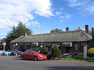
Note Printing Australia
Distance: Approx. 9366 meters
Latitude and longitude: -37.612974,144.943453
Note Printing Australia (NPA) is a wholly owned subsidiary of the Reserve Bank of Australia (RBA) that produces banknotes and passports. It was corporatised in July 1998 and is located in Craigieburn, Melbourne. NPA has its origins as a subsidiary of the Commonwealth Bank and was established in 1913 to print banknotes for Australia.
Beveridge railway station
Former railway station in Victoria, Australia
Distance: Approx. 7676 meters
Latitude and longitude: -37.4675,144.99611111
Beveridge is a closed railway station on the North East railway that served the township of Beveridge, Victoria, Australia. The station opened on 14 October 1872. A goods shed was provided on opening, and was moved in 1885 to the down side of the line.
Donnybrook, Victoria
Suburb of City of Whittlesea, Victoria, Australia
Distance: Approx. 2133 meters
Latitude and longitude: -37.543,144.976
Donnybrook is a suburb in Melbourne, Victoria, Australia, 30 km (19 mi) north of Melbourne's Central Business District, located within the City of Whittlesea local government area. Donnybrook recorded a population of 2,100 at the 2021 census. Bounded to the west by Merri Creek and in the east by Darebin Creek, the suburb consists of a railway station, general store, pub, spa and a small number of houses.

Woodstock, Victoria
Town in Victoria, Australia
Distance: Approx. 8744 meters
Latitude and longitude: -37.544,145.056
Woodstock is a bounded semi-rural locality in Victoria, Australia, located just north of Melbourne's outer suburbs, located within the City of Whittlesea local government area. Woodstock recorded a population of 150 at the 2021 census. Australian contemporary poet Robbie Coburn hails from Woodstock.
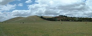
Mount Fraser (Australia)
Mountain in Victoria, Australia
Distance: Approx. 7535 meters
Latitude and longitude: -37.4639,144.9786
Mount Fraser is a volcanic cone near Beveridge, Victoria, Australia. It is the largest scoria cone near Melbourne. The extinct volcano last erupted about one million years ago.
Hayes Hill (Victoria)
Distance: Approx. 4229 meters
Latitude and longitude: -37.539167,145.004994
Hayes Hill is a small scoria cone in Donnybrook, approximately 30 km north of Melbourne, Victoria, Australia. It is on the eastern edge of the Newer Volcanics Province.
Weather in this IP's area
clear sky
10 Celsius
10 Celsius
8 Celsius
11 Celsius
1018 hPa
73 %
1018 hPa
990 hPa
10000 meters
0.89 m/s
4.02 m/s
17 degree
06:42:14
19:31:49