Country:
Region:
City:
Latitude and Longitude:
Time Zone:
Postal Code:
IP information under different IP Channel
ip-api
Country
Region
City
ASN
Time Zone
ISP
Blacklist
Proxy
Latitude
Longitude
Postal
Route
Luminati
Country
ASN
Time Zone
Asia/Jakarta
ISP
PT Aplikanusa Lintasarta
Latitude
Longitude
Postal
IPinfo
Country
Region
City
ASN
Time Zone
ISP
Blacklist
Proxy
Latitude
Longitude
Postal
Route
db-ip
Country
Region
City
ASN
Time Zone
ISP
Blacklist
Proxy
Latitude
Longitude
Postal
Route
ipdata
Country
Region
City
ASN
Time Zone
ISP
Blacklist
Proxy
Latitude
Longitude
Postal
Route
Popular places and events near this IP address

West Jakarta
Administrative city in Jakarta, Indonesia
Distance: Approx. 3942 meters
Latitude and longitude: -6.16833333,106.75888889
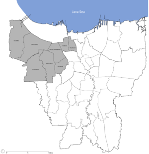
West Jakarta (Indonesian: Jakarta Barat; Betawi: Jakarte Bekulon), abbreviated as Jakbar, is one of the five administrative cities of the Special Capital Region of Jakarta, Indonesia. West Jakarta is not self-governed and does not have a city council, hence it is not classified as a proper municipality. It had a population of 2,281,945 at the 2010 Census and 2,434,511 at the 2020 Census; the official estimate as at mid 2023 was 2,611,515 (comprising 1,312,120 males and 1,299,395 females).
Kalideres
Distance: Approx. 1957 meters
Latitude and longitude: -6.14601111,106.71095833
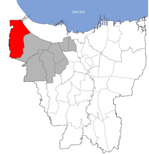
Kalideres is an administrative district {kecamatan) of the administrative city of West Jakarta, Indonesia and is the westernmost district of Jakarta. Kalideres covers 2,897 hectares (7,160 acres) and is bounded by Tangerang Regency to the north, Penjaringan District (North Jakarta) to the northeast, Cengkareng District (West Jakarta) to the east and Tangerang City to the south and west. As of mid 2023, Kalideres had an area of 28.97 km2 and a population of 468,119 people (comprising 236,118 males and 232,001 females); giving a population density of 15,159 people per km2 (41,843 people per sq mi).
Duri Kosambi, Cengkareng
Village in Jakarta, Indonesia
Distance: Approx. 2523 meters
Latitude and longitude: -6.1721148,106.7205154
Duri Kosambi is an administrative village (kelurahan) in the Cengkareng district of Indonesia. It has postal code of 11750.
Kalideres, Kalideres
Administrative village in DKI Jakarta, Indonesia
Distance: Approx. 3707 meters
Latitude and longitude: -6.154444,106.694722
Kalideres is an administrative village in the Kalideres district of Indonesia. Its postal code is 11840.
Pegadungan
Subdistrict in DKI Jakarta, Indonesia
Distance: Approx. 2995 meters
Latitude and longitude: -6.1301,106.7106
Pegadungan is an administrative village in the Kalideres district of Indonesia. It is in the province of Jakarta. Its postal code is 11830.
Cengkareng Barat, Cengkareng
Subdistrict in DKI Jakarta, Indonesia
Distance: Approx. 699 meters
Latitude and longitude: -6.1495,106.7218
Cengkareng Barat is a subdistrict in the Cengkareng district of Jakarta. It has postal code of 11730.
Cengkareng Timur, Cengkareng
Subdistrict in DKI Jakarta, Indonesia
Distance: Approx. 872 meters
Latitude and longitude: -6.1453,106.7337
Cengkareng Timur is a subdistrict in the Cengkareng district of Jakarta. It has postal code of 11740.

Pantai Indah Kapuk
A township in Jakarta, Indonesia
Distance: Approx. 3110 meters
Latitude and longitude: -6.13333333,106.75
Pantai Indah Kapuk (PIK) is an integrated township, located in parts of Penjaringan, North Jakarta and Kapuk, West Jakarta, Indonesia. It is one of the most prestigious residential areas in Jakarta along with Menteng, Pondok Indah, and Puri Indah. PIK is often the most sought residential area for wealthy Indonesians, featuring large mansions in exclusive gated clusters.

Taman Kota railway station
Railway station in Indonesia
Distance: Approx. 3277 meters
Latitude and longitude: -6.158651,106.75651
Taman Kota Station (TKO, formerly Kembangan Station) is a class III railway station located in North Kembangan, Kembangan, West Jakarta. The station, which is located at an altitude of +12 meters, is included in the Jakarta Operational Area I and only serves the KRL Commuterline route.

Pesanggrahan River
River in Indonesia
Distance: Approx. 3532 meters
Latitude and longitude: -6.17374,106.74995
The Pesanggrahan River (Indonesian: Sungai Pesanggrahan or Kali Pesanggrahan) is a river with the upstream in the Bogor Regency, flowing through the cities of Depok, Jakarta and Tangerang, Banten. The river passes the districts of Tanah Sereal, Bojong Gede, Sawangan, Limo, Kebayoran Lama, Pesanggrahan, Kembangan, and Kebun Jeruk before flowing into the Cengkareng Drain. Based on 2005 data, 55 percent of the watershed area of the Pesanggrahan River is occupied by housing, only 7 percent is still forests, 20 percent rice fields, and 13 percent other agriculture fields.
West Vista
Residential in Jakarta, Indonesia
Distance: Approx. 822 meters
Latitude and longitude: -6.157906,106.726351
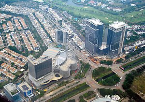
West Vista is a twin towers skyscraper in Cengkareng, Jakarta, Indonesia. The 48 floors residential twin towers is part of an 8 hectares complex, of which 3 hectares are occupied by this building of 2855 apartment units. Singapore-based Keppel Land Limited is the developer of the complex.
Daan Mogot City
Shopping center, Residential in Jakarta, Indonesia
Distance: Approx. 1942 meters
Latitude and longitude: -6.156791,106.711553
Daan Mogot City, also known as Damoci, is a mixed development project at Daan Mogot, Jakarta. The development area has a land area of 16 hectares. The total will be developed in 4 phases.
Weather in this IP's area
light rain
32 Celsius
38 Celsius
32 Celsius
34 Celsius
1006 hPa
62 %
1006 hPa
1005 hPa
8000 meters
5.36 m/s
20 degree
40 %
05:26:14
17:50:35
