Country:
Region:
City:
Latitude and Longitude:
Time Zone:
Postal Code:
IP information under different IP Channel
ip-api
Country
Region
City
ASN
Time Zone
ISP
Blacklist
Proxy
Latitude
Longitude
Postal
Route
Luminati
Country
Region
vic
City
melbourne
ASN
Time Zone
Australia/Melbourne
ISP
Over The Wire Pty Ltd
Latitude
Longitude
Postal
IPinfo
Country
Region
City
ASN
Time Zone
ISP
Blacklist
Proxy
Latitude
Longitude
Postal
Route
db-ip
Country
Region
City
ASN
Time Zone
ISP
Blacklist
Proxy
Latitude
Longitude
Postal
Route
ipdata
Country
Region
City
ASN
Time Zone
ISP
Blacklist
Proxy
Latitude
Longitude
Postal
Route
Popular places and events near this IP address

Newport, Victoria
Suburb of Melbourne, Victoria, Australia
Distance: Approx. 540 meters
Latitude and longitude: -37.842,144.884
Newport is an inner suburb in Melbourne, Victoria, Australia, 7.5 km (4.7 mi) south-west of Melbourne's Central Business District, located within the City of Hobsons Bay local government area. Newport recorded a population of 13,658 at the 2021 census. Newport is approximately 10 minutes by car from Melbourne via the West Gate Freeway or a 20-minute train journey from Flinders Street.

Spotswood, Victoria
Suburb of Melbourne, Victoria, Australia
Distance: Approx. 1301 meters
Latitude and longitude: -37.831,144.887
Spotswood is an inner suburb in Melbourne, Victoria, Australia, 7 km (4.3 mi) south-west of Melbourne's Central Business District, located within the City of Hobsons Bay local government area. Spotswood recorded a population of 2,820 at the 2021 census. The suburb is bounded by the Newport–Sunshine freight railway line in the west, the West Gate Freeway in the north, the Yarra River in the east and the Burleigh Street in the south.

Spotswood railway station
Railway station in Melbourne, Australia
Distance: Approx. 1279 meters
Latitude and longitude: -37.8306,144.8858
Spotswood railway station is a commuter railway station on the Werribee and Williamstown lines, which are part of the Melbourne railway network. It serves the western suburb of Spotswood, in Melbourne, Victoria, Australia. Spotswood station is a ground level unstaffed station, featuring two side platforms.

Newport railway station, Melbourne
Railway station in Melbourne, Australia
Distance: Approx. 501 meters
Latitude and longitude: -37.8424,144.8833
Newport railway station is a commuter railway station and the junction point on the Werribee and Williamstown lines, which are part of the Melbourne railway network. It serves the western suburb of Newport, in Melbourne, Victoria, Australia. Newport station is a ground level premium station, featuring two side platforms.

Australian Railway Historical Society
Society preserving Australian railway operations
Distance: Approx. 1570 meters
Latitude and longitude: -37.8542719,144.8814227
The Australian Railway Historical Society (ARHS) has been a railway organisation concerned with history and preservation of railway heritage at a national level. It has had divisions in every state and the Australian Capital Territory, although the ACT division was wound up in 2016, along with the Victorian division in 2020. Since 1967, when each division incorporated, the state divisions operated as separate entities.

Newport Power Station
Distance: Approx. 1485 meters
Latitude and longitude: -37.8418,144.895
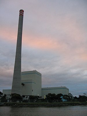
The Newport Power Station was a complex of power stations located on the west bank of the Yarra River, approximately 6 km south-west of Melbourne, Victoria, Australia, in the suburb of Newport. Newport A, B, and C were coal-fired plants which operated at the site between 1919 and the 1980s, and were claimed to be (in terms of the amount of plant) the largest power station in the southern hemisphere in 1953 with 42 boilers and 14 turbo-alternators producing 327 megawatts (439,000 hp). Newport D is a gas-fired peaking power plant which has operated since 1981.

Newport Workshops
Railway workshops in Melbourne, Victoria, Australia
Distance: Approx. 1289 meters
Latitude and longitude: -37.8516,144.8819
The Newport Railway Workshops is a facility in the Melbourne suburb of Newport, Australia, that builds, maintains and refurbishes railway rollingstock. It is located between the Williamstown and Werribee railway lines.

Newport Railway Museum
Railway museum in Newport, Victoria
Distance: Approx. 1901 meters
Latitude and longitude: -37.85611111,144.88666667
The Newport Railway Museum is located on Champion Road, Newport, Victoria, near the North Williamstown station.

Steamrail Victoria
Volunteer group in Victoria, Australia
Distance: Approx. 1172 meters
Latitude and longitude: -37.85083333,144.88
Steamrail Victoria is a not-for-profit volunteer group established in 1965 to restore and operate historic locomotives and rolling stock used on the railways in Victoria, Australia. The main depot of the group is at the Newport Workshops ('West Block') in suburban Melbourne. In addition to operating railfan special trains and charters for private groups, the group also operates special steam trains in the Melbourne suburban area.

Paisley Park Soccer Complex
Distance: Approx. 1995 meters
Latitude and longitude: -37.84666667,144.85694444
The Paisley Park Soccer Complex in Altona North, Victoria, provides the facilities for local soccer club Altona Magic, who play in National Premier Leagues Victoria and are supported by the Macedonian Australian community. The stadium has a capacity of 5,000 spectators. The Altona East Phoenix, who currently participate in the Victorian State League Division 1 N/W, also share the facilities, and are predominantly backed by the local Greek Australian community.

Bayside College
Public, co-educational P-12 school in Melbourne, Australia
Distance: Approx. 1390 meters
Latitude and longitude: -37.84361111,144.86291667
Bayside P–12 College is a public, co-educational prep to year 12 school in Melbourne, Australia. It spans three campuses, in Altona North, Newport and Williamstown. Founded as Bayside Secondary College amidst the forced school amalgamations of the Kennett Government in the early 1990s, the school was born from the merger of Altona North High School, Altona North Technical School, Williamstown Technical School and Paisley High School.

Williamstown Cemetery
Cemetery in Williamstown North, Victoria, Australia
Distance: Approx. 1421 meters
Latitude and longitude: -37.853,144.8808
Williamstown Cemetery is located in the Melbourne suburb of Williamstown North, Victoria, Australia. The main entrance is on Champion Road, Williamstown North. The Cemetery is managed by Greater Metropolitan Cemeteries Trust (GMCT).
Weather in this IP's area
few clouds
18 Celsius
17 Celsius
17 Celsius
21 Celsius
1020 hPa
49 %
1020 hPa
1017 hPa
10000 meters
7.2 m/s
180 degree
20 %
06:01:07
20:08:54