Country:
Region:
City:
Latitude and Longitude:
Time Zone:
Postal Code:
IP information under different IP Channel
ip-api
Country
Region
City
ASN
Time Zone
ISP
Blacklist
Proxy
Latitude
Longitude
Postal
Route
Luminati
Country
Region
vic
City
melbourne
ASN
Time Zone
Australia/Melbourne
ISP
Over The Wire Pty Ltd
Latitude
Longitude
Postal
IPinfo
Country
Region
City
ASN
Time Zone
ISP
Blacklist
Proxy
Latitude
Longitude
Postal
Route
db-ip
Country
Region
City
ASN
Time Zone
ISP
Blacklist
Proxy
Latitude
Longitude
Postal
Route
ipdata
Country
Region
City
ASN
Time Zone
ISP
Blacklist
Proxy
Latitude
Longitude
Postal
Route
Popular places and events near this IP address

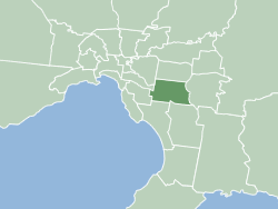
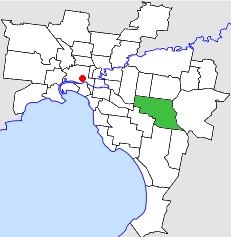
City of Monash
Local government area in Victoria, Australia
Distance: Approx. 1499 meters
Latitude and longitude: -37.88333333,145.16666667
The City of Monash is a local government area in Melbourne, Victoria, Australia in the south-eastern suburbs of Melbourne with an area of 81.5 square kilometres and a population of 200,077 people in 2016.

Glen Waverley, Victoria
Suburb of Melbourne, Victoria, Australia
Distance: Approx. 1083 meters
Latitude and longitude: -37.88,145.164
Glen Waverley is an eastern suburb in Melbourne, Victoria, Australia, 19 km (12 mi) south-east of Melbourne's Central Business District, located within the City of Monash local government area. Glen Waverley recorded a population of 42,642 at the 2021 census.
Syndal railway station
Railway station in Melbourne, Australia
Distance: Approx. 463 meters
Latitude and longitude: -37.87625,145.14936
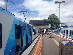
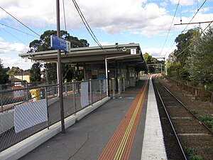
Syndal railway station is a commuter railway station on the Glen Waverley line, which is part of the Melbourne railway network. It serves the south-eastern suburb of Glen Waverley, in Melbourne, Victoria, Australia. Syndal station is a ground level unstaffed station, featuring an island platform with two faces, connected to Hunter Street and Coleman Parade via a pedestrian subway.

Glen Waverley railway station
Commuter railway station in Melbourne, Australia
Distance: Approx. 953 meters
Latitude and longitude: -37.87954,145.16259
Glen Waverley railway station is a commuter railway station located in the suburb of Glen Waverley in the south-east of Melbourne, Victoria, Australia. The station originally opened in 1930 as part of the line's extension from Eastmalvern. The station consists of a single island platform with two faces, that is connected to Kingsway via a ramp on the station's eastern end.
Syndal, Victoria
Neighbourhood in Melbourne
Distance: Approx. 587 meters
Latitude and longitude: -37.872,145.148
Syndal is a Locality in the Melbourne suburbs of Glen Waverley and Mount Waverley in Victoria, Australia around the intersection of High Street Road and Blackburn Road. It is in the local government area of the City of Monash. From the intersection down to Syndal railway station on Coleman Parade, is the Syndal Shopping Centre.
Glen Waverley Secondary College
Public school in Glen Waverley, Victoria, Australia
Distance: Approx. 836 meters
Latitude and longitude: -37.87722222,145.16277778
Glen Waverley Secondary College is a non-selective public government school located in Glen Waverley, Victoria, Australia. It is one of the largest secondary schools in Victoria, with 2,250 students and 181 teachers as of 2024. In addition, the college is one of the highest performing state high schools in Victoria, it ranked 59 out of all 530 Victorian high-schools in 2013, based on the Australian Tertiary Admission Rank (ATAR).
The Glen Shopping Centre
Shopping mall in Victoria, Australia
Distance: Approx. 993 meters
Latitude and longitude: -37.87638889,145.165
The Glen Shopping Centre is a major regional shopping centre located in Glen Waverley, Victoria, Australia. The head offices of MYOB are located in the centre.
Electoral district of Syndal
Former state electoral district of Victoria
Distance: Approx. 920 meters
Latitude and longitude: -37.86666667,145.15
Electoral district of Syndal was an electoral district of the Legislative Assembly in the Australian state of Victoria.

City of Waverley
Local government area in Victoria, Australia
Distance: Approx. 1499 meters
Latitude and longitude: -37.88333333,145.16666667
The City of Waverley was a local government area about 20 kilometres (12 mi) east-southeast of Melbourne, the state capital of Victoria, Australia. The city covered an area of 60.86 square kilometres (23.50 sq mi), and existed from 1857 until 1994.
Syndal High School
Defunct secondary school in Victoria, Australia
Distance: Approx. 944 meters
Latitude and longitude: -37.86701389,145.1595
Syndal High School (also known as Syndal Secondary School) was a public secondary school located in Glen Waverley, Victoria, Australia.

Kingsway, Glen Waverley
Street in Melbourne, Australia
Distance: Approx. 1155 meters
Latitude and longitude: -37.88138889,145.16361111
Kingsway is a shopping, dining and entertainment precinct at the town centre of Glen Waverley, a southeastern suburb of Melbourne, Victoria, Australia. It starts off at the northern end from High Street, and runs north-south parallel to Springvale Road before curving east at its southern end to join the latter as a T-intersection. Along Kingsway are two major shopping centres, The Glen Shopping Centre at its northern end, which offers more than 3,500 parking spaces; and Century City Walk at its southern end, which contains a Village Cinemas multiplex, other entertainment retailers (such as Strike Bowling Bar), a tavern and various eateries, as well as Novotel and Ibis.
Casey Central
Shopping mall in Victoria, Australia
Distance: Approx. 993 meters
Latitude and longitude: -37.87638889,145.165
Casey Central is a regional shopping centre located in the suburb of Narre Warren South, Victoria, approximately 38 kilometres (24 mi) south-east from the Melbourne central business district. The centre recently underwent a major redevelopment and currently includes a Kmart Discount Department store, three supermarkets and over 90 specialty stores. The centre also features a fresh food hall and a number of casual dining options.
Weather in this IP's area
clear sky
18 Celsius
17 Celsius
17 Celsius
19 Celsius
1019 hPa
48 %
1019 hPa
1004 hPa
10000 meters
1.34 m/s
4.02 m/s
143 degree
5 %
05:59:56
20:07:52
