103.119.254.14 - IP Lookup: Free IP Address Lookup, Postal Code Lookup, IP Location Lookup, IP ASN, Public IP
Country:
Region:
City:
Location:
Time Zone:
Postal Code:
ISP:
ASN:
language:
User-Agent:
Proxy IP:
Blacklist:
IP information under different IP Channel
ip-api
Country
Region
City
ASN
Time Zone
ISP
Blacklist
Proxy
Latitude
Longitude
Postal
Route
db-ip
Country
Region
City
ASN
Time Zone
ISP
Blacklist
Proxy
Latitude
Longitude
Postal
Route
IPinfo
Country
Region
City
ASN
Time Zone
ISP
Blacklist
Proxy
Latitude
Longitude
Postal
Route
IP2Location
103.119.254.14Country
Region
kerala
City
beypore
Time Zone
Asia/Kolkata
ISP
Language
User-Agent
Latitude
Longitude
Postal
ipdata
Country
Region
City
ASN
Time Zone
ISP
Blacklist
Proxy
Latitude
Longitude
Postal
Route
Popular places and events near this IP address

Chaliyar
River in Kerala, India
Distance: Approx. 3171 meters
Latitude and longitude: 11.16,75.8
Chaliyar River is the fourth longest river in Kerala at 169 km in length. The Chaliyar is also known as Chulika River, Nilambur River or Beypore River as it is near the sea. Pothukal, Chungathara, Nilambur, Mampad, Edavanna, Kavanoor, Perakamanna, Areekode, Kizhuparamba, Elamaram, Cheekkode, Vazhakkad, Vazhayur, Cheruvadi, Edavannappara, Mavoor, Peruvayal, Perumanna, Feroke and Beypore are some of the towns/villages situated along the banks of the Chaliyar.
Beypore
City in Kerala, India
Distance: Approx. 819 meters
Latitude and longitude: 11.18,75.81
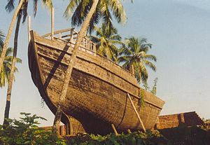
Beypore or Beypur (formerly Beypoor) is an ancient port town and a locality town in Kozhikode district in the state of Kerala, India. It is located opposite to Chaliyam, the estuary where the river Chaliyar empties into Arabian Sea. Beypore is part of Kozhikode Municipal Corporation.

Feroke
Municipality in Kerala, India
Distance: Approx. 3637 meters
Latitude and longitude: 11.18333333,75.85
Feroke (IPA: [fɐroːkːɨ̆]) is a Municipality and a part of Kozhikode metropolitan area under Kozhikode Development Authority (K.D.A) in the Kozhikode district of the Indian state of Kerala. Feroke municipality shares its borders with Kozhikode corporation, Ramanattukara municipality, Kadalundi panchayat and Chelembra panchayath. Feroke is located 11 km away from Kozhikode city.
Kunnummal
Village in Kerala, India
Distance: Approx. 2787 meters
Latitude and longitude: 11.20833333,75.81666667
Kunnummal is a panchayath in Kozhikode district in the state of Kerala, India.
Mahlkot
Town in Kerala, India
Distance: Approx. 1988 meters
Latitude and longitude: 11.16550833,75.81508889
Mahlkot is an area situated in the Kozhikode district of the Kerala state in India. The very same name is some times used to refer to an area in Tirurangadi taluk of Malappuram district.

Cheruvannur Nallalam
Census town in Kerala, India
Distance: Approx. 1351 meters
Latitude and longitude: 11.195,75.82
Cheruvannur is a census town and Cheruvannur-Nallalam Part of Kozhikode Corporation.

Chaliyam
Village in Kerala, India
Distance: Approx. 3185 meters
Latitude and longitude: 11.15592,75.80824
Chaliyam is a village situated at the estuary of Chaliyar (River Beypore) in Kozhikode district of Kerala, India. Chaliyam forms an island, bounded by the Chaliyar in the north, and River Kadalundi in south, and the Conolly Canal in the east. It is located just opposite to Beypore port.

Beypore Lighthouse
Lighthouse in Kerala, India
Distance: Approx. 3028 meters
Latitude and longitude: 11.15827,75.80585
The Beypore Lighthouse is a lighthouse at Feroke, Kozhikode, on the south shore of the Chaliyam River. The six-sided tower has a height of 30.48 metres (100.0 ft). The tower is painted with red and white bands.

Paruthippara
Village in Kerala, India
Distance: Approx. 3908 meters
Latitude and longitude: 11.2000621,75.8481448
Paruthippara or Kodampuzha is a small village near Feroke in Kozhikode District. The village is considered an industrial belt as a large number of small-scale are established here for a long time.

Government College, Meenchantha
Distance: Approx. 3916 meters
Latitude and longitude: 11.21356,75.79841
Government Arts and Science College, Meenchantha, Kozhikode is one of the oldest government college in Kozhikode, Kerala. The college has grows considerably over the years and has started accommodating science courses also and underwent a name-change from Arts College to Arts and Science College because of the changes in the course structure.

Beypore Assembly constituency
Constituency of the Kerala legislative assembly in India
Distance: Approx. 2349 meters
Latitude and longitude: 11.17,75.8
Beypore State assembly constituency is one of the 140 state legislative assembly constituencies in Kerala state in southern India. It is also one of the 7 state legislative assembly constituencies included in the Kozhikode Lok Sabha constituency. As of the 2021 Assembly election, the current MLA is P. A. Mohammed Riyas of CPI(M).

Marine Cemetery
Art installation dedicated to nine endangered marine and riverine species
Distance: Approx. 2651 meters
Latitude and longitude: 11.163281,75.80356
The Marine Cemetery is an art installation located at Beypore beach in Kozhikode, Kerala, India dedicated to nine endangered marine and riverine species. It is made up of 2,000 plastic bottles that had been previously collected from the beach. It was opened in 2019.
Weather in this IP's area
few clouds
28 Celsius
30 Celsius
28 Celsius
28 Celsius
1008 hPa
74 %
1008 hPa
1007 hPa
6000 meters
2.06 m/s
230 degree
20 %