103.117.93.55 - IP Lookup: Free IP Address Lookup, Postal Code Lookup, IP Location Lookup, IP ASN, Public IP
Country:
Region:
City:
Location:
Time Zone:
Postal Code:
ISP:
ASN:
language:
User-Agent:
Proxy IP:
Blacklist:
IP information under different IP Channel
ip-api
Country
Region
City
ASN
Time Zone
ISP
Blacklist
Proxy
Latitude
Longitude
Postal
Route
db-ip
Country
Region
City
ASN
Time Zone
ISP
Blacklist
Proxy
Latitude
Longitude
Postal
Route
IPinfo
Country
Region
City
ASN
Time Zone
ISP
Blacklist
Proxy
Latitude
Longitude
Postal
Route
IP2Location
103.117.93.55Country
Region
koshi
City
ithari
Time Zone
ISP
Language
User-Agent
Latitude
Longitude
Postal
ipdata
Country
Region
City
ASN
Time Zone
ISP
Blacklist
Proxy
Latitude
Longitude
Postal
Route
Popular places and events near this IP address
Thadiya
Village in Kosi Zone, Nepal
Distance: Approx. 5689 meters
Latitude and longitude: 26.65472222,87.33888889
Thadiya is a small village along the Mahendra Highway in eastern Nepal. It is located in middle between Gothgau and Gachhiya.

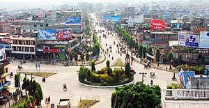
Itahari
Sub-Metropolitan City in Nepal
Distance: Approx. 970 meters
Latitude and longitude: 26.66305556,87.27444444
Itahari (Nepali: ईटहरी) is a sub-metropolitan city in the Sunsari District of Koshi Province in Nepal. Itahari city has grown as an important business hub of eastern Nepal. It is the second most populous city in eastern Nepal after Biratnagar.
Aekamba
Place in Nepal
Distance: Approx. 5619 meters
Latitude and longitude: 26.65,87.23
Ekamba is a part of Itahari Sub-Metropolitan City in Sunsari District in the Kosi Zone of south-eastern Nepal. At the time of the 1991 Nepal census it had a population of 7781.
Bhadgau Sinawari
Village development committee in Kosi Zone, Nepal
Distance: Approx. 8295 meters
Latitude and longitude: 26.67,87.2
Bhadgau Sinawari is a village development committee in Sunsari District in the Kosi Zone of south-eastern Nepal. At the time of the 1991 Nepal census, it had a population of 8737 people living in 1681 individual households.
Hanshpokha
Village development committee in Kosi Zone, Nepal
Distance: Approx. 4971 meters
Latitude and longitude: 26.7,87.25
Hanshpokha is a village development committee in Sunsari District in the Kosi Zone of south-eastern Nepal. At the time of the 1991 Nepal census it had a population of 11479 people living in 2242 individual households.

Khanar
Town in Koshi Zone, Nepal
Distance: Approx. 4099 meters
Latitude and longitude: 26.63,87.28
Khanar is a town in Itahari in Sunsari District in the Koshi Zone of south-eastern Nepal. The VDC village development committee was merged to form the submetropolis in June 2014. At the time of the 2011 Nepal census it had a population of 20,323 people living in 5,130 individual households.
Madheli
Village development committee in Kosi Zone, Nepal
Distance: Approx. 7642 meters
Latitude and longitude: 26.61,87.24
Madheli is a village development committee in Sunsari District in the Kosi Zone of south-eastern Nepal. At the time of the 1991 Nepal census it had a population of 6816 people living in 1190 individual households.
Pakali
Village development committee in Koshi Zone, Nepal
Distance: Approx. 5505 meters
Latitude and longitude: 26.68,87.23
Pakali is part of Sub-metropolitan city Itahari. It has a famous temple of Goddess Bhawani called as (Jabdi). At the time of the 1991 Nepal census, it had a population of 9500.
Sonapur, Sunsari
Village development committee in Kosi Zone, Nepal
Distance: Approx. 7542 meters
Latitude and longitude: 26.6,87.27
Sonapur is a village development committee in Sunsari District in the Kosi Zone of south-eastern Nepal. At the time of the 1991 Nepal census it had a population of 6241 people living in 1154 individual households.
Sisabanibadahara
Village development committee in Kosi Zone, Nepal
Distance: Approx. 7886 meters
Latitude and longitude: 26.6,87.31
Sisabanibadahara is a village development committee in Morang District in the Kosi Zone of south-eastern Nepal. At the time of the 1991 Nepal census it had a population of 3978 people living in 733 individual households.

Labipur
Sub-Metropolitan City in Koshi Zone, Nepal
Distance: Approx. 3313 meters
Latitude and longitude: 26.66666667,87.25
Labipur (a village) (Nepali: लबिपुर) is a Tharu village located in the Itahari sub-metropolitan city of Sunsari District in the Koshi Zone of south-eastern Nepal. Labipur was previously included in the village development committee known as Hansposha.

Itahari International College
Private undergraduate college in Morang, Nepal
Distance: Approx. 2246 meters
Latitude and longitude: 26.6554,87.302
Itahari International College (IIC) is an information technology and business college in Sundar Haraicha, Nepal, established in 2017. The college directly partners with London Metropolitan University (London Met) of United Kingdom offering the honorary undergraduate degrees in BA (Hons) in Business Administration and B.Sc. (Hons) in Computing.
Weather in this IP's area
clear sky
20 Celsius
19 Celsius
20 Celsius
20 Celsius
1015 hPa
49 %
1015 hPa
1000 hPa
10000 meters
0.62 m/s
0.94 m/s
351 degree