Country:
 Indonesia
Region:
City:
Latitude and Longitude:
Time Zone:
Postal Code:
IP information under different IP Channel
ip-api
Country
Region
City
ASN
Time Zone
ISP
Blacklist
Proxy
Latitude
Longitude
Postal
Route
IPinfo
Country
Region
City
ASN
Time Zone
ISP
Blacklist
Proxy
Latitude
Longitude
Postal
Route
MaxMind
Country
Region
City
ASN
Time Zone
ISP
Blacklist
Proxy
Latitude
Longitude
Postal
Route
Luminati
Country
IDASN
Time Zone
Asia/Jakarta
ISP
PT. Indomarco Prismatama
Latitude
Longitude
Postal
db-ip
Country
Region
City
ASN
Time Zone
ISP
Blacklist
Proxy
Latitude
Longitude
Postal
Route
ipdata
Country
Region
City
ASN
Time Zone
ISP
Blacklist
Proxy
Latitude
Longitude
Postal
Route
Popular places and events near this IP address
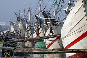
Sunda Kelapa
Port in Indonesia
Distance: Approx. 724 meters
Latitude and longitude: -6.123871,106.80861
Sunda Kelapa (Sundanese: ᮞᮥᮔ᮪ᮓ ᮊᮜᮕ, Sunda Kalapa) is the old port of Jakarta, located on the estuary of the Ciliwung River. "Sunda Kalapa" (Sundanese: "Coconut of Sunda") is the original name, and it was the main port of the Sunda Kingdom. The port is situated in Penjaringan District, of North Jakarta, Indonesia.

Jakarta History Museum
History museum in Jakarta, Indonesia
Distance: Approx. 1106 meters
Latitude and longitude: -6.135,106.81305556
The Jakarta History Museum (Indonesian: Museum Sejarah Jakarta), also known as Fatahillah Museum or Batavia Museum, is located in the Old Town (known as Kota Tua) of Jakarta, Indonesia. The building was built in 1710 as the Stadhuis (city hall) of Batavia. Jakarta History Museum opened in 1974 and displays objects from the prehistory period of the city region, the founding of Jayakarta in 1527, and the Dutch colonization period from the 16th century until Indonesia's Independence in 1945.

Wayang Museum
Puppet museum in Jakarta, Indonesia
Distance: Approx. 1091 meters
Latitude and longitude: -6.1347,106.8124
The Wayang Museum (Indonesian: Museum Wayang) is a museum dedicated to Javan wayang puppetry. The museum is located in Kota Tua, Jakarta, Indonesia. It is one of several museums and galleries facing Fatahillah Square, which include the Jakarta History Museum, Fine Art and Ceramic Museum, and Kota Post Office art gallery.

Museum of Fine Arts and Ceramics
Art Museum in Jakarta, Indonesia
Distance: Approx. 966 meters
Latitude and longitude: -6.13388889,106.81416667
The Museum of Fine Arts and Ceramics (Indonesian: Museum Seni Rupa dan Keramik) is a museum in Jakarta, Indonesia. The museum is dedicated especially to the display of traditional fine art and ceramics of Indonesia. The museum is located in the east side of Fatahillah Square, near Jakarta History Museum and Wayang Museum.

Maritime Museum (Indonesia)
Maritime museum in Jakarta , Indonesia
Distance: Approx. 766 meters
Latitude and longitude: -6.12698333,106.8083
The Maritime Museum (Indonesian: Museum Bahari) is located in the old Sunda Kelapa harbor area in Penjaringan Administrative Village, Penjaringan Subdistrict, Jakarta, Indonesia. The museum was inaugurated inside the former Dutch East India Company warehouses. The museum focuses on the maritime history of Indonesia and the importance of the sea to the economy of present-day Indonesia.

Amsterdam Gate, Jakarta
Distance: Approx. 701 meters
Latitude and longitude: -6.1308,106.812
The Amsterdam Gate (Dutch: Amsterdamse Poort) formed the entrance to the Castle Square (Dutch: Kasteelplein) south of Batavia Castle. The gate existed from 1744 up to the 1950s in what is now known as Kota, Jakarta, where it would have stood near the intersection of Jalan Nelayan Timur and Jalan Cengkeh.
University of Bunda Mulia
University in Jakarta Utara, Indonesia
Distance: Approx. 676 meters
Latitude and longitude: -6.1302887,106.8184124
The University of Bunda Mulia (also known in Indonesian: Universitas Bunda Mulia or simply as "UBM") is one of the major Indonesian private universities, located in North Jakarta, Indonesia. Based on the selection made by the Directorate General of Higher Education from March to June 2006 to more than 2,000 universities in Indonesia, by the method of information filtering using the inputs from EPSBED, BAN PT (Indonesian: Badan Akreditasi Nasional Perguruan Tinggi, which is the National Accreditation Board for Higher-Education), layoffs A1, A2, A3 and B, TPSDP, DUE, QUE and INHERE, as well as from such public TEMPO & Webometrics Weekly Magazine, the result was the election of 156 universities that were considered eligible for the selection to a more advanced stage. In connection with this advanced selection, UBM was selected as one of the universities included in the Promising Indonesian Universities.

Melaka Gallery (Indonesia)
Gallery in Tambora, Jakarta, Indonesia
Distance: Approx. 1106 meters
Latitude and longitude: -6.135,106.81305556
Melaka Gallery (Indonesian: Galeri Melaka) is a gallery in Jakarta, Indonesia which displays various pictures and items of the Malaysian state of Malacca. It was established by renovating an old building at Jalan Malaka. The street location was chosen due to its name resemblance.

Fatahillah Square
Distance: Approx. 1069 meters
Latitude and longitude: -6.1347,106.8133
Fatahillah Square (Indonesian: Taman Fatahillah) is the historical center of the old Batavia. The square is located at the center of Jakarta Old Town. Today the square is a tourist area home to the Jakarta History Museum, Wayang Museum and Fine Art and Ceramics Museum in Kota, Jakarta.

Batavia Castle
VOC fort in Jakarta
Distance: Approx. 472 meters
Latitude and longitude: -6.1275,106.81138889
Batavia Castle (Dutch: Kasteel Batavia, Indonesian: Kastel Batavia) was a fort located at the mouth of Ciliwung River in Jakarta. Batavia Castle was the administrative center of Dutch East India Company (VOC) in Asia. Batavia Castle was also the residence of the Governor General, the highest VOC official in the Dutch East Indies who chaired the Council of the Indies, the executive committee that made decisions in the Dutch East Indies.

Kali Besar
Place in Jakarta, Indonesia
Distance: Approx. 838 meters
Latitude and longitude: -6.13136111,106.81058333
Kali Besar (de Groote Rivier) refers to the channel connecting Sunda Kelapa in the north to the south part in old town of Jakarta, parallel to Ciliwung River in their east disemboguing at the heart of the old city of Jakarta. Literally meaning Grand River, this channel is now part of Kali Krukut (Krukut river) in Tambora subdistrict.

Kota Intan Bridge
Distance: Approx. 830 meters
Latitude and longitude: -6.1312475,106.8105445
Kota Intan Bridge (Indonesian: Jembatan Kota Intan) is a hanging bridge located at Kali Besar of Kota Tua in Jakarta. It is the oldest bridge in Indonesia that was built in 1628 by the Dutch East India Company. Now the bridge is under the management of the Jakarta Provincial Tourism and Culture Department.
Weather in this IP's area
haze
25 Celsius
26 Celsius
25 Celsius
26 Celsius
1010 hPa
84 %
1010 hPa
1010 hPa
5000 meters
3.09 m/s
190 degree
20 %
05:29:48
17:45:16