103.116.152.208 - IP Lookup: Free IP Address Lookup, Postal Code Lookup, IP Location Lookup, IP ASN, Public IP
Country:
Region:
City:
Location:
Time Zone:
Postal Code:
IP information under different IP Channel
ip-api
Country
Region
City
ASN
Time Zone
ISP
Blacklist
Proxy
Latitude
Longitude
Postal
Route
Luminati
Country
ASN
Time Zone
Asia/Tokyo
ISP
OPTAGE Inc.
Latitude
Longitude
Postal
IPinfo
Country
Region
City
ASN
Time Zone
ISP
Blacklist
Proxy
Latitude
Longitude
Postal
Route
IP2Location
103.116.152.208Country
Region
yamanashi
City
chuo
Time Zone
Asia/Tokyo
ISP
Language
User-Agent
Latitude
Longitude
Postal
db-ip
Country
Region
City
ASN
Time Zone
ISP
Blacklist
Proxy
Latitude
Longitude
Postal
Route
ipdata
Country
Region
City
ASN
Time Zone
ISP
Blacklist
Proxy
Latitude
Longitude
Postal
Route
Popular places and events near this IP address
Yamanashi Prefecture
Prefecture of Japan
Distance: Approx. 6284 meters
Latitude and longitude: 35.61666667,138.61666667
Yamanashi Prefecture (山梨県, Yamanashi-ken) is a prefecture of Japan located in the Chūbu region of Honshu. Yamanashi Prefecture has a population of 817,192 (1 January 2019) and has a geographic area of 4,465 km2 (1,724 sq mi). Yamanashi Prefecture borders Saitama Prefecture to the northeast, Nagano Prefecture to the northwest, Shizuoka Prefecture to the southwest, Kanagawa Prefecture to the southeast, and Tokyo to the east.
Fuefuki
City in Chūbu, Japan
Distance: Approx. 6563 meters
Latitude and longitude: 35.64730556,138.63972222
Fuefuki (笛吹市, Fuefuki-shi) is a city in Yamanashi Prefecture, Japan. As of 1 September 2020, the city had an estimated population of 67,300 in 30,408 households, and a population density of 340 persons per km2. The total area of the city is 201.92 square kilometres (77.96 sq mi).
Chūō, Yamanashi
City in Chūbu, Japan
Distance: Approx. 4443 meters
Latitude and longitude: 35.59961111,138.63391667
Chūō (中央市, Chūō-shi) is a city located in Yamanashi Prefecture, Japan. As of 1 October 2020, the city had an estimated population of 30,660 in 13,954 households, and a population density of 970 persons per km². The total area of the city is 31.69 square kilometres (12.24 sq mi).

Isawa-Onsen Station
Railway station in Fuefuki, Yamanashi Prefecture, Japan
Distance: Approx. 7727 meters
Latitude and longitude: 35.657561,138.635281
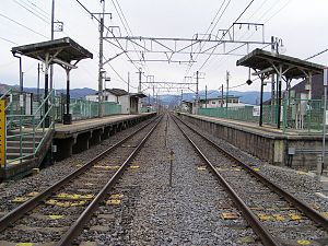
Isawa-Onsen Station (石和温泉駅, Isawa-Onsen-eki) is a railway station of the Chūō Main Line, East Japan Railway Company (JR East) in the Isawa-Matsumoto neighborhood of the city of Fuefuki, Yamanashi Prefecture, Japan. It is also a freight terminal for the Japan Freight Railway Company (JR Freight).

Kasugaichō Station
Railway station in Fuefuki, Yamanashi Prefecture, Japan
Distance: Approx. 8464 meters
Latitude and longitude: 35.673503,138.659053
Kasugaichō Station (春日居町駅, Kasugaichō-eki) is a railway station of the Chūō Main Line, operated by East Japan Railway Company (JR East) in the Kasugai-Betsuden neighborhood of the city of Fuefuki, Yamanashi Prefecture, Japan.
Yamanashi Eiwa College
Distance: Approx. 9257 meters
Latitude and longitude: 35.6614,138.614
Yamanashi Eiwa College (山梨英和大学, Yamanashi eiwa daigaku) is a private university in Kofu, Yamanashi Prefecture, Japan. The predecessor of the school, a women's school, was founded in 1889 and was chartered as a junior college in 1966. It became coeducational in 2001 and became a four-year college the following year.

Yamanashi Prefectural Museum
Building in Yamanashi Prefecture, Japan
Distance: Approx. 5455 meters
Latitude and longitude: 35.640259,138.648623
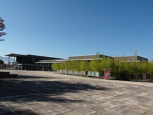
Yamanashi Prefectural Museum (山梨県立博物館, Yamanashi kenritsu hakubutsukan) opened in Fuefuki, Yamanashi Prefecture, Japan in 2005. The collection relates to the natural history, history, and culture of Yamanashi Prefecture; special exhibitions are also held.
Ichinomiya Asama Shrine (Fuefuki)
Shintō shrine in Yamanashi Prefecture, Japan
Distance: Approx. 5475 meters
Latitude and longitude: 35.64775833,138.69744167
The Ichinomiya Asama Jinja (一宮浅間神社) is a Shintō shrine in the Ichinomiya neighborhood of the city of Fuefuki in Yamanashi Prefecture, Japan. It is one of two shrines which vie for the total of ichinomiya of former Kai Province. The main festival of the shrine is held annually on April 15.
Kai Kokubun-ji
Heian period Buddhist temple in Fuefuki, Japan
Distance: Approx. 4299 meters
Latitude and longitude: 35.63861111,138.68361111
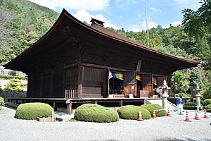
The Kai Kokubun-ji (甲斐国分寺) is a Rinzai Zen Buddhist temple located in the city of Fuefuki, Yamanashi, Japan. It is the descendant of one of the provincial temples established by Emperor Shōmu during the Nara period (710 – 794) for the purpose of promoting Buddhism as the national religion of Japan and standardising control of the imperial rule to the provinces. The ruins of the Nara period temple are adjacent to the modern temple and were designated as a National Historic Site in 1922.

Katsunuma clan residence ruins
Archaeological site in Kõshū, Chūbu, Japan
Distance: Approx. 7982 meters
Latitude and longitude: 35.65888889,138.73333333
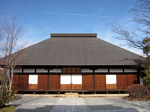
The Katsunuma clan residence ruins (勝沼氏館跡, Katsunuma-shi yakata ato) is an archaeological site consisting of the ruins of a Sengoku period fortified residence, located in what is now part of the city of Kōshū, Yamanashi in the Chūbu region of Japan. The site was designated a National Historic Site of Japan in 1981.
Ōmaruyama Kofun
4th century Kofun period tumulus in Japan
Distance: Approx. 9328 meters
Latitude and longitude: 35.59333333,138.58027778
The Ōmaruyama Kofun (大丸山古墳) is a 4th century Kofun period tumulus located in the Nakamichi neighborhood of the city of Kōfu, Yamanashi in the Chūbu region of Japan. The tumulus was designated a National Historic Site of Japan in 2013.

Daizen-ji
Buddhist temple in Japan
Distance: Approx. 8272 meters
Latitude and longitude: 35.65594444,138.74316667
Daizen-ji (大善寺) is a Buddhist temple belonging to the Shingon school of Japanese Buddhism, located in the city of Kōshū, Yamanashi, Japan.
Weather in this IP's area
broken clouds
6 Celsius
6 Celsius
6 Celsius
6 Celsius
1014 hPa
58 %
1014 hPa
931 hPa
10000 meters
1.27 m/s
2.27 m/s
294 degree
68 %


