Country:
 Australia
Region:
City:
Latitude and Longitude:
Time Zone:
Postal Code:
IP information under different IP Channel
ip-api
Country
Region
City
ASN
Time Zone
ISP
Blacklist
Proxy
Latitude
Longitude
Postal
Route
IPinfo
Country
Region
City
ASN
Time Zone
ISP
Blacklist
Proxy
Latitude
Longitude
Postal
Route
MaxMind
Country
Region
City
ASN
Time Zone
ISP
Blacklist
Proxy
Latitude
Longitude
Postal
Route
Luminati
Country
AUASN
Time Zone
Australia/Sydney
ISP
TPG Telecom Limited
Latitude
Longitude
Postal
db-ip
Country
Region
City
ASN
Time Zone
ISP
Blacklist
Proxy
Latitude
Longitude
Postal
Route
ipdata
Country
Region
City
ASN
Time Zone
ISP
Blacklist
Proxy
Latitude
Longitude
Postal
Route
Popular places and events near this IP address

Highett, Victoria
Suburb of Melbourne, Victoria, Australia
Distance: Approx. 531 meters
Latitude and longitude: -37.95,145.05
Highett () is a suburb in Melbourne, Victoria, Australia, 16 km south-east of Melbourne's Central Business District, located within the Cities of Bayside and Kingston local government areas. Highett recorded a population of 12,016 at the 2021 census. Located 2 km east of Port Phillip, Highett is bordered by Hampton/Sandringham to the west, Hampton East/Moorabbin to the north and Cheltenham to the east and south.

Moorabbin, Victoria
Suburb of Melbourne, Victoria, Australia
Distance: Approx. 951 meters
Latitude and longitude: -37.941,145.058
Moorabbin is a suburb in Melbourne, Victoria, Australia, 15 km south-east of Melbourne's Central Business District, located within the City of Kingston local government area. Moorabbin recorded a population of 6,287 at the 2021 census. Most of the eastern side of Moorabbin has been an industrial area since the first development in the mid-1960s.

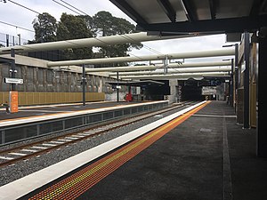
Highett railway station
Railway station in Melbourne, Australia
Distance: Approx. 1251 meters
Latitude and longitude: -37.9485,145.0418
Highett railway station is a commuter railway station on the Frankston line, which is part of the Melbourne railway network. It serves the south-eastern suburb of Highett, in Melbourne, Victoria, Australia. Highett station is a ground-level unstaffed station, featuring two side platforms.
Cheltenham railway station, Melbourne
Railway station in Melbourne, Australia
Distance: Approx. 1963 meters
Latitude and longitude: -37.967,145.0547
Cheltenham railway station is a commuter railway station on the Frankston line, which is part of the Melbourne railway network. It serves the south-eastern suburb of Cheltenham, in Melbourne, Victoria, Australia. Cheltenham station is a below ground premium station, featuring three platforms, an island platform with two faces and one side platform.

Westfield Southland
Shopping mall in Victoria, Australia
Distance: Approx. 1093 meters
Latitude and longitude: -37.958,145.05
Westfield Southland (previously known as Southland Centre) is a shopping centre in the suburb of Cheltenham in Melbourne. Southland has a floor area of 129,180m², making it one of the biggest shopping centres in Australia by size. There are approximately 400 retailers in Southland, including Myer, David Jones and Harris Scarfe.

Moorabbin Oval
Australian rules football ground in Melbourne, Victoria, Australia
Distance: Approx. 1698 meters
Latitude and longitude: -37.9375,145.0439
Moorabbin Oval (also known as RSEA Park under a naming rights agreement) is an Australian rules football ground in the city of Melbourne, Victoria, Australia at Linton Street in the suburb of Moorabbin. The ground was most notable as the home of the St Kilda Football Club in the Australian Football League, serving as its home ground for VFL/AFL matches from 1965 until 1992, and as its primary training and administrative base from 1965 until 2010. In 2018 the ground was once again reopened as the primary training and administrative base for St Kilda.
Pennydale, Victoria
Place in Victoria, Australia
Distance: Approx. 1465 meters
Latitude and longitude: -37.96,145.04611111
Pennydale is a neighbourhood in the suburb of Cheltenham in Melbourne, Victoria, Australia, approximately 17 km south-east of the Melbourne central business district. Pennydale lies within Cheltenham between Bay Road to the north, Jack Road to the west, Park Road to the south, and the Frankston railway line to the east. It is entirely within the local government area of the City of Bayside.
Electoral district of Moorabbin
Former electoral district in Australia
Distance: Approx. 1864 meters
Latitude and longitude: -37.93333333,145.05
Electoral district of Moorabbin was an electoral district of the Legislative Assembly in the Australian state of Victoria.

Cheltenham Secondary College
Public school in Cheltenham, Victoria, Australia
Distance: Approx. 1168 meters
Latitude and longitude: -37.95333333,145.06833333
Cheltenham Secondary College is a co-educational high school in Cheltenham, Victoria, Australia, catering for students in years 7 to 12. The school officially opened in 1959 as 'Cheltenham High School', and then later changed its name to Cheltenham Secondary College. The school participates in the Windsor-Cheltenham Exchange, an exchange between Avenues College in Adelaide and Cheltenham where a range of sports and other activities are played out over a week to see who will win the Exchange Shield, Captains Plate and Exchange Cup.

Southland railway station
Railway station in Melbourne, Australia
Distance: Approx. 1214 meters
Latitude and longitude: -37.9589,145.0492
Southland railway station is a commuter railway station on the Frankston line, which is part of the Melbourne railway network. It serves the south-eastern suburb of Cheltenham, in Melbourne, Victoria, Australia. Southland station is a ground-level staffed station, featuring two side platforms.
Victoria Golf Club (Australia)
Distance: Approx. 2162 meters
Latitude and longitude: -37.9667,145.0448
The Victoria Golf Club is a golf club in Cheltenham, Victoria, Australia. It is located in the Melbourne Sandbelt, and its course is consistently ranked amongst the best in Australia. It has hosted many events over the years including the Australian Open in 1961, 1981,2002 and 2022 and the Women's Australian Open in 1974, 1976 and 2014.
Aboriginal Gallery of Dreamings
Distance: Approx. 868 meters
Latitude and longitude: -37.95138889,145.06555556
Aboriginal Gallery of Dreamings (AGOD) is an art gallery in Cheltenham, Melbourne, Australia, owned and run by art collector Hank Ebes. It was one of the first galleries in Melbourne to be devoted entirely to Aboriginal art. Starting as a small gallery on Bourke Street, it moved to larger premises in the same street in early 1990, until it outgrew those premises and moved to larger premises in Cheltenham.
Weather in this IP's area
clear sky
11 Celsius
10 Celsius
9 Celsius
12 Celsius
1019 hPa
66 %
1019 hPa
1014 hPa
10000 meters
1.79 m/s
1.79 m/s
23 degree
06:41:30
19:31:46