103.107.187.195 - IP Lookup: Free IP Address Lookup, Postal Code Lookup, IP Location Lookup, IP ASN, Public IP
Country:
Region:
City:
Location:
Time Zone:
Postal Code:
IP information under different IP Channel
ip-api
Country
Region
City
ASN
Time Zone
ISP
Blacklist
Proxy
Latitude
Longitude
Postal
Route
Luminati
Country
ASN
Time Zone
Asia/Jakarta
ISP
UIN AR-RANIRY
Latitude
Longitude
Postal
IPinfo
Country
Region
City
ASN
Time Zone
ISP
Blacklist
Proxy
Latitude
Longitude
Postal
Route
IP2Location
103.107.187.195Country
Region
aceh
City
banda aceh
Time Zone
Asia/Jakarta
ISP
Language
User-Agent
Latitude
Longitude
Postal
db-ip
Country
Region
City
ASN
Time Zone
ISP
Blacklist
Proxy
Latitude
Longitude
Postal
Route
ipdata
Country
Region
City
ASN
Time Zone
ISP
Blacklist
Proxy
Latitude
Longitude
Postal
Route
Popular places and events near this IP address

Aceh
Province of Indonesia
Distance: Approx. 441 meters
Latitude and longitude: 5.55694444,95.32611111
Aceh ( AH-chay, Indonesian: [aˈtʃɛ(h)] ; Acehnese: Acèh [atʃeh], Jawi: اچيه), officially the Province of Aceh (Indonesian: Provinsi Aceh, Acehnese: Nanggroë Acèh, Jawi: نڠڬرواي اچيه دارالسلام), is the westernmost province of Indonesia. It is located on the northern end of Sumatra island, with Banda Aceh being its capital and largest city. It is bordered by the Indian Ocean to the west, Strait of Malacca to the northeast, as well bordering the province of North Sumatra to the east, its sole land border, and shares maritime borders with Malaysia and Thailand to the east, and Andaman and Nicobar Islands of India to the north.

Banda Aceh
City and capital of Aceh, Indonesia
Distance: Approx. 1003 meters
Latitude and longitude: 5.55,95.3175
Banda Aceh (; Acehnese: Banda Acèh, Jawi: بند اچيه) is the capital and largest city in the province of Aceh, Indonesia. It is located on the island of Sumatra and has an elevation of 35 meters (115 feet). The city covers an area of 61.36 square kilometers (23.69 sq mi) and had a population of 223,446 people at the 2010 Census, rising to 252,899 at the 2020 Census.

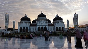
Baiturrahman Grand Mosque
Mosque in Banda Aceh, Aceh, Indonesia
Distance: Approx. 717 meters
Latitude and longitude: 5.55361111,95.31719444
Baiturrahman Grand Mosque (Indonesian: Masjid Raya Baiturrahman; Acehnese: Meuseujid Raya Baiturrahman) is a mosque located in Banda Aceh, Aceh, Indonesia. The Baiturrahman Grand Mosque is a symbol of religion, culture, spirit, strength, struggle, and nationalism of the Acehnese people. The mosque is a landmark in Banda Aceh and has survived the 2004 Indian Ocean earthquake and tsunami.

Syiah Kuala University
Distance: Approx. 5481 meters
Latitude and longitude: 5.571,95.36983333
Syiah Kuala University (Indonesian: Universitas Syiah Kuala), abbreviated as USK (formerly: Unsyiah), founded on 2 September 1961, is the largest and the oldest national university in Banda Aceh, Indonesia. The name of the university is taken from the prominent theologian, Tengku Abdur Rauf As Singkili, who lived in the 16th century. USK has twelve faculties, providing Associate, Bachelor, and master's degrees.
Aceh Tsunami Museum
Museum in Indonesia
Distance: Approx. 1362 meters
Latitude and longitude: 5.54772222,95.31508333
The Aceh Tsunami Museum, located in Banda Aceh, Aceh, Indonesia, is a museum designed as a symbolic reminder of the 2004 Indian Ocean earthquake and tsunami disaster, as well as an educational center and an emergency disaster shelter in case the area is ever hit by a tsunami again.
Ulèë Lheuë
Area in Meuraxa sub-district, Banda Aceh, Indonesia
Distance: Approx. 4391 meters
Latitude and longitude: 5.55,95.28333333
Ulèë Lheuë is an area in Meuraxa sub-district, Banda Aceh, Indonesia. It was the former main seaport of Aceh. The town and seaport was heavily damaged and depopulated during the 2004 Indian Ocean earthquake and tsunami.
Apung 1
Museum ship in Indonesia
Distance: Approx. 2123 meters
Latitude and longitude: 5.546381,95.306783
PLTD Apung 1 is a tourist attraction and former electric generator barge, stranded on dry land in Banda Aceh, Sumatra, Indonesia. The 2,600-ton vessel was at sea when the 2004 Indian Ocean earthquake and tsunami occurred, with the tsunami carrying it two to three kilometres (1.2 to 1.9 mi) inland. The Apung 1, then owned by the local power generating company, crashed into two homes when it was taken ashore, killing those inside.
Aceh Museum
Ethnographic museum in Aceh, Indonesia
Distance: Approx. 1030 meters
Latitude and longitude: 5.548581,95.320642
Aceh State Museum, popularly known as Aceh Museum or Banda Aceh Museum is a museum in Banda Aceh, Indonesia. It is one of the oldest museum in Indonesia.
Ar-Raniry State Islamic University
University in Banda Aceh, Aceh, Indonesia
Distance: Approx. 5546 meters
Latitude and longitude: 5.57888889,95.3675
Ar-Raniry State Islamic University Banda Aceh (Bahasa Indonesia: Universitas Islam Negeri Ar-Raniry Banda Aceh or it is simply called UIN Ar-Raniry (UINAR), is a public Islamic university in Banda Aceh, Aceh Province, Indonesia. The University is run under the auspices of the Ministry of Religious Affairs of the Republic of Indonesia.
Baiturrahim Mosque
Mosque in Aceh, Indonesia
Distance: Approx. 4217 meters
Latitude and longitude: 5.555789,95.284188
Baiturrahim Mosque (Indonesian: Masjid Baiturrahim) is a mosque located in the Meuraksa sub-district of Ulee Lheue, Banda Aceh, Aceh, Indonesia. As a legacy of the sultan of Aceh in the 17th century, it is one of the historical mosques in Indonesia. Previously, the mosque was named Jami Ulee Lheu Mosque.
H. Dimurthala Stadium
Distance: Approx. 2281 meters
Latitude and longitude: 5.565437,95.34126
H. Dimurthala Stadium (Indonesian: Stadion H. Dimurthala), previously known as Lampineung Stadium is a football-specific stadium located in Banda Aceh, Aceh, Indonesia. The stadium holds 7,000 people and it is a homebase for Persiraja Banda Aceh and Liga 3 club Kuala Nanggroe.
University of Abulyatama
Distance: Approx. 7875 meters
Latitude and longitude: 5.5338,95.3891
University of Abulyatama is a private university located in Aceh Besar, Indonesia.
Weather in this IP's area
broken clouds
27 Celsius
31 Celsius
27 Celsius
27 Celsius
1013 hPa
79 %
1013 hPa
1012 hPa
10000 meters
5.13 m/s
5.83 m/s
51 degree
83 %


