103.105.219.117 - IP Lookup: Free IP Address Lookup, Postal Code Lookup, IP Location Lookup, IP ASN, Public IP
Country:
Region:
City:
Location:
Time Zone:
Postal Code:
ISP:
ASN:
language:
User-Agent:
Proxy IP:
Blacklist:
IP information under different IP Channel
ip-api
Country
Region
City
ASN
Time Zone
ISP
Blacklist
Proxy
Latitude
Longitude
Postal
Route
db-ip
Country
Region
City
ASN
Time Zone
ISP
Blacklist
Proxy
Latitude
Longitude
Postal
Route
IPinfo
Country
Region
City
ASN
Time Zone
ISP
Blacklist
Proxy
Latitude
Longitude
Postal
Route
IP2Location
103.105.219.117Country
Region
victoria
City
footscray
Time Zone
Australia/Melbourne
ISP
Language
User-Agent
Latitude
Longitude
Postal
ipdata
Country
Region
City
ASN
Time Zone
ISP
Blacklist
Proxy
Latitude
Longitude
Postal
Route
Popular places and events near this IP address
Victoria University (Australia)
Dual-sector public research university based in Melbourne, Victoria, Australia
Distance: Approx. 649 meters
Latitude and longitude: -37.79416667,144.9
Victoria University (VU or Vic Uni) is an Australian public research university based in Melbourne, Victoria. It is a dual-sector university, providing courses in both higher education and technical and further education (TAFE). The university has several campuses in Melbourne Central Business District, Melbourne Western Region, and in Sydney, comprising six academic colleges, six research institutes, seven research centres and VU's Victoria Polytechnic.

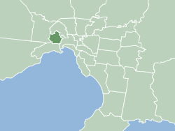
City of Maribyrnong
Local government area in Victoria, Australia
Distance: Approx. 0 meters
Latitude and longitude: -37.8,144.9
The City of Maribyrnong is a local government area within the metropolitan area of Melbourne, Australia. It comprises the inner western suburbs between 5 and 10 kilometres from Melbourne city centre. It was formed in 1994 from the merger of the City of Footscray and parts of the City of Sunshine.

Footscray, Victoria
Suburb of Melbourne, Victoria, Australia
Distance: Approx. 0 meters
Latitude and longitude: -37.8,144.9
Footscray ( FUUT-skray) is an inner-city suburb in Melbourne, Victoria, Australia, 5 km (3.1 mi) west of Melbourne's Central Business District, located within the City of Maribyrnong local government area and its council seat. Footscray recorded a population of 17,131 at the 2021 census. Footscray is characterised by a very diverse, multicultural central shopping area, which reflects the successive waves of immigration experienced by Melbourne, and by Footscray in particular.

Middle Footscray railway station
Railway station in Melbourne, Australia
Distance: Approx. 798 meters
Latitude and longitude: -37.8025,144.8915
Middle Footscray railway station is a commuter railway station on the Sunbury line, which is part of the Melbourne railway network. It serves the western suburb of Footscray, in Melbourne, Victoria, Australia. Middle Footscray station is a ground-level unstaffed station, featuring an island platform.

Footscray railway station
Railway station in Melbourne, Australia
Distance: Approx. 276 meters
Latitude and longitude: -37.8016,144.9024
Footscray railway station is a commuter and regional railway station and the junction point for the Sunbury, Werribee and Williamstown lines and V/Line services to Ballarat, Bendigo and Geelong, part of the Metropolitan and Regional railway networks. It serves the western Melbourne suburb of Footscray in Victoria, Australia. Footscray is a ground level premium station, featuring six platforms, two island platform with two faces and two side platform, connected by an accessible overground concourse.

Footscray Park
Park in Footscray, Melbourne, Victoria, Australia
Distance: Approx. 753 meters
Latitude and longitude: -37.7942,144.9044
Footscray Park is one of the largest and most intact examples of an Edwardian park in Australia. The 15-hectare park is located on the south bank of the Maribyrnong River in Footscray in Victoria. It is classified as a heritage place on the Victorian Heritage Register for its aesthetic, horticultural and social significance to the State of Victoria and was the first gardens to be placed on the register.

Footscray High School
Government (public) school in Footscray, VIC, Australia
Distance: Approx. 618 meters
Latitude and longitude: -37.79916667,144.89305556
Footscray High School is a multi-campus secondary school in Melbourne, Australia. It consists of two junior, years 7-9, campuses (Barkly and Pilgrim) and a newly renovated senior, years 10-12 campus (Kinnear). Footscray High School is part of the Footscray Learning Precinct and has formed a network with the University of Melbourne which gives students a better chance of getting into the university after they leave high school.

Snuff Puppets
Australian puppet theatre company
Distance: Approx. 1072 meters
Latitude and longitude: -37.7986647,144.8879336
Snuff Puppets is an Australian puppet theatre company. Founded in 1992, they combine elements of puppetry, live music, visual, and physical theatre to discuss taboo topics and make political satire.

City of Footscray
Local government area in Victoria, Australia
Distance: Approx. 111 meters
Latitude and longitude: -37.799,144.9
The City of Footscray was a local government area about 5 kilometres (3 mi) west of Melbourne, the state capital of Victoria, Australia. The city covered an area of 17.10 square kilometres (6.60 sq mi) and existed from 1859 until 1994. Its civic centre, after which it was named, was Footscray.

Footscray Town Hall
Civic building in Melbourne, Australia
Distance: Approx. 516 meters
Latitude and longitude: -37.804608,144.900669
Footscray Town Hall, also known as Maribyrnong Town Hall since council amalgamations in the 1990s, is a civic building located on Napier Street in Footscray, a suburb of Melbourne, Australia. The hall was built in 1936 to the design of architect Joseph Plottel in the Romanesque Revival—Richardson Romanesque style. It replaced the previous town hall on the same site, which was demolished in 1935.
Gilmore College for Girls
Government school in Footscray, Victoria, Australia
Distance: Approx. 480 meters
Latitude and longitude: -37.7987,144.8948
Gilmore College for Girls was founded in 1925 as the Footscray Domestic Arts School in response to the vast demand for employment in the Domestic Arts.

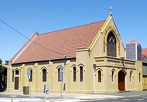
St. Prophet Ilija Macedonian Orthodox Church, Footscray
Church in Victoria, Australia
Distance: Approx. 848 meters
Latitude and longitude: -37.80466,144.89238
The St. Prophet Ilija Macedonian Orthodox Church (Macedonian: Македонска Православна Црква „Свети Пророк Илија“, Makedonska Pravoslavna Crkva „Sveti Prorok Ilija“) is a Macedonian Orthodox church serving the inner western Melbourne suburb of Footscray, Victoria, Australia. The church borders Footscray and is itself located on the outskirts of Seddon, a inner western Melburnian suburb.
Weather in this IP's area
broken clouds
20 Celsius
20 Celsius
19 Celsius
21 Celsius
1008 hPa
81 %
1008 hPa
1003 hPa
10000 meters
5.14 m/s
210 degree
75 %