103.105.178.235 - IP Lookup: Free IP Address Lookup, Postal Code Lookup, IP Location Lookup, IP ASN, Public IP
Country:
Region:
City:
Location:
Time Zone:
Postal Code:
ISP:
ASN:
language:
User-Agent:
Proxy IP:
Blacklist:
IP information under different IP Channel
ip-api
Country
Region
City
ASN
Time Zone
ISP
Blacklist
Proxy
Latitude
Longitude
Postal
Route
db-ip
Country
Region
City
ASN
Time Zone
ISP
Blacklist
Proxy
Latitude
Longitude
Postal
Route
IPinfo
Country
Region
City
ASN
Time Zone
ISP
Blacklist
Proxy
Latitude
Longitude
Postal
Route
IP2Location
103.105.178.235Country
Region
telangana
City
nanakramguda
Time Zone
Asia/Kolkata
ISP
Language
User-Agent
Latitude
Longitude
Postal
ipdata
Country
Region
City
ASN
Time Zone
ISP
Blacklist
Proxy
Latitude
Longitude
Postal
Route
Popular places and events near this IP address

Gachibowli
Neighbourhood in Ranga Reddy District, Telangana, India
Distance: Approx. 1962 meters
Latitude and longitude: 17.4372,78.3444
Gachibowli is a neighbourhood in Hyderabad, Telangana, India, located in the Serilingampally mandal of the Ranga Reddy district. It is situated about 5 km away from HITEC City, another IT hub. Gachibowli is home to numerous tech companies and residential units.

Manikonda
Neighbourhood in Rangareddy, Telangana, India
Distance: Approx. 2546 meters
Latitude and longitude: 17.406994,78.370085
Manikonda is a commercial hub and a residential neighbourhood in Hyderabad, Telangana, India. This suburb has boomed in recent years due to the presence of leading software company headquarters in the area as well as Lanco hills, a luxury hi-rise residential project, and an upcoming Chitrapuri Colony residential layout for Telugu cinema workers.
Oakridge International School
Independent international school in Hyderabad, India, Telangana, India
Distance: Approx. 1392 meters
Latitude and longitude: 17.419637,78.363955
Oakridge International School is an International Baccalaureate school located in Hyderabad, India. Oakridge International School provides the IBDP and CBSE syllabus. It has five day-schools in Hyderabad, Bangalore, Mohali and one boarding campus in Visakhapatnam city.
Gopichand Badminton Academy
Badminton academy in Hyderabad, India
Distance: Approx. 2010 meters
Latitude and longitude: 17.438269,78.346531
Pullela Gopichand Badminton Academy (PGBA) is a badminton training facility in Hyderabad, Telangana, India. Founded in 2008 by the 2001 All England Open Badminton champion Pullela Gopichand, the facility trains several badminton players such as Saina Nehwal, P. V. Sindhu, Srikanth Kidambi, Parupalli Kashyap, H.S. Prannoy, Sai Praneeth, Sameer Verma .

Khajaguda
Neighbourhood in Ranga Reddy, Telangana, India
Distance: Approx. 950 meters
Latitude and longitude: 17.4148017,78.3573688
Khajaguda is a major commercial and residential area in Hyderabad, Telangana, in the suburb of Gachibowli. It is in the vicinity of Financial district, Gachibowli and HITEC City. Several residential apartments like ASBL Lakeside, IT HEIGHTS, Niharika Interlake, Niharika Lakefront are situated in Khajaguda.

Nanakramguda
Neighbourhood in Ranga Reddy District, Telangana, India
Distance: Approx. 459 meters
Latitude and longitude: 17.41666667,78.35
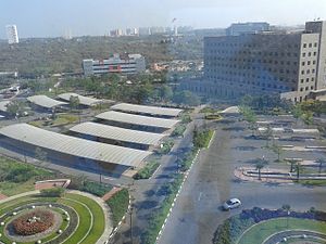
Nanakramguda is a fast-growing residential location in West Zone of Hyderabad, India. Nanakramguda is part of Financial District and is an IT, real estate and architectural suburb in Serlingampally mandal, in Hyderabad, India. The first phase of financial district is home to TSI Business parks, IT/ITES special economic zones, Tishman Speyer's, Waverock Building, which houses multinational conglomerates.
National Institute of Tourism and Hospitality Management
Distance: Approx. 1797 meters
Latitude and longitude: 17.4308,78.3641
The National Institute of Tourism and Hospitality Management is an Indian hospitality university. The campus is located on a 30-acre expanse. It is located in the Business and Education hub in Gachibowli of Hyderabad, with a built-up area of about 2 lakh square feet in multiple blocks.

Biodiversity park, Hyderabad
Park in Hyderabad, India
Distance: Approx. 2727 meters
Latitude and longitude: 17.4286,78.3752
The Biodiversity Park in Gachibowli, Hyderabad was established during the Convention on Biological Diversity held in 2012. It was inaugurated along with a commemorative pylon by the Prime Minister of India, Manmohan Singh. It was thrown open to the public on 19 January 2015.

Khajaguda Lake
Natural lake in Makthakousarali, Hyderabad
Distance: Approx. 950 meters
Latitude and longitude: 17.4148017,78.3573688
Khajaguda Lake, also known as Bhagirathamma Cheruvu or Nanakramguda lake is a lake in Ranga Reddy District in the Indian state of Telangana and on the western edge of the city of Hyderabad, in the suburb of Manikonda, in the middle of Makthakousarali, Khajaguda area.

Telangana Institute of Medical Sciences and Research
Hospital in Telangana, India
Distance: Approx. 2576 meters
Latitude and longitude: 17.44280556,78.34372222
Telangana Institute of Medical Sciences and Research, Hyderabad (Abbreviated TIMS, Hyderabad or TIMS or TIMSR) is a dedicated COVID-19 hospital in Telangana, India. It is later to be developed as a medical school and public hospital. The hospital came into existence with the issue of G.O.Ms.No.

Financial District, Hyderabad
Central business district in Telangana, India
Distance: Approx. 459 meters
Latitude and longitude: 17.41666667,78.35
Financial District is an information technology, real estate and architectural suburb in Serlingampally mandal, in Hyderabad, India. The Financial District covers a 75-acre (0.30 km2) area.

Khajaguda Talab
Natural lake in Ranga Reddy, Hyderabad
Distance: Approx. 950 meters
Latitude and longitude: 17.4148017,78.3573688
Khajaguda Talab, also known as Pedda Cheruvu is a small lake in Ranga Reddy District in the Indian state of Telangana and on the western edge of the city of Hyderabad, in the suburb of Manikonda, in the middle of Khajaguda area. It is situated near to Engineering Staff College of India and CARE Hospitals. DSR The First, a residential Apartment is located near the eastern edge of this lake.
Weather in this IP's area
few clouds
30 Celsius
29 Celsius
30 Celsius
30 Celsius
1010 hPa
35 %
1010 hPa
946 hPa
6000 meters
3.6 m/s
100 degree
13 %