103.104.88.194 - IP Lookup: Free IP Address Lookup, Postal Code Lookup, IP Location Lookup, IP ASN, Public IP
Country:
Region:
City:
Location:
Time Zone:
Postal Code:
IP information under different IP Channel
ip-api
Country
Region
City
ASN
Time Zone
ISP
Blacklist
Proxy
Latitude
Longitude
Postal
Route
Luminati
Country
ASN
Time Zone
Asia/Tokyo
ISP
Cable Television Saiki Co.Ltd.
Latitude
Longitude
Postal
IPinfo
Country
Region
City
ASN
Time Zone
ISP
Blacklist
Proxy
Latitude
Longitude
Postal
Route
IP2Location
103.104.88.194Country
Region
oita
City
oita
Time Zone
Asia/Tokyo
ISP
Language
User-Agent
Latitude
Longitude
Postal
db-ip
Country
Region
City
ASN
Time Zone
ISP
Blacklist
Proxy
Latitude
Longitude
Postal
Route
ipdata
Country
Region
City
ASN
Time Zone
ISP
Blacklist
Proxy
Latitude
Longitude
Postal
Route
Popular places and events near this IP address

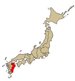
Ōita Prefecture
Prefecture of Japan
Distance: Approx. 751 meters
Latitude and longitude: 33.23818611,131.61260556
Ōita Prefecture (大分県, Ōita-ken) is a prefecture of Japan located on the island of Kyūshū. Ōita Prefecture has a population of 1,136,245 (1 June 2019) and has a geographic area of 6,340 km2 (2,448 sq mi). Ōita Prefecture borders Fukuoka Prefecture to the northwest, Kumamoto Prefecture to the southwest, and Miyazaki Prefecture to the south.
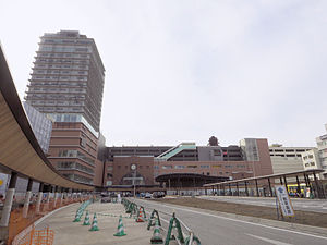
Ōita Station
Railway station in Ōita, Ōita Prefecture, Japan
Distance: Approx. 96 meters
Latitude and longitude: 33.23264,131.606705
Ōita Station (大分駅, Ōita-eki) is a junction passenger railway station located in Ōita City, Ōita Prefecture, Japan. It is operated by JR Kyushu.

Ōita (city)
Core city in Kyushu, Japan
Distance: Approx. 22 meters
Latitude and longitude: 33.23333333,131.60666667
Ōita (大分市, Ōita-shi) is the capital city of Ōita Prefecture, located on the island of Kyushu, Japan. As of 30 November 2023, the city had an estimated population of 474,804 in 230,867 households, and a population density of 950 persons per km2. The total area of the city is 502.38 km2 (193.97 sq mi).

Funai Castle
Castle in Ōita, Ōita Prefecture, Japan
Distance: Approx. 854 meters
Latitude and longitude: 33.24013,131.611417
Funai Castle (府内城, Funai-jō) is a 16th-century castle, located in Ōita city, Ōita Prefecture, Japan. It was built by Ōtomo Sōrin in 1562, who owned much of the surrounding Kyūshū island. The castle was originally built with several turrets (yagura), all of which were burnt down with the three-story donjon in 1743.

Funai Domain
Administrative division in western Japan during the Edo period (1600-1871)
Distance: Approx. 905 meters
Latitude and longitude: 33.24064167,131.61143333
Funai Domain (府内藩, Funai-han) was a feudal domain under the Tokugawa shogunate of Edo period Japan, in what is now southern Ōita Prefecture. It was centered around Funai Castle in what is now the city of Ōita and was ruled by the fudai daimyō Ogyū-Matsudaira clan for most of its history.

Roman Catholic Diocese of Oita
Roman Catholic diocese in Japan
Distance: Approx. 22 meters
Latitude and longitude: 33.23333333,131.60666667
The Diocese of Oita (Latin: Dioecesis Oitaensis, Japanese: カトリック大分教区, romanized: Katorikku Ōita Kyōku) is a suffragan Latin Church diocese of the Catholic Church in the ecclesiastical province of the metropolitan Nagasaki in southern Japan. Its cathedral episcopal see is the Cathedral of St. Francis Xavier (Oita Church), in the city of Ōita.

Oita Junior College
Distance: Approx. 1238 meters
Latitude and longitude: 33.24444444,131.60444444
Oita Junior College (大分短期大学, Ōita tanki daigaku) is a private junior college in Ōita, Ōita, Japan, established in 1964.
Oita Prefectural College of Arts and Culture
Distance: Approx. 1370 meters
Latitude and longitude: 33.22361111,131.61555556
Oita Prefectural College of Arts and Culture (大分県立芸術文化短期大学, Ōita-kenritsu geijutsu bunka tanki daigaku) is a public junior college in Ōita, Ōita Prefecture, Japan, established in 1961. The university has departments in art, music, global studies, and information and communication.
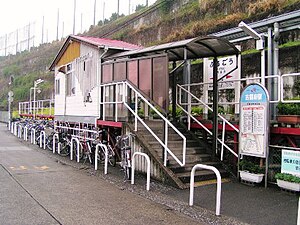
Furugō Station
Railway station in Ōita, Ōita Prefecture, Japan
Distance: Approx. 1444 meters
Latitude and longitude: 33.22055556,131.60777778
Furugō Station (古国府駅, Furugō-eki) is a passenger railway station located in Ōita City, Ōita Prefecture, Japan. It is operated by JR Kyushu.

Oasis Hiroba 21
Distance: Approx. 697 meters
Latitude and longitude: 33.23805556,131.60166667
The Oasis Hiroba 21 (OASISひろば21) is a skyscraper located in Ōita, Ōita Prefecture, Japan. Construction of the 102-metre, 21-storey skyscraper was finished in 1998.

Ōita Prefectural Art Museum
Art museum in Ōita Prefecture, Japan
Distance: Approx. 827 meters
Latitude and longitude: 33.2394,131.6014
The Ōita Prefectural Art Museum (大分県立美術館, Ōitakenritsu Bijutsukan), also known informally as OpAm, is an art museum and community exhibition venue in Ōita Prefecture, Japan. The museum is located in the center of the prefectural capital Ōita-shi, a 15-minute walk north-west of Ōita Station.

Oita Art Museum
Building in Ōita Prefecture, Japan
Distance: Approx. 1184 meters
Latitude and longitude: 33.223569,131.602242
Oita Art Museum (大分市美術館, Ōita-shi Bijutsukan) opened in Ōita, Ōita Prefecture, Japan, in 1999. The collection includes Nihonga, Yōga, Bungo Nanga, crafts, modern art, and the Important Cultural Property Materials relating to Tanomura Chikuden.
Weather in this IP's area
broken clouds
4 Celsius
1 Celsius
4 Celsius
4 Celsius
1026 hPa
75 %
1026 hPa
1008 hPa
10000 meters
2.75 m/s
2.25 m/s
278 degree
78 %


