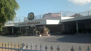
Country:
Region:
City:
Latitude and Longitude:
Time Zone:
Postal Code:
IP information under different IP Channel
ip-api
Country
Region
City
ASN
Time Zone
ISP
Blacklist
Proxy
Latitude
Longitude
Postal
Route
Luminati
Country
ASN
Time Zone
Asia/Jakarta
ISP
PT Aplikanusa Lintasarta
Latitude
Longitude
Postal
IPinfo
Country
Region
City
ASN
Time Zone
ISP
Blacklist
Proxy
Latitude
Longitude
Postal
Route
db-ip
Country
Region
City
ASN
Time Zone
ISP
Blacklist
Proxy
Latitude
Longitude
Postal
Route
ipdata
Country
Region
City
ASN
Time Zone
ISP
Blacklist
Proxy
Latitude
Longitude
Postal
Route
Popular places and events near this IP address
Tanah Lot
Rock formation off the coast of Bali
Distance: Approx. 3969 meters
Latitude and longitude: -8.62107,115.08716
Tanah Lot (Balinese: ᬢᬦᬄᬮᭀᬢ᭄) is a rock formation off the Indonesian island of Bali. It is home to the ancient Hindu pilgrimage temple Pura Tanah Lot (literally "Tanah Lot temple"), a popular tourist and cultural icon for photography.

Tabanan Regency
Regency in Bali, Indonesia
Distance: Approx. 8222 meters
Latitude and longitude: -8.55114722,115.12161389
Tabanan is one of the regencies (kabupaten) in Bali, Indonesia. Relatively underdeveloped (compared with Badung and Denpasar to the east), Tabanan Regency has an area of 839.33 km2 and had a population of 386,850 in 2000, rising to 420,913 in 2010, then 461,630 at the 2020 census; the official estimate as at mid 2022 was 469,340. Its regency seat is the town of Tabanan.

Legian
Suburban and beach area on Bali, Indonesia
Distance: Approx. 9598 meters
Latitude and longitude: -8.70055556,115.165
Legian is a suburban and beach area on the west coast of Bali in Indonesia, just north of Kuta and south of Seminyak, the area between Jl. Melasti and Jl. Dhyana Pura.

Kerobokan Prison
Prison on Bali, Indonesia
Distance: Approx. 7272 meters
Latitude and longitude: -8.67277778,115.16805556
Kerobokan Penitentiary Institution (Indonesian: Lembaga Pemasyarakatan Kerobokan, also known as LP Kerobokan, Kerobokan Prison or Hotel K) is a prison located in Kerobokan, Badung Regency, on the Indonesian island of Bali. Located 4 km (2.49 miles) away from the Canggu village, the prison opened in 1979 and was built to hold 300 inmates. As of 2017, the Kerobokan Prison contains over 1,400 male and female prisoners of various nationalities.

Kerobokan
Village in Bali, Indonesia
Distance: Approx. 7169 meters
Latitude and longitude: -8.67277778,115.16666667
Kerobokan is a kelurahan (administrative village) in North Kuta district, Badung Regency, Bali, Indonesia. Kerobokan Prison is located there. It is boxed in by the Seminyak/Oberoi, Umalas/Canggu, and Denpasar regions.

Canggu
Village in Bali, Indonesia
Distance: Approx. 3647 meters
Latitude and longitude: -8.65583333,115.13416667
Canggu (Indonesian pronunciation: [ˈt͡ʃaŋɡu]) is a coastal village with a 10 km-long beach on the south-west coast of Bali, Indonesia.

Badung Regency
Regency of Indonesia
Distance: Approx. 8100 meters
Latitude and longitude: -8.58333333,115.18333333
Badung is a regency of Bali, Indonesia. Its regency seat is in the upland town of Mangupura. It covers districts to the west of the provincial capital of Denpasar, and it has a land area of 418.52 km2.
Mangupura
Place in Bali, Indonesia
Distance: Approx. 6601 meters
Latitude and longitude: -8.60277778,115.17861111
Mangupura is the capital of Badung Regency, Bali, Indonesia. The city has been the capital of Badung Regency since the enactment of Regulation Number 67, of 16 November 2009. Previously, the capital was located in Denpasar.
Dalung, Kuta Utara
Village in Bali, Indonesia
Distance: Approx. 5360 meters
Latitude and longitude: -8.6175,115.17111111
Dalung is a Village in North Kuta District, Badung Regency of Bali, Indonesia.

Lycée Français de Bali
School in Indonesia
Distance: Approx. 6083 meters
Latitude and longitude: -8.669106,115.155619
Lycée Français de Bali Louis Antoine de Bougainville (LFB, Indonesian: Sekolah Perancis Bali), also known as the École Internationale Française de Bali (EIFB) before 2016, is a French international school in Kerobokan, Bali, Indonesia. It serves maternelle (preschool) through the terminale (final year) of the lycée (senior high school). The school first opened on 1 September 1991.

Tibubeneng
Village in Bali, Indonesia
Distance: Approx. 3871 meters
Latitude and longitude: -8.64694444,115.15027778
Tibubeneng is a village in the south of Bali, Indonesia. Tibubeng was part of Canggu until it was split off in 1997. It is headed by an elected perbekel, or village head.
Kompyang Sujana Stadium
Stadium in Indonesia
Distance: Approx. 8438 meters
Latitude and longitude: -8.6526,115.1944
Kompyang Sujana Stadium is a multi-purpose stadium in Denpasar, Bali, Indonesia, and the home of Indonesia Liga 3 club Perseden Denpasar. It has a capacity of 7,000 spectators. In 2021, the field renovation has been carried out.
Weather in this IP's area
light rain
32 Celsius
39 Celsius
32 Celsius
32 Celsius
1007 hPa
79 %
1007 hPa
1002 hPa
10000 meters
4.63 m/s
110 degree
20 %
05:49:07
18:20:32
