103.102.245.235 - IP Lookup: Free IP Address Lookup, Postal Code Lookup, IP Location Lookup, IP ASN, Public IP
Country:
Region:
City:
Location:
Time Zone:
Postal Code:
IP information under different IP Channel
ip-api
Country
Region
City
ASN
Time Zone
ISP
Blacklist
Proxy
Latitude
Longitude
Postal
Route
Luminati
Country
Region
vic
City
melbourne
ASN
Time Zone
Australia/Melbourne
ISP
VICTORIA AMATEUR TURF CLUB INCORPORATING THE MELBOURNE RACING
Latitude
Longitude
Postal
IPinfo
Country
Region
City
ASN
Time Zone
ISP
Blacklist
Proxy
Latitude
Longitude
Postal
Route
IP2Location
103.102.245.235Country
Region
victoria
City
caulfield
Time Zone
Australia/Melbourne
ISP
Language
User-Agent
Latitude
Longitude
Postal
db-ip
Country
Region
City
ASN
Time Zone
ISP
Blacklist
Proxy
Latitude
Longitude
Postal
Route
ipdata
Country
Region
City
ASN
Time Zone
ISP
Blacklist
Proxy
Latitude
Longitude
Postal
Route
Popular places and events near this IP address

Caulfield, Victoria
Suburb of Melbourne, Victoria, Australia
Distance: Approx. 365 meters
Latitude and longitude: -37.884,145.0266
Caulfield is a suburb in Melbourne, Victoria, Australia, 10 kilometres (6.2 mi) south-east of Melbourne's Central Business District, located within the City of Glen Eira local government area. Caulfield recorded a population of 5,748 at the 2021 census. It is bounded by Kooyong Road in the west, Glen Eira Road in the north, Glen Huntly Road in the south and Booran Road in the east.

Caulfield South
Suburb of Melbourne, Victoria, Australia
Distance: Approx. 985 meters
Latitude and longitude: -37.891,145.026
Caulfield South is a suburb in Melbourne, Victoria, Australia, 10 km south-east of Melbourne's Central Business District, located within the City of Glen Eira local government area. Caulfield South recorded a population of 12,328 at the 2021 census. Caulfield South is bounded by Glen Huntly Road to the north, Booran Road to the east, North Road to the south and Kooyong Road to the west.

Caulfield North, Victoria
Suburb of Melbourne, Victoria, Australia
Distance: Approx. 1074 meters
Latitude and longitude: -37.873,145.025
Caulfield North is an inner suburb in Melbourne, Victoria, Australia, 8 km south-east of Melbourne's Central Business District, located within the City of Glen Eira local government area. Caulfield North recorded a population of 16,903 at the 2021 census. It is bounded by Orrong Road in the west, Glen Eira Road in the south, Dandenong Road in the north and Kambrook Road in the east.

Glenhuntly tram depot
Depot in Melbourne, Australia
Distance: Approx. 541 meters
Latitude and longitude: -37.8862,145.0269
Glenhuntly tram depot is located on Glen Huntly Road, Caulfield a suburb in Melbourne, Victoria, Australia. Operated by Yarra Trams, it is one of eight tram depots on the Melbourne tram network.

Balaclava Junction
Distance: Approx. 1107 meters
Latitude and longitude: -37.87266,145.024717
Balaclava Junction is the only extant grand union in Australia. Located at the intersection of Balaclava Road and Hawthorn Road, Caulfield North on the Melbourne tram network, trams can go in all directions from all directions. It is the only surviving example of a grand union in the southern hemisphere.

Electoral district of Caulfield
State electoral district of Victoria, Australia
Distance: Approx. 555 meters
Latitude and longitude: -37.88333333,145.01666667
The electoral district of Caulfield is an electoral district of the Victorian Legislative Assembly that has existed since 1927. It covers the metropolitan suburbs of Caulfield, Caulfield North, Caulfield South, Caulfield East, Elsternwick, Gardenvale, Ripponlea and Balaclava and parts of St Kilda East, St Kilda, Glen Huntly and Ormond. The longest serving member is Ted Tanner, who held the seat for a period of 17 years, between 1979 and 1996.

Southern Metropolitan Region
Electoral region of the Victorian Legislative Council
Distance: Approx. 921 meters
Latitude and longitude: -37.88333333,145.03333333
Southern Metropolitan Region is one of the eight electoral regions of Victoria, Australia, which elects five members to the Victorian Legislative Council (also referred to as the upper house) by proportional representation. The region was created in 2006 following the 2005 reform of the Victorian Legislative Council. The region comprises the Legislative Assembly districts of Albert Park, Ashwood, Bentleigh, Brighton, Caulfield, Hawthorn, Kew, Malvern, Oakleigh, Prahran and Sandringham.

City of Caulfield
Local government area in Victoria, Australia
Distance: Approx. 278 meters
Latitude and longitude: -37.883,145.026
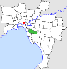
The City of Caulfield was a local government area about 10 kilometres (6 mi) southeast of Melbourne, the state capital of Victoria, Australia. The city covered an area of 21.97 square kilometres (8.48 sq mi), and existed from 1857 until 1994.

Glen Eira Town Hall
Historic town hall in Victoria, Australia
Distance: Approx. 257 meters
Latitude and longitude: -37.880204,145.022588
Glen Eira Town Hall, known originally as Caulfield Town Hall, is located in Caulfield, Victoria, Australia. The hall was finished in 1890 and is a designated historic building with the Heritage Council of Victoria.
The Japanese School of Melbourne
International school in Caulfield South, Australia
Distance: Approx. 1140 meters
Latitude and longitude: -37.89238889,145.01952778
The Japanese School of Melbourne (JSM) (メルボルン日本人学校, Meruborun Nihonjin Gakkō) is a Japanese international school located in Caulfield South, Victoria in the Melbourne area. The school uses a Japanese curriculum and the school is tailored to Japanese temporary residents; however is considered to be a state school by the Victorian Government. The school covers elementary and junior high school levels.
Online Hate Prevention Institute
Distance: Approx. 316 meters
Latitude and longitude: -37.8852,145.0218
Online Hate Prevention Institute (OHPI) is an independent harm prevention charity established in 2012 and based in Australia.
Caulfield Hospital
Hospital in Victoria, Australia
Distance: Approx. 640 meters
Latitude and longitude: -37.8841,145.0159
Caulfield Hospital is a hospital based in Melbourne, Victoria, originally opened as the No. 11 Australian General Hospital in 1916. It focuses on rehabilitation, care, and mental health, particularly for the elderly.
Weather in this IP's area
broken clouds
18 Celsius
18 Celsius
17 Celsius
19 Celsius
1016 hPa
71 %
1016 hPa
1012 hPa
10000 meters
0.89 m/s
2.68 m/s
357 degree
62 %