Country:
 Australia
Region:
City:
Latitude and Longitude:
Time Zone:
Postal Code:
IP information under different IP Channel
ip-api
Country
Region
City
ASN
Time Zone
ISP
Blacklist
Proxy
Latitude
Longitude
Postal
Route
IPinfo
Country
Region
City
ASN
Time Zone
ISP
Blacklist
Proxy
Latitude
Longitude
Postal
Route
MaxMind
Country
Region
City
ASN
Time Zone
ISP
Blacklist
Proxy
Latitude
Longitude
Postal
Route
Luminati
Country
AUASN
Time Zone
Australia/Sydney
ISP
TPG Telecom Limited
Latitude
Longitude
Postal
db-ip
Country
Region
City
ASN
Time Zone
ISP
Blacklist
Proxy
Latitude
Longitude
Postal
Route
ipdata
Country
Region
City
ASN
Time Zone
ISP
Blacklist
Proxy
Latitude
Longitude
Postal
Route
Popular places and events near this IP address

Frenchs Forest, New South Wales
Suburb of Sydney, New South Wales, Australia
Distance: Approx. 1041 meters
Latitude and longitude: -33.749,151.2331
Frenchs Forest (pron. frenches) is a suburb of northern Sydney, in the state of New South Wales, Australia. Frenchs Forest is 13 kilometres north of the Sydney central business district in the local government area of Northern Beaches Council.

Beacon Hill, New South Wales
Suburb of Sydney, New South Wales, Australia
Distance: Approx. 1115 meters
Latitude and longitude: -33.7522,151.256
Beacon Hill is a suburb of northern Sydney, in the state of New South Wales, Australia 17 kilometres north-east of the Sydney central business district, in the local government area of Northern Beaches Council. It is part of the Northern Beaches region.
Oxford Falls, New South Wales
Suburb of Sydney, New South Wales, Australia
Distance: Approx. 1812 meters
Latitude and longitude: -33.7352,151.2469
Oxford Falls is a suburb of northern Sydney, in the state of New South Wales, Australia 20 kilometres north-east of the Sydney central business district in the local government area of Northern Beaches Council. Oxford Falls is part of the Northern Beaches region and also considered to be part of the Forest District, colloquially known as The Forest.
Narraweena, New South Wales
Suburb of Sydney, New South Wales, Australia
Distance: Approx. 2221 meters
Latitude and longitude: -33.74861111,151.26777778
Narraweena is a suburb of northern Sydney, in the state of New South Wales, Australia. Narraweena is 18 kilometres north-east of the Sydney central business district, in the local government area of Northern Beaches Council and is part of the Northern Beaches region. Narraweena has two primary schools; Narraweena Public School and St John the Apostle Narraweena Catholic School.

Brookvale Oval
Sports venue in Brookvale, New South Wales, Australia
Distance: Approx. 2882 meters
Latitude and longitude: -33.76,151.27333333
Brookvale Oval, known commercially as 4 Pines Park, is a sporting ground located within Brookvale Park at Brookvale, New South Wales, Australia. The ground is owned by Northern Beaches Council and is primarily used by the Manly-Warringah Sea Eagles rugby league team. Brookvale Oval has an approximate capacity of 20,000 people.
Manly Dam Reserve
Protected area in New South Wales, Australia
Distance: Approx. 2750 meters
Latitude and longitude: -33.775803,151.247769
The Manly Dam Reserve, also known as the Manly Warringah War Memorial Park, is an urban bushland reserve located in the Northern Beaches region of Sydney, Australia. The reserve adjoins the south-eastern edge of Garigal National Park. Located within the 376 hectares (930 acres) reserve is the 30-hectare (74-acre) dam reservoir.
Oxford Falls Grammar School
School in Sydney, New South Wales, Australia
Distance: Approx. 1488 meters
Latitude and longitude: -33.7381161,151.2466768
Oxford Falls Grammar School (OFG) is an independent Christian co-educational primary and secondary school, located in Oxford Falls on the Northern Beaches of Sydney, New South Wales, Australia. The school is set on 6 hectares (15 acres) of landscaped grounds and incorporate a four-stream infants school, three-stream primary school and a triple-stream senior school of approximately 1,300 students. The school is a member of Christian Schools Australia, the Christian Schools Sporting Association (CSSA) and is a member of the Combined Independent Schools (CIS).
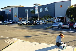
Westfield Warringah Mall
Shopping mall in New South Wales, Australia
Distance: Approx. 2736 meters
Latitude and longitude: -33.76772,151.265991
Westfield Warringah Mall, previously known as Warringah Mall, is a large indoor/outdoor shopping centre in the suburb of Brookvale in the Northern Beaches region of Sydney.

Oxford Falls Peace Park
Distance: Approx. 1293 meters
Latitude and longitude: -33.73969541,151.2447077
Oxford Falls Peace Park is a park in Oxford Falls, New South Wales, Australia, a suburb of Sydney.
Wakehurst Public School
School in Belrose, New South Wales, Australia
Distance: Approx. 2784 meters
Latitude and longitude: -33.73860278,151.21809444
Wakehurst Public School is a co-educational primary school located in the Sydney suburb of Belrose, and draws its students predominantly from the surrounding suburbs of Belrose, Davidson and Frenchs Forest. The school has approximately 400 enrolled pupils from Kindergarten to Year 6.

Manly Dam
Dam
Distance: Approx. 2750 meters
Latitude and longitude: -33.775803,151.247769
The Manly Dam is a heritage-listed dam near King Street, Manly Vale with a reservoir extending into Allambie Heights, both in the Northern Beaches Council local government area of New South Wales, Australia. It is often used as a place to have recreational activities. The reservoir is located within the Manly Dam Reserve.

Northern Beaches Hospital
Hospital in New South Wales, Australia
Distance: Approx. 1031 meters
Latitude and longitude: -33.750751,151.23288
The Northern Beaches Hospital is a district general hospital in Frenchs Forest, located in the Northern Beaches region of Sydney, New South Wales, Australia.
Weather in this IP's area
overcast clouds
13 Celsius
12 Celsius
12 Celsius
14 Celsius
1024 hPa
81 %
1024 hPa
1006 hPa
10000 meters
0.89 m/s
1.34 m/s
303 degree
100 %
06:20:00
19:03:47