103.100.22.80 - IP Lookup: Free IP Address Lookup, Postal Code Lookup, IP Location Lookup, IP ASN, Public IP
Country:
Region:
City:
Location:
Time Zone:
Postal Code:
IP information under different IP Channel
ip-api
Country
Region
City
ASN
Time Zone
ISP
Blacklist
Proxy
Latitude
Longitude
Postal
Route
Luminati
Country
ASN
Time Zone
Asia/Kolkata
ISP
C.d. Palace And Electronics
Latitude
Longitude
Postal
IPinfo
Country
Region
City
ASN
Time Zone
ISP
Blacklist
Proxy
Latitude
Longitude
Postal
Route
IP2Location
103.100.22.80Country
Region
assam
City
guwahati
Time Zone
Asia/Kolkata
ISP
Language
User-Agent
Latitude
Longitude
Postal
db-ip
Country
Region
City
ASN
Time Zone
ISP
Blacklist
Proxy
Latitude
Longitude
Postal
Route
ipdata
Country
Region
City
ASN
Time Zone
ISP
Blacklist
Proxy
Latitude
Longitude
Postal
Route
Popular places and events near this IP address

Gauhati High Court
Indian High Court jurisdiction
Distance: Approx. 603 meters
Latitude and longitude: 26.1913,91.7514
The Gauhati High Court was promulgated by governor general of India on 1 March 1948 after the Government of India Act 1935 was passed, establishing the high court with effect from 5 April 1948, for the then-province of Assam. It was originally known as the High Court of Assam and Nagaland, but renamed as Gauhati High Court in 1971 by the North-Eastern Areas (Reorganisation) Act, 1971. It has largest jurisdiction in terms of states, with its area covering the states of Assam, Arunachal Pradesh, Nagaland, and Mizoram.

Ugratara Devalaya
Temple in India
Distance: Approx. 459 meters
Latitude and longitude: 26.18911389,91.75377222
Ugratara Devalaya is a temple dedicated to Ugratara located in the western side of Jor Pukhury tanks in the heart of Guwahati city in the Lotaxil (Latasil) locality in Northeast India. The Ugratara Temple in Uzan Bazaar in the eastern part of Guwahati, Assam, is a Shakti shrine. Legend has said that the navel of Sati, first consort of Shiva, is related to this temple.

Pan Bazaar
Locality in Assam, India
Distance: Approx. 484 meters
Latitude and longitude: 26.1829,91.7474
Pan Bazaar (also spelled as Panbazar; Assamese pronunciation: [pan bɔzaɹ]) is a locality in Guwahati, India surrounded by localities of Paltan Bazaar, Ambari and Fancy Bazaar. Situated on the banks of the river Brahmaputra, it is part of the city centre. Pan Bazaar means "betel-leaf mart" in English.

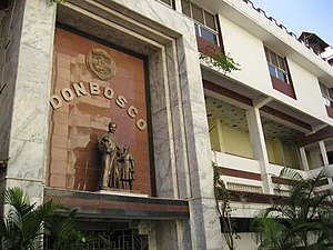
Don Bosco High School, Guwahati
Private school in Guwahati, India
Distance: Approx. 504 meters
Latitude and longitude: 26.185126,91.745929
Don Bosco Senior Secondary School is a school located in Guwahati, Assam. It is a Catholic school founded on the teachings of Saint John Bosco, and is run by the Salesians of Don Bosco. Started in 1948, Don Bosco is one of the leading private schools in the North-Eastern states.
Roman Catholic Archdiocese of Guwahati
Latin Catholic territory in India
Distance: Approx. 454 meters
Latitude and longitude: 26.1853,91.7464
The Archdiocese of Guwahati (Latin: Guvahatin(a)) is a Latin Church ecclesiastical territory or archdiocese of the Catholic Church located in the city of Guwahati in India. The archdiocese is a metropolitan see with six suffragan dioceses in its ecclesiastical province.
Ambari
Neighbourhood in Kamrup Metropolitan district, Assam, India
Distance: Approx. 286 meters
Latitude and longitude: 26.184074,91.752909
Ambari (Assamese pronunciation: [ambaɹi]) is a locality in Guwahati, India. Located in northern Guwahati, it is a site for important archaeological excavations related to ancient Assam. At the southern end of the neighbourhood lies the Guwahati railway station.
Handique Girls College
College in Assam
Distance: Approx. 175 meters
Latitude and longitude: 26.1873,91.7501
Handique Girls College is a constituent college of the University of Gauhati. It is one of the oldest colleges located in the Indian state of Assam and offers undergraduate courses in Arts and Science.

Dighalipukhuri
Man-made pond located in Assam, India
Distance: Approx. 185 meters
Latitude and longitude: 26.18755,91.751083
Dighalipukhuri; also Dighalipukhri is a rectangular man-made pond in Guwahati, about half a mile long. Dighalipukhuri is occupied altogether area of garden and pond between 17-18 bigha lands.
Cotton University
University in Guwahati, India
Distance: Approx. 345 meters
Latitude and longitude: 26.1868,91.7476
Cotton University (formerly known as Cotton College) is a public state university located in Guwahati, Assam, India. It was established in 2017 by the provisions of an Act from the Assam Legislative Assembly which merged Cotton College State University and Cotton College. The university has progressed to become one of the top 200 institutions of the country (appearing on the list of 150–200 in the National Institutional Ranking Framework rank list in May 2020).
Cotton Collegiate Government H.S. School
Government school in Guwahati, India
Distance: Approx. 649 meters
Latitude and longitude: 26.18833333,91.745
Cotton Collegiate Government Higher Secondary School is an institution for high school education located in the heart of Guwahati, Assam, a northeastern state of India. It is the first school in the state. The school was established in the year 1835.
Judges Field
Multi-purpose sports ground in Guwahati, Assam, India
Distance: Approx. 423 meters
Latitude and longitude: 26.189317,91.74905
Judges Field or Gauhati Town Club Ground is a multi-purpose sports ground in Guwahati, Assam. The ground is mainly used for football and cricket matches. It is the home of Gauhati Town Club, one of the oldest and premier sports club in India's north-east.
Nehru Park, Guwahati
Urban park in Guwahati, India
Distance: Approx. 470 meters
Latitude and longitude: 26.188612,91.747295
Nehru Park (Assamese pronunciation: [nɛɦɹu uˈdjan]) is an urban park situated in the Pan Bazaar area of Guwahati, India.
Weather in this IP's area
haze
22 Celsius
22 Celsius
22 Celsius
22 Celsius
1012 hPa
60 %
1012 hPa
999 hPa
3000 meters
1.03 m/s
200 degree
40 %